![](/images/other/stat-length.png)
![Randonnée Marche nordique Beek - Beek wandeling langs Klein Genhout - Photo](https://media.geolcdn.com/t/1900/400/ext.pjpeg?maxdim=2&url=https%3A%2F%2Fservices.sitytrail.com%2FGeolivesWS%2FDownloadMedia.ashx%3FTrailID%3D1071978%26Media%3D20181115141453.jpg)
Beek wandeling langs Klein Genhout
jos.wessels
Utilisateur
![Longueur](/images/other/stat-length.png)
Longueur
7,8 km
![Altitude max](https://static1.geolcdn.com/siteimages/upload/files/1508320355ic_sort_altitude_max_24dp.png)
Altitude max
121 m
![Dénivelé positif](https://static1.geolcdn.com/siteimages/upload/files/1508320355ic_sort_den_pos_24dp.png)
Dénivelé positif
64 m
![Km-Effort](/images/other/stat-length.png)
Km-Effort
8,7 km
![Altitude min](https://static1.geolcdn.com/siteimages/upload/files/1508320355ic_sort_altitude_min_24dp.png)
Altitude min
74 m
![Dénivelé négatif](https://static1.geolcdn.com/siteimages/upload/files/1508320355ic_sort_den_neg_24dp.png)
Dénivelé négatif
67 m
![Boucle](https://static1.geolcdn.com/siteimages/upload/files/16400158638029165_repeat_loop_refresh_sync_direction_icon.png)
Boucle
Oui
Date de création :
2019-01-15 18:51:26.685
Dernière modification :
2019-01-15 18:51:26.685
![Marche nordique](https://static1.geolcdn.com/sitytour/trail-icons/102.png)
3h24
Difficulté : Très facile
![Scannez ce code QR pour ouvrir la randonnée dans l'application SityTrail](https://capi.geolives.com/qq0zvz2zws4bq2lad0pu/sitytour/trails/1071978/qr.png?size=200)
Application GPS de randonnée GRATUITE
À propos
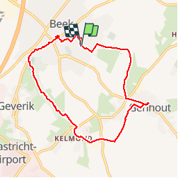
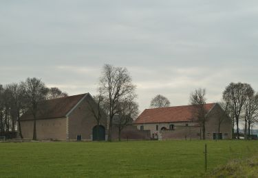
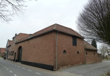
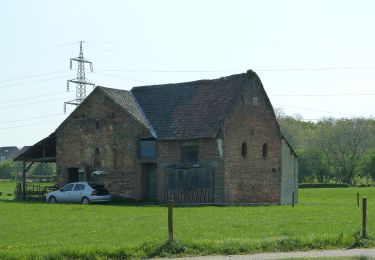
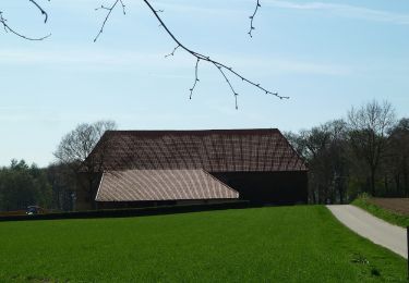
Randonnée Marche nordique de 7,8 km à découvrir à Limbourg, Inconnu, Beek. Cette randonnée est proposée par jos.wessels.
Description
Hele mooie herfstwandeling. Lunchen in eetcafé: de Poort. Heerlijk
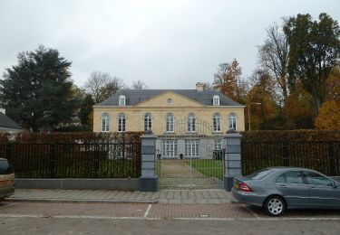
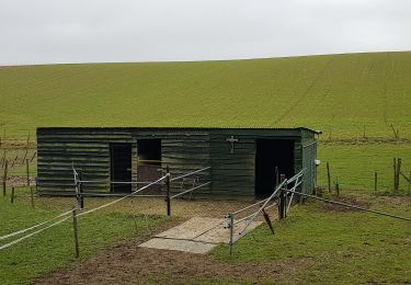
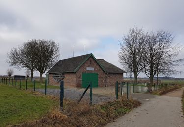
Localisation
Pays :
Pays-Bas
Région :
Limbourg
Département/Province :
Inconnu
Commune :
Beek
Localité :
Unknown
Départ:(Dec)
Départ:(UTM)
696925 ; 5646666 (31U) N.
Commentaires
Randonnées à proximité
![Randonnée A pied Beekdaelen - Kollenboomroute - Photo](https://media.geolcdn.com/t/375/260/e12664f1-60f5-45cc-b950-31ef25be4e8a.jpeg&format=jpg&maxdim=2)
![A pied A pied](https://static1.geolcdn.com/sitytour/trail-icons/100.png)
Kollenboomroute
A pied
Facile
Beekdaelen,
Limbourg,
Inconnu,
Pays-Bas
![](/images/other/stat-length.png)
8,2 km | 9,4 km-effort
2h 8min
![](https://static1.geolcdn.com/siteimages/upload/files/16400158638029165_repeat_loop_refresh_sync_direction_icon.png)
Oui
![Randonnée A pied Beekdaelen - Zevenmijlslaarzenroute - Photo](https://media.geolcdn.com/t/375/260/dev_1fdcc12b-c712-40a2-acfe-86dd1f2376f2.jpeg&format=jpg&maxdim=2)
![A pied A pied](https://static1.geolcdn.com/sitytour/trail-icons/100.png)
Zevenmijlslaarzenroute
A pied
Facile
Beekdaelen,
Limbourg,
Inconnu,
Pays-Bas
![](/images/other/stat-length.png)
11,9 km | 13,6 km-effort
3h 5min
![](https://static1.geolcdn.com/siteimages/upload/files/16400158638029165_repeat_loop_refresh_sync_direction_icon.png)
Oui
![Randonnée A pied Beekdaelen - De route van de Reus - Photo](https://media.geolcdn.com/t/375/260/338816e8-9944-45a5-9788-662998f69101.jpeg&format=jpg&maxdim=2)
![A pied A pied](https://static1.geolcdn.com/sitytour/trail-icons/100.png)
De route van de Reus
A pied
Facile
Beekdaelen,
Limbourg,
Inconnu,
Pays-Bas
![](/images/other/stat-length.png)
4,9 km | 5,3 km-effort
1h 12min
![](https://static1.geolcdn.com/siteimages/upload/files/16400158638029165_repeat_loop_refresh_sync_direction_icon.png)
Non
![Randonnée A pied Beek - Rondje Genhout - Photo](https://media.geolcdn.com/t/375/260/abb5d7e1-7a3a-42b7-bbd5-5c0d66587d99.jpeg&format=jpg&maxdim=2)
![A pied A pied](https://static1.geolcdn.com/sitytour/trail-icons/100.png)
![Randonnée A pied Beek - Kelmonderbosroute - Photo](https://media.geolcdn.com/t/375/260/837572e5-dbfd-4f84-bcb5-1e417ba2c29f.jpeg&format=jpg&maxdim=2)
![A pied A pied](https://static1.geolcdn.com/sitytour/trail-icons/100.png)
![Randonnée A pied Beek - Genhoutroute - Photo](https://media.geolcdn.com/t/375/260/abb5d7e1-7a3a-42b7-bbd5-5c0d66587d99.jpeg&format=jpg&maxdim=2)
![A pied A pied](https://static1.geolcdn.com/sitytour/trail-icons/100.png)
![Randonnée A pied Beek - Spaubeekroute - Photo](https://media.geolcdn.com/t/375/260/0d529b5d-b69f-4c46-9023-af83299ad0c9.jpeg&format=jpg&maxdim=2)
![A pied A pied](https://static1.geolcdn.com/sitytour/trail-icons/100.png)
![Randonnée A pied Beek - Vrouwenbosroute - Photo](https://media.geolcdn.com/t/375/260/2bb02fa8-e3a9-4730-9f28-c7fea4e28296.jpeg&format=jpg&maxdim=2)
![A pied A pied](https://static1.geolcdn.com/sitytour/trail-icons/100.png)
![Randonnée A pied Beekdaelen - Panoramaroute - Photo](https://media.geolcdn.com/t/375/260/9cb0613e-7784-4339-8414-c13724353666.jpeg&format=jpg&maxdim=2)
![A pied A pied](https://static1.geolcdn.com/sitytour/trail-icons/100.png)
Panoramaroute
A pied
Facile
Beekdaelen,
Limbourg,
Inconnu,
Pays-Bas
![](/images/other/stat-length.png)
8,6 km | 10,6 km-effort
2h 24min
![](https://static1.geolcdn.com/siteimages/upload/files/16400158638029165_repeat_loop_refresh_sync_direction_icon.png)
Non