![](/images/other/stat-length.png)
![Randonnée V.T.T. Val-Revermont - Rando raid(e) du Mont Myon - Photo](https://media.geolcdn.com/t/1900/400/ext.pjpeg?maxdim=2&url=https%3A%2F%2Fservices.sitytrail.com%2FGeolivesWS%2FDownloadMedia.ashx%3FTrailID%3D107081%26Media%3D11905_1.jpg)
Rando raid(e) du Mont Myon
tracegps
Utilisateur
![Longueur](/images/other/stat-length.png)
Longueur
45 km
![Altitude max](https://static1.geolcdn.com/siteimages/upload/files/1508320355ic_sort_altitude_max_24dp.png)
Altitude max
644 m
![Dénivelé positif](https://static1.geolcdn.com/siteimages/upload/files/1508320355ic_sort_den_pos_24dp.png)
Dénivelé positif
1330 m
![Km-Effort](/images/other/stat-length.png)
Km-Effort
63 km
![Altitude min](https://static1.geolcdn.com/siteimages/upload/files/1508320355ic_sort_altitude_min_24dp.png)
Altitude min
239 m
![Dénivelé négatif](https://static1.geolcdn.com/siteimages/upload/files/1508320355ic_sort_den_neg_24dp.png)
Dénivelé négatif
1331 m
![Boucle](https://static1.geolcdn.com/siteimages/upload/files/16400158638029165_repeat_loop_refresh_sync_direction_icon.png)
Boucle
Oui
Date de création :
2014-12-10 00:00:00.0
Dernière modification :
2014-12-10 00:00:00.0
![V.T.T.](https://static1.geolcdn.com/sitytour/trail-icons/202.png)
3h40
Difficulté : Difficile
![Scannez ce code QR pour ouvrir la randonnée dans l'application SityTrail](https://capi.geolives.com/qq0zvz2zws4bq2lad0pu/sitytour/trails/107081/qr.png?size=200)
Application GPS de randonnée GRATUITE
À propos
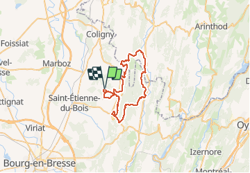
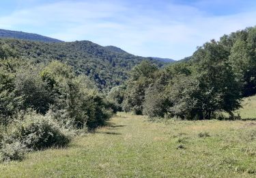
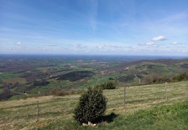
Randonnée V.T.T. de 45 km à découvrir à Auvergne-Rhône-Alpes, Ain, Val-Revermont. Cette randonnée est proposée par tracegps.
Description
Circuit 45km de la randonnée organisée par le Cyclo Club d’Attignat le dimanche 28 Août 2011 au départ de la Grange du Pin à Treffort Cuisiat.
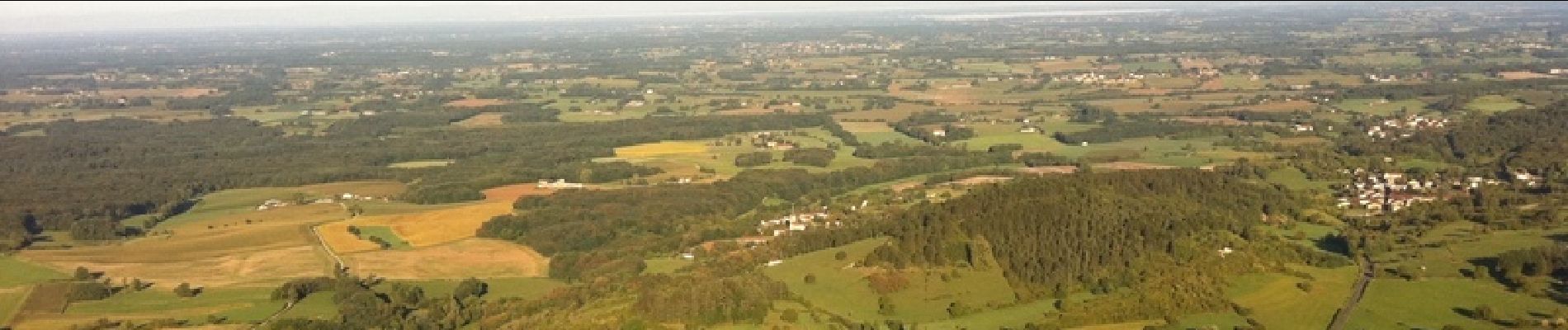
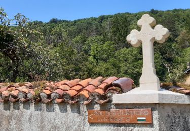
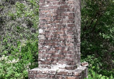
Localisation
Pays :
France
Région :
Auvergne-Rhône-Alpes
Département/Province :
Ain
Commune :
Val-Revermont
Localité :
Cuisiat
Départ:(Dec)
Départ:(UTM)
681442 ; 5130806 (31T) N.
Commentaires
Randonnées à proximité
![Randonnée Marche Val-Revermont - Mont Myon-Revermint - Photo](https://media.geolcdn.com/t/375/260/fa5e203c-ad7c-4758-9da8-ad868bde480a.jpg&format=jpg&maxdim=2)
![Marche Marche](https://static1.geolcdn.com/sitytour/trail-icons/101.png)
Mont Myon-Revermint
Marche
Moyen
(1)
Val-Revermont,
Auvergne-Rhône-Alpes,
Ain,
France
![](/images/other/stat-length.png)
7 km | 11,3 km-effort
2h 8min
![](https://static1.geolcdn.com/siteimages/upload/files/16400158638029165_repeat_loop_refresh_sync_direction_icon.png)
Oui
![Randonnée Cheval Val-Revermont - paque2019 - Photo](https://media.geolcdn.com/t/375/260/ext.jpg?maxdim=2&url=https%3A%2F%2Fstatic1.geolcdn.com%2Fsiteimages%2Fupload%2Ffiles%2F1524743154cheval.jpg)
![Cheval Cheval](https://static1.geolcdn.com/sitytour/trail-icons/300.png)
paque2019
Cheval
Très facile
(1)
Val-Revermont,
Auvergne-Rhône-Alpes,
Ain,
France
![](/images/other/stat-length.png)
20 km | 24 km-effort
Inconnu
![](https://static1.geolcdn.com/siteimages/upload/files/16400158638029165_repeat_loop_refresh_sync_direction_icon.png)
Non
![Randonnée sport Val-Revermont - Reverront - Photo](https://media.geolcdn.com/t/375/260/90ed7a28-6e56-489e-8fc9-dbc01a9c6620.jpg&format=jpg&maxdim=2)
Reverront
sport
Très facile
Val-Revermont,
Auvergne-Rhône-Alpes,
Ain,
France
![](/images/other/stat-length.png)
12,9 km | 18,3 km-effort
Inconnu
![](https://static1.geolcdn.com/siteimages/upload/files/16400158638029165_repeat_loop_refresh_sync_direction_icon.png)
Oui
![Randonnée Marche Val-Revermont - Cuisiat, Pouillat, Nivigne, Rosy, col des justices - Photo](https://media.geolcdn.com/t/375/260/69b52874-606e-4bef-ae55-908d7637bffc.jpg&format=jpg&maxdim=2)
![Marche Marche](https://static1.geolcdn.com/sitytour/trail-icons/101.png)
Cuisiat, Pouillat, Nivigne, Rosy, col des justices
Marche
Difficile
Val-Revermont,
Auvergne-Rhône-Alpes,
Ain,
France
![](/images/other/stat-length.png)
21 km | 34 km-effort
6h 39min
![](https://static1.geolcdn.com/siteimages/upload/files/16400158638029165_repeat_loop_refresh_sync_direction_icon.png)
Oui
![Randonnée A pied Val-Revermont - Nivigne Cuisiat - Photo](https://media.geolcdn.com/t/375/260/936871ef-5815-4043-8b67-0b61d7f563b1.jpg&format=jpg&maxdim=2)
![A pied A pied](https://static1.geolcdn.com/sitytour/trail-icons/100.png)
Nivigne Cuisiat
A pied
Moyen
Val-Revermont,
Auvergne-Rhône-Alpes,
Ain,
France
![](/images/other/stat-length.png)
15,2 km | 26 km-effort
5h 48min
![](https://static1.geolcdn.com/siteimages/upload/files/16400158638029165_repeat_loop_refresh_sync_direction_icon.png)
Oui
![Randonnée Marche Courmangoux - Chevignat Mont Verjon - Photo](https://media.geolcdn.com/t/375/260/7394bea6-7022-424f-91c2-af6b779be288.jpg&format=jpg&maxdim=2)
![Marche Marche](https://static1.geolcdn.com/sitytour/trail-icons/101.png)
Chevignat Mont Verjon
Marche
Facile
Courmangoux,
Auvergne-Rhône-Alpes,
Ain,
France
![](/images/other/stat-length.png)
13,4 km | 19,7 km-effort
3h 9min
![](https://static1.geolcdn.com/siteimages/upload/files/16400158638029165_repeat_loop_refresh_sync_direction_icon.png)
Oui
![Randonnée Marche Val-Revermont - départ de cuisuiat ensuite la chapelle de montfort - Photo](https://media.geolcdn.com/t/375/260/c9c53256-53d3-44a1-aaa2-a8696c44291d.jpg&format=jpg&maxdim=2)
![Marche Marche](https://static1.geolcdn.com/sitytour/trail-icons/101.png)
départ de cuisuiat ensuite la chapelle de montfort
Marche
Moyen
Val-Revermont,
Auvergne-Rhône-Alpes,
Ain,
France
![](/images/other/stat-length.png)
15,4 km | 24 km-effort
5h 27min
![](https://static1.geolcdn.com/siteimages/upload/files/16400158638029165_repeat_loop_refresh_sync_direction_icon.png)
Oui
![Randonnée Marche Val-Revermont - Signal de Nivigne par la grotte à l'Ours - Photo](https://media.geolcdn.com/t/375/260/a53f1016-f4b3-4716-b614-defee1deebea.jpg&format=jpg&maxdim=2)
![Marche Marche](https://static1.geolcdn.com/sitytour/trail-icons/101.png)
Signal de Nivigne par la grotte à l'Ours
Marche
Moyen
Val-Revermont,
Auvergne-Rhône-Alpes,
Ain,
France
![](/images/other/stat-length.png)
7 km | 12 km-effort
2h 46min
![](https://static1.geolcdn.com/siteimages/upload/files/16400158638029165_repeat_loop_refresh_sync_direction_icon.png)
Oui
![Randonnée Marche Courmangoux - la crête du Grand Chevalet - Photo](https://media.geolcdn.com/t/375/260/a724f844-8582-4591-945e-dc1e0020bc62.jpg&format=jpg&maxdim=2)
![Marche Marche](https://static1.geolcdn.com/sitytour/trail-icons/101.png)
la crête du Grand Chevalet
Marche
Très facile
Courmangoux,
Auvergne-Rhône-Alpes,
Ain,
France
![](/images/other/stat-length.png)
4,3 km | 6,1 km-effort
1h 12min
![](https://static1.geolcdn.com/siteimages/upload/files/16400158638029165_repeat_loop_refresh_sync_direction_icon.png)
Oui