Randonnée Moteur La Baroche - swiss TET - Photo
 olivieraron
olivieraron

Utilisateur

© OpenStreetMap contributors
Longueur
Longueur
562 km
Altitude max
Altitude max
2442 m
Dénivelé positif
Dénivelé positif
16907 m
Km-Effort
Km-Effort  
787 km
Altitude min
Altitude min
423 m
Dénivelé négatif
Dénivelé négatif
16742 m
Boucle
Boucle
Non
Date de création :
2019-01-14 09:38:59.151
Dernière modification :
2019-01-14 09:38:59.151

(0 Avis)

Moteur
Moteur
--
Difficulté : Inconnu

Scannez ce code QR pour ouvrir la randonnée dans l'application SityTrail

Application GPS de randonnée GRATUITE

Logo SityTrail SityTrail

IGN / Instituts géographiques

Télécharger SityTrail sur l'App Store Télécharger SityTrail sur Google Play

Logo SityTrail SityTrail World

Le monde est à vous

Télécharger SityTrail sur l'App Store Télécharger SityTrail sur Google Play Télécharger SityTrail sur Huawei AppGallery

À propos

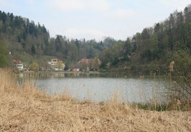
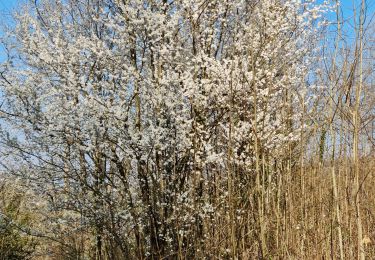
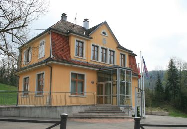
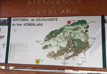
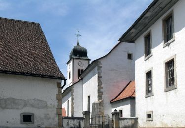
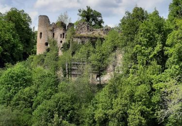
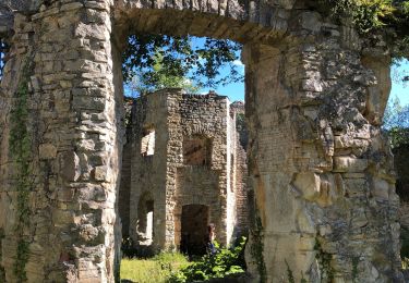
Randonnée Moteur de 562 km à découvrir à Jura, District de Porrentruy, La Baroche. Cette randonnée est proposée par olivieraron.

Profil altimétrique

Points d'intérêt

Point d'intérêt Nods - 1_TET_CH_Bison_a - Photo
olivieraron
Point d'intérêt Nods - 1_TET_CH_Bison_b - Photo
olivieraron
Point d'intérêt Plateau de Diesse - 1_TET_CH_Bison_c - Photo
olivieraron
PLATEAU DE DIESSE 
Point d'intérêt Saignelégier - 1_TET_CH_Camping_Saignelegier - Photo
olivieraron
Point d'intérêt Corgémont - 1_TET_CH_Jobert_a - Photo
olivieraron
CORGÉMONT 
Point d'intérêt Orvin - 1_TET_CH_Jobert_b - Photo
olivieraron
Point d'intérêt Sachseln - 2_TET_CH_Aelggi_a - Photo
olivieraron
Point d'intérêt Sachseln - 2_TET_CH_Aelggi_b - Photo
olivieraron
Point d'intérêt Sarnen - 2_TET_CH_Camping_Sarnen - Photo
olivieraron
Point d'intérêt Röthenbach im Emmental - 2_TET_CH_cheese_machine - Photo
olivieraron
RÖTHENBACH IM EMMENTAL 
Point d'intérêt Entlebuch - 2_TET_CH_Entlebucher_Brewery - Photo
olivieraron
Point d'intérêt Sachseln - 2_TET_CH_Flueli_Ranft - Photo
olivieraron
Point d'intérêt Röthenbach im Emmental - 2_TET_CH_Gabelspitz - Photo
olivieraron
RÖTHENBACH IM EMMENTAL 
Point d'intérêt Andermatt - 2_TET_CH_Tourist_Info_Andermatt - Photo
olivieraron
Point d'intérêt Andermatt - 3_TET_CH_Gotthard_Camping - Photo
olivieraron
Point d'intérêt Realp - 3_TET_CH_Taetsch_a - Photo
olivieraron
Point d'intérêt Realp - 3_TET_CH_Taetsch_b - Photo
olivieraron
Point d'intérêt Realp - 3_TET_CH_Taetsch_c - Photo
olivieraron
Point d'intérêt Andermatt - 3_TET_CH_Unteralp_a - Photo
olivieraron
Point d'intérêt Andermatt - 3_TET_CH_Unteralp_b - Photo
olivieraron

Localisation

Pays :
Suisse
Région :
Jura
Département/Province :
District de Porrentruy
Commune :
La Baroche
Localité :
Unknown
Départ:(Dec)
Départ:(UTM)
367698 ; 5254049 (32T) N.

Randonnées à proximité

Randonnée A pied Bourrignon - Bourrignon - Lucelle Douane - Photo
A pied
GUIDE+

A pied

Facile
Bourrignon, Jura, District de Delémont, Suisse
7,5 km | 11 km-effort
2h 29min
Non
Randonnée Marche Levoncourt - Sortie les Copains d'abord.. 24/03/2022 - Photo
Marche
boubou68

Marche

Moyen
Levoncourt, Grand Est, Haut-Rhin, France
24 km | 34 km-effort
4h 57min
Oui
Randonnée A pied Pleigne - Lucelle Douane - Pleigne - Photo
A pied
GUIDE+

A pied

Facile
Pleigne, Jura, District de Delémont, Suisse
5,3 km | 8 km-effort
1h 48min
Non
Randonnée Marche Oberlarg - Oberlarg - sa grotte - la ferme des Ebourbettes - le château de Morimont - Photo
Marche
Bart2015

Marche

Moyen
Oberlarg, Grand Est, Haut-Rhin, France
9,5 km | 13,3 km-effort
3h 22min
Oui
Randonnée A pied Pleigne - Sentier panoramique - Photo
A pied
GUIDE+

A pied

Facile
Pleigne, Jura, District de Delémont, Suisse
5,7 km | 6,8 km-effort
1h 33min
Oui
Randonnée A pied La Baroche - Pleujuse - fixme - Photo
A pied
GUIDE+

A pied

Facile
La Baroche, Jura, District de Porrentruy, Suisse
3,1 km | 5,6 km-effort
1h 16min
Non
Randonnée A pied Pleigne - Pleigne - Bourrignon - Photo
A pied
GUIDE+

A pied

Facile
Pleigne, Jura, District de Delémont, Suisse
4,9 km | 6,9 km-effort
1h 34min
Non
Randonnée Marche Oberlarg - oberlag- château de morimont  - Photo
Marche
jcguew

Marche

Facile
Oberlarg, Grand Est, Haut-Rhin, France
9,9 km | 13,7 km-effort
3h 49min
Oui
Randonnée Marche Oberlarg - Château de Morimont avec Patrice - Photo
Marche
olivier080956

Marche

Moyen
Oberlarg, Grand Est, Haut-Rhin, France
6,2 km | 8,1 km-effort
2h 10min
Oui


Fermer
Mes abonnements