![](/images/other/stat-length.png)
![Randonnée Marche Saint-Leu-la-Forêt - De la Fontaine Sainte Radegonde à l'Etang de la Chasse - St Leu la Forêt - Photo](https://media.geolcdn.com/t/1900/400/ext.pjpeg?maxdim=2&url=https%3A%2F%2Fservices.sitytrail.com%2FGeolivesWS%2FDownloadMedia.ashx%3FTrailID%3D106852%26Media%3D11574_2.jpg)
De la Fontaine Sainte Radegonde à l'Etang de la Chasse - St Leu la Forêt
tracegps
Utilisateur
![Longueur](/images/other/stat-length.png)
Longueur
12,9 km
![Altitude max](https://static1.geolcdn.com/siteimages/upload/files/1508320355ic_sort_altitude_max_24dp.png)
Altitude max
194 m
![Dénivelé positif](https://static1.geolcdn.com/siteimages/upload/files/1508320355ic_sort_den_pos_24dp.png)
Dénivelé positif
292 m
![Km-Effort](/images/other/stat-length.png)
Km-Effort
16,8 km
![Altitude min](https://static1.geolcdn.com/siteimages/upload/files/1508320355ic_sort_altitude_min_24dp.png)
Altitude min
77 m
![Dénivelé négatif](https://static1.geolcdn.com/siteimages/upload/files/1508320355ic_sort_den_neg_24dp.png)
Dénivelé négatif
292 m
![Boucle](https://static1.geolcdn.com/siteimages/upload/files/16400158638029165_repeat_loop_refresh_sync_direction_icon.png)
Boucle
Oui
Date de création :
2014-12-10 00:00:00.0
Dernière modification :
2014-12-10 00:00:00.0
![Marche](https://static1.geolcdn.com/sitytour/trail-icons/101.png)
4h00
Difficulté : Moyen
![Scannez ce code QR pour ouvrir la randonnée dans l'application SityTrail](https://capi.geolives.com/qq0zvz2zws4bq2lad0pu/sitytour/trails/106852/qr.png?size=200)
Application GPS de randonnée GRATUITE
À propos
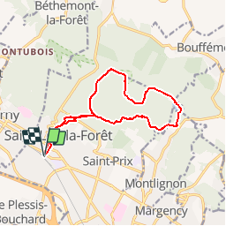
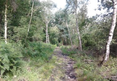
Randonnée Marche de 12,9 km à découvrir à Île-de-France, Val-d'Oise, Saint-Leu-la-Forêt. Cette randonnée est proposée par tracegps.
Description
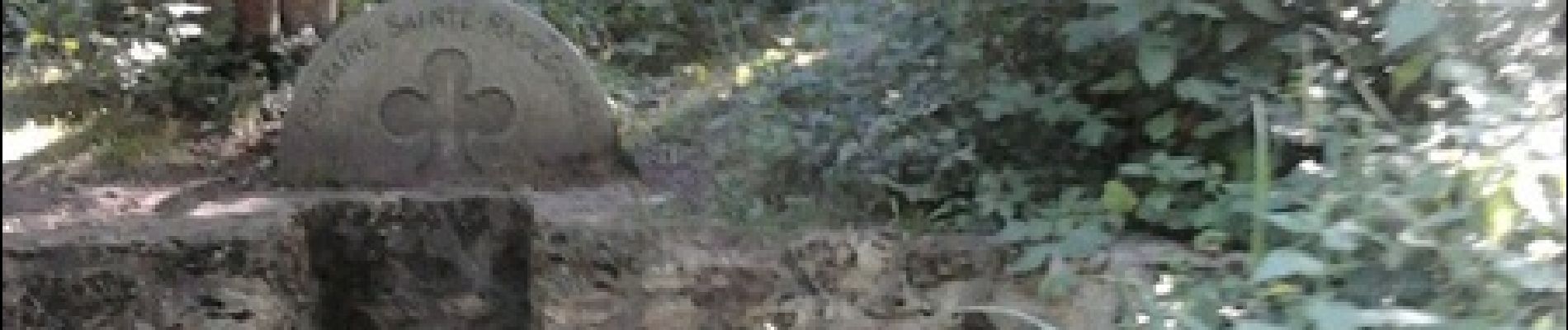
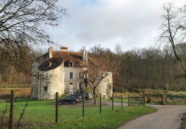
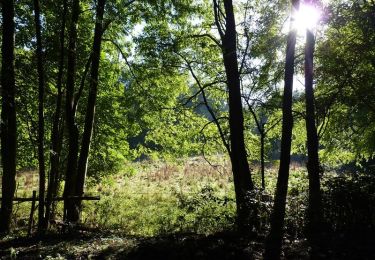
Départ et arrivée à la Gare SNCF de St Leu la Forêt. Parcours dans la forêt de Montmorency en passant par la Fontaine Ste Radegonde, l'Étang de la Chasse, la Tour du Plumet. Daniel BAIJOT
Localisation
Pays :
France
Région :
Île-de-France
Département/Province :
Val-d'Oise
Commune :
Saint-Leu-la-Forêt
Localité :
Unknown
Départ:(Dec)
Départ:(UTM)
444625 ; 5429486 (31U) N.
Commentaires
Randonnées à proximité
![Randonnée Marche Frépillon - GRP CV-IDF 07R Frépillon à Montmorency - Photo](https://media.geolcdn.com/t/375/260/cd8022c7-e75e-42b2-b52b-fdfab1f12efc.jpg&format=jpg&maxdim=2)
![Marche Marche](https://static1.geolcdn.com/sitytour/trail-icons/101.png)
GRP CV-IDF 07R Frépillon à Montmorency
Marche
Très difficile
(1)
Frépillon,
Île-de-France,
Val-d'Oise,
France
![](/images/other/stat-length.png)
16 km | 20 km-effort
4h 32min
![](https://static1.geolcdn.com/siteimages/upload/files/16400158638029165_repeat_loop_refresh_sync_direction_icon.png)
Non
![Randonnée V.T.T. Taverny - La Tabernacienne 2013 - Taverny - Photo](https://media.geolcdn.com/t/375/260/ext.jpg?maxdim=2&url=https%3A%2F%2Fservices.sitytrail.com%2FGeolivesWS%2FDownloadMedia.ashx%3FTrailID%3D191578%26Media%3D15203_6.jpg)
![V.T.T. V.T.T.](https://static1.geolcdn.com/sitytour/trail-icons/202.png)
La Tabernacienne 2013 - Taverny
V.T.T.
Moyen
(1)
Taverny,
Île-de-France,
Val-d'Oise,
France
![](/images/other/stat-length.png)
32 km | 39 km-effort
2h 30min
![](https://static1.geolcdn.com/siteimages/upload/files/16400158638029165_repeat_loop_refresh_sync_direction_icon.png)
Oui
![Randonnée Marche Taverny - Boucle en forêt à partir de Taverny - Photo](https://media.geolcdn.com/t/375/260/ext.jpg?maxdim=2&url=https%3A%2F%2Fservices.sitytrail.com%2FGeolivesWS%2FDownloadMedia.ashx%3FTrailID%3D106699%26Media%3D11336_3.jpg)
![Marche Marche](https://static1.geolcdn.com/sitytour/trail-icons/101.png)
Boucle en forêt à partir de Taverny
Marche
Moyen
(1)
Taverny,
Île-de-France,
Val-d'Oise,
France
![](/images/other/stat-length.png)
12,3 km | 15,8 km-effort
3h 30min
![](https://static1.geolcdn.com/siteimages/upload/files/16400158638029165_repeat_loop_refresh_sync_direction_icon.png)
Oui
![Randonnée Marche Méry-sur-Oise - Méry sur OIse- Neuville université - Photo](https://media.geolcdn.com/t/375/260/0452f9bb-6c09-4fbf-9ffd-3ef1f0d5be1d.jpg&format=jpg&maxdim=2)
![Marche Marche](https://static1.geolcdn.com/sitytour/trail-icons/101.png)
Méry sur OIse- Neuville université
Marche
Très facile
Méry-sur-Oise,
Île-de-France,
Val-d'Oise,
France
![](/images/other/stat-length.png)
15,6 km | 17,7 km-effort
3h 37min
![](https://static1.geolcdn.com/siteimages/upload/files/16400158638029165_repeat_loop_refresh_sync_direction_icon.png)
Non
![Randonnée Cheval Taverny - Rando testé Montmorency l'isle adam 23km - Photo](https://media.geolcdn.com/t/375/260/ext.jpg?maxdim=2&url=https%3A%2F%2Fstatic1.geolcdn.com%2Fsiteimages%2Fupload%2Ffiles%2F1524743154cheval.jpg)
![Cheval Cheval](https://static1.geolcdn.com/sitytour/trail-icons/300.png)
Rando testé Montmorency l'isle adam 23km
Cheval
Moyen
(2)
Taverny,
Île-de-France,
Val-d'Oise,
France
![](/images/other/stat-length.png)
25 km | 31 km-effort
3h 51min
![](https://static1.geolcdn.com/siteimages/upload/files/16400158638029165_repeat_loop_refresh_sync_direction_icon.png)
Oui
![Randonnée V.T.T. Saint-Leu-la-Forêt - Montmorency - Photo](https://media.geolcdn.com/t/375/260/ext.jpg?maxdim=2&url=https%3A%2F%2Fstatic1.geolcdn.com%2Fsiteimages%2Fupload%2Ffiles%2F1524743154velo.jpg)
![V.T.T. V.T.T.](https://static1.geolcdn.com/sitytour/trail-icons/202.png)
Montmorency
V.T.T.
Moyen
(2)
Saint-Leu-la-Forêt,
Île-de-France,
Val-d'Oise,
France
![](/images/other/stat-length.png)
23 km | 30 km-effort
Inconnu
![](https://static1.geolcdn.com/siteimages/upload/files/16400158638029165_repeat_loop_refresh_sync_direction_icon.png)
Oui
![Randonnée Marche Cormeilles-en-Parisis - Aller-Retour - Le balcon de l'Ile de France - Cormeilles en Parisis - Photo](https://media.geolcdn.com/t/375/260/91f10824-53f3-435b-97ce-a888d45f778b.jpg&format=jpg&maxdim=2)
![Marche Marche](https://static1.geolcdn.com/sitytour/trail-icons/101.png)
Aller-Retour - Le balcon de l'Ile de France - Cormeilles en Parisis
Marche
Facile
Cormeilles-en-Parisis,
Île-de-France,
Val-d'Oise,
France
![](/images/other/stat-length.png)
10,5 km | 13,4 km-effort
2h 13min
![](https://static1.geolcdn.com/siteimages/upload/files/16400158638029165_repeat_loop_refresh_sync_direction_icon.png)
Oui
![Randonnée Marche Chauvry - Foutue route vers Baillet - Photo](https://media.geolcdn.com/t/375/260/ext.jpg?maxdim=2&url=https%3A%2F%2Fstatic1.geolcdn.com%2Fsiteimages%2Fupload%2Ffiles%2F1553511878bg_sport_marche.png)
![Marche Marche](https://static1.geolcdn.com/sitytour/trail-icons/101.png)
Foutue route vers Baillet
Marche
Moyen
(1)
Chauvry,
Île-de-France,
Val-d'Oise,
France
![](/images/other/stat-length.png)
19,1 km | 24 km-effort
5h 20min
![](https://static1.geolcdn.com/siteimages/upload/files/16400158638029165_repeat_loop_refresh_sync_direction_icon.png)
Oui
![Randonnée Marche Ermont - Ermont-Lac d'enghien - Photo](https://media.geolcdn.com/t/375/260/ext.jpg?maxdim=2&url=https%3A%2F%2Fstatic1.geolcdn.com%2Fsiteimages%2Fupload%2Ffiles%2F1553511878bg_sport_marche.png)
![Marche Marche](https://static1.geolcdn.com/sitytour/trail-icons/101.png)
Ermont-Lac d'enghien
Marche
Difficile
(1)
Ermont,
Île-de-France,
Val-d'Oise,
France
![](/images/other/stat-length.png)
11,6 km | 12,5 km-effort
2h 49min
![](https://static1.geolcdn.com/siteimages/upload/files/16400158638029165_repeat_loop_refresh_sync_direction_icon.png)
Oui
Attention Bois de Corbon privé