![](/images/other/stat-length.png)
![Randonnée Marche Lembach - Entre Fleckenstein et Froensbourg - Photo](https://media.geolcdn.com/t/1900/400/ext.pjpeg?maxdim=2&url=https%3A%2F%2Fservices.sitytrail.com%2FGeolivesWS%2FDownloadMedia.ashx%3FTrailID%3D106316%26Media%3D10753_1.jpg)
Entre Fleckenstein et Froensbourg
tracegps
Utilisateur
![Longueur](/images/other/stat-length.png)
![Altitude max](https://static1.geolcdn.com/siteimages/upload/files/1508320355ic_sort_altitude_max_24dp.png)
![Dénivelé positif](https://static1.geolcdn.com/siteimages/upload/files/1508320355ic_sort_den_pos_24dp.png)
![Km-Effort](/images/other/stat-length.png)
![Altitude min](https://static1.geolcdn.com/siteimages/upload/files/1508320355ic_sort_altitude_min_24dp.png)
![Dénivelé négatif](https://static1.geolcdn.com/siteimages/upload/files/1508320355ic_sort_den_neg_24dp.png)
![Boucle](https://static1.geolcdn.com/siteimages/upload/files/16400158638029165_repeat_loop_refresh_sync_direction_icon.png)
![Marche](https://static1.geolcdn.com/sitytour/trail-icons/101.png)
3h00
Difficulté : Moyen
![Scannez ce code QR pour ouvrir la randonnée dans l'application SityTrail](https://capi.geolives.com/qq0zvz2zws4bq2lad0pu/sitytour/trails/106316/qr.png?size=200)
Application GPS de randonnée GRATUITE
À propos
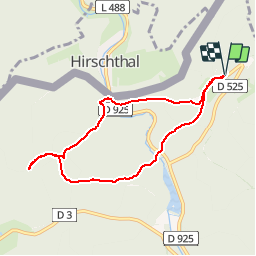
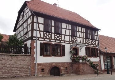
Randonnée Marche de 6,9 km à découvrir à Grand Est, Bas-Rhin, Lembach. Cette randonnée est proposée par tracegps.
Description
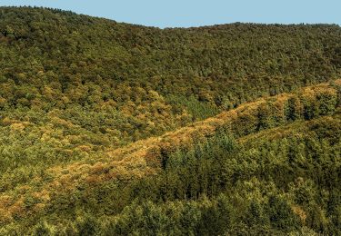
Ce n’est pas une randonnée d’une grande difficulté, ni en ce qui concerne la dénivelée, ni la longueur. C’est une belle randonnée que l'on peut faire avec des enfants car elle n’est pas excessivement longue (7km). On peut pique-niquer au Froensbourg et terminer par la visite du site du Fleckenstein qui offre des activités ludiques et pédagogiques. Retrouver les informations pratiques sur http://www.partance.org - Rubrique : Randonnée d'un jour/Entre Fleckenstein et Froensbourg
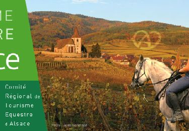
Localisation
Commentaires
Randonnées à proximité
![Randonnée Randonnée équestre Wingen - Boucle Loewenstein Hohenbourg Fleckenstein - Photo](https://media.geolcdn.com/t/375/260/70102c74-cde7-4712-ad3f-8ece0b83e7cb.jpg&format=jpg&maxdim=2)
![Randonnée équestre Randonnée équestre](https://static1.geolcdn.com/sitytour/trail-icons/301.png)
Randonnée équestre
![](/images/other/stat-length.png)
![](https://static1.geolcdn.com/siteimages/upload/files/16400158638029165_repeat_loop_refresh_sync_direction_icon.png)
![Randonnée Marche Lembach - Fleckenstein, circuit des 5 châteaux. - Photo](https://media.geolcdn.com/t/375/260/ext.jpg?maxdim=2&url=https%3A%2F%2Fservices.sitytrail.com%2FGeolivesWS%2FDownloadMedia.ashx%3FTrailID%3D364388%26Media%3Dfix__20141120164801.jpg)
![Marche Marche](https://static1.geolcdn.com/sitytour/trail-icons/101.png)
Marche
![](/images/other/stat-length.png)
![](https://static1.geolcdn.com/siteimages/upload/files/16400158638029165_repeat_loop_refresh_sync_direction_icon.png)
![Randonnée Randonnée équestre Schönau (Pfalz) - 2024-09-29 Rando CVA Palatinat Gebug Obersteinbach - Photo](https://media.geolcdn.com/t/375/260/8b46bdbb-d46a-437e-9444-a15a461aae7b.jpg&format=jpg&maxdim=2)
![Randonnée équestre Randonnée équestre](https://static1.geolcdn.com/sitytour/trail-icons/301.png)
Randonnée équestre
![](/images/other/stat-length.png)
![](https://static1.geolcdn.com/siteimages/upload/files/16400158638029165_repeat_loop_refresh_sync_direction_icon.png)
![Randonnée A pied Lembach - Anneau vert - Photo](https://media.geolcdn.com/t/375/260/94c60cdc-936e-47ee-9965-23e9ec9e034a.jpeg&format=jpg&maxdim=2)
![A pied A pied](https://static1.geolcdn.com/sitytour/trail-icons/100.png)
![Randonnée A pied Lembach - Anneau jaune - Photo](https://media.geolcdn.com/t/375/260/ca3811e6-33d3-4810-a71b-1526bcfc4047.jpeg&format=jpg&maxdim=2)
![A pied A pied](https://static1.geolcdn.com/sitytour/trail-icons/100.png)
![Randonnée A pied Wingen - Croix rouge - Photo](https://media.geolcdn.com/t/375/260/59ca20a7-ed62-4c6a-9fd9-47494a5cdd7a.jpeg&format=jpg&maxdim=2)
![A pied A pied](https://static1.geolcdn.com/sitytour/trail-icons/100.png)
![Randonnée A pied Lembach - Croix bleue - Photo](https://media.geolcdn.com/t/375/260/06df198a-1199-44ec-a8d9-2d9a150b410c.jpeg&format=jpg&maxdim=2)
![A pied A pied](https://static1.geolcdn.com/sitytour/trail-icons/100.png)
A pied
![](/images/other/stat-length.png)
![](https://static1.geolcdn.com/siteimages/upload/files/16400158638029165_repeat_loop_refresh_sync_direction_icon.png)
![Randonnée A pied Wingen - Anneau rouge - Photo](https://media.geolcdn.com/t/375/260/06df198a-1199-44ec-a8d9-2d9a150b410c.jpeg&format=jpg&maxdim=2)
![A pied A pied](https://static1.geolcdn.com/sitytour/trail-icons/100.png)
![Randonnée A pied Lembach - Disque bleu - Photo](https://media.geolcdn.com/t/375/260/0eb9d5da-4d5d-4850-86c1-81932a32bac4.jpeg&format=jpg&maxdim=2)
![A pied A pied](https://static1.geolcdn.com/sitytour/trail-icons/100.png)