![](/images/other/stat-length.png)
![Randonnée Marche Crevant-Laveine - Entre Crevant et Laveine - Photo](https://media.geolcdn.com/t/1900/400/ext.pjpeg?maxdim=2&url=https%3A%2F%2Fservices.sitytrail.com%2FGeolivesWS%2FDownloadMedia.ashx%3FTrailID%3D106259%26Media%3D10610_2.jpg)
Entre Crevant et Laveine
tracegps
Utilisateur
![Longueur](/images/other/stat-length.png)
![Altitude max](https://static1.geolcdn.com/siteimages/upload/files/1508320355ic_sort_altitude_max_24dp.png)
![Dénivelé positif](https://static1.geolcdn.com/siteimages/upload/files/1508320355ic_sort_den_pos_24dp.png)
![Km-Effort](/images/other/stat-length.png)
![Altitude min](https://static1.geolcdn.com/siteimages/upload/files/1508320355ic_sort_altitude_min_24dp.png)
![Dénivelé négatif](https://static1.geolcdn.com/siteimages/upload/files/1508320355ic_sort_den_neg_24dp.png)
![Boucle](https://static1.geolcdn.com/siteimages/upload/files/16400158638029165_repeat_loop_refresh_sync_direction_icon.png)
![Marche](https://static1.geolcdn.com/sitytour/trail-icons/101.png)
2h45
Difficulté : Facile
![Scannez ce code QR pour ouvrir la randonnée dans l'application SityTrail](https://capi.geolives.com/qq0zvz2zws4bq2lad0pu/sitytour/trails/106259/qr.png?size=200)
Application GPS de randonnée GRATUITE
À propos
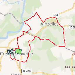
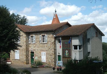
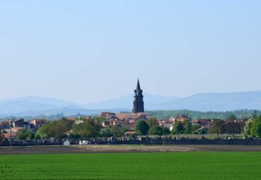
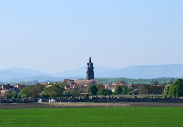
Randonnée Marche de 9,8 km à découvrir à Auvergne-Rhône-Alpes, Puy-de-Dôme, Crevant-Laveine. Cette randonnée est proposée par tracegps.
Description
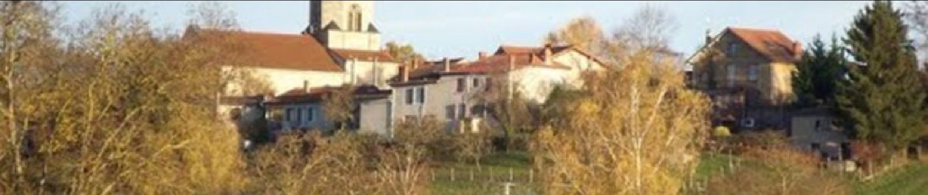
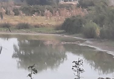
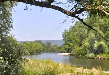
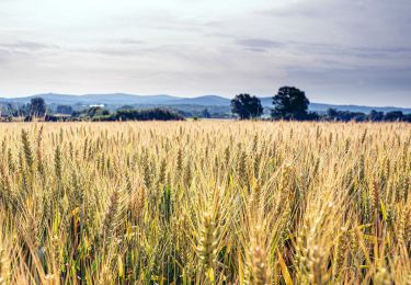
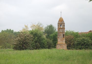
En bordure de l'Allier et des cultures céréalières, ce petit coin de Varennes est un pays de collines, de petites polycultures situées entre Saint Clément de Régnat à l'est et Puy Guillaume à l'ouest, entre le nord du département et Crevant Laveine au sud). Parsemé de villages tranquilles, il surprend par son relief vallonné et ses ruisseaux encaissés. Dans les bois de chênes, on peut encore rencontrer des rapaces et quelques cervidés.
Localisation
Commentaires
Randonnées à proximité
![Randonnée A pied Maringues - La Butte de Montgacon - circuit court - Photo](https://media.geolcdn.com/t/375/260/ab4843d0-b44d-4ab7-8595-840f5a55ca60.jpeg&format=jpg&maxdim=2)
![A pied A pied](https://static1.geolcdn.com/sitytour/trail-icons/100.png)
A pied
![](/images/other/stat-length.png)
![](https://static1.geolcdn.com/siteimages/upload/files/16400158638029165_repeat_loop_refresh_sync_direction_icon.png)
![Randonnée A pied Luzillat - La Butte de Montgacon - Photo](https://media.geolcdn.com/t/375/260/dae0ac9a-ba68-464f-a0a3-8b55925d12f4.jpeg&format=jpg&maxdim=2)
![A pied A pied](https://static1.geolcdn.com/sitytour/trail-icons/100.png)
A pied
![](/images/other/stat-length.png)
![](https://static1.geolcdn.com/siteimages/upload/files/16400158638029165_repeat_loop_refresh_sync_direction_icon.png)
![Randonnée A pied Vinzelles - Entre Crevant et Laveine - Photo](https://media.geolcdn.com/t/375/260/dd947ee4-d5c1-4bf1-b419-c5f2be4d1510.jpeg&format=jpg&maxdim=2)
![A pied A pied](https://static1.geolcdn.com/sitytour/trail-icons/100.png)
A pied
![](/images/other/stat-length.png)
![](https://static1.geolcdn.com/siteimages/upload/files/16400158638029165_repeat_loop_refresh_sync_direction_icon.png)
![Randonnée Marche Culhat - les Berges du Litroux, 7km300,59m - Photo](https://media.geolcdn.com/t/375/260/b60c59f2-2d70-4cad-a96e-175da2f9f2f4.jpg&format=jpg&maxdim=2)
![Marche Marche](https://static1.geolcdn.com/sitytour/trail-icons/101.png)
Marche
![](/images/other/stat-length.png)
![](https://static1.geolcdn.com/siteimages/upload/files/16400158638029165_repeat_loop_refresh_sync_direction_icon.png)
![Randonnée Marche Charnat - Charnat_Allier_Dore - Photo](https://media.geolcdn.com/t/375/260/b3a84eb6-99f5-4918-aef5-e43023b7bd8b.jpg&format=jpg&maxdim=2)
![Marche Marche](https://static1.geolcdn.com/sitytour/trail-icons/101.png)
Marche
![](/images/other/stat-length.png)
![](https://static1.geolcdn.com/siteimages/upload/files/16400158638029165_repeat_loop_refresh_sync_direction_icon.png)
![Randonnée Marche Vinzelles - Vinzelles_Ronde_Fours - Photo](https://media.geolcdn.com/t/375/260/aa2c240c-b9d5-44e1-88ec-cb361f7fa5cf.jpg&format=jpg&maxdim=2)
![Marche Marche](https://static1.geolcdn.com/sitytour/trail-icons/101.png)
Marche
![](/images/other/stat-length.png)
![](https://static1.geolcdn.com/siteimages/upload/files/16400158638029165_repeat_loop_refresh_sync_direction_icon.png)
![Marche Marche](https://static1.geolcdn.com/sitytour/trail-icons/101.png)
Marche
![](/images/other/stat-length.png)
![](https://static1.geolcdn.com/siteimages/upload/files/16400158638029165_repeat_loop_refresh_sync_direction_icon.png)
![Randonnée A pied Culhat - Les berges du litroux - Photo](https://media.geolcdn.com/t/375/260/b455793d-fd72-46b6-a443-473d5331581d.jpeg&format=jpg&maxdim=2)
![A pied A pied](https://static1.geolcdn.com/sitytour/trail-icons/100.png)
A pied
![](/images/other/stat-length.png)
![](https://static1.geolcdn.com/siteimages/upload/files/16400158638029165_repeat_loop_refresh_sync_direction_icon.png)
![Randonnée Marche Maringues - Maringues_Butte_Montgacon - Photo](https://media.geolcdn.com/t/375/260/fef1ecfc-3d14-4465-b9c8-110655272baa.jpg&format=jpg&maxdim=2)
![Marche Marche](https://static1.geolcdn.com/sitytour/trail-icons/101.png)
Marche
![](/images/other/stat-length.png)
![](https://static1.geolcdn.com/siteimages/upload/files/16400158638029165_repeat_loop_refresh_sync_direction_icon.png)
dommage que certaines personnes jettent tout et n'importe quoi au bord du chemin