![](/images/other/stat-length.png)
![Randonnée V.T.T. Fontaine-Chaalis - En forêt d'Ermenonville - Photo](https://media.geolcdn.com/t/1900/400/ext.pjpeg?maxdim=2&url=https%3A%2F%2Fservices.sitytrail.com%2FGeolivesWS%2FDownloadMedia.ashx%3FTrailID%3D106099%26Media%3D10325_1.jpg)
En forêt d'Ermenonville
tracegps
Utilisateur
![Longueur](/images/other/stat-length.png)
Longueur
19,4 km
![Altitude max](https://static1.geolcdn.com/siteimages/upload/files/1508320355ic_sort_altitude_max_24dp.png)
Altitude max
122 m
![Dénivelé positif](https://static1.geolcdn.com/siteimages/upload/files/1508320355ic_sort_den_pos_24dp.png)
Dénivelé positif
202 m
![Km-Effort](/images/other/stat-length.png)
Km-Effort
22 km
![Altitude min](https://static1.geolcdn.com/siteimages/upload/files/1508320355ic_sort_altitude_min_24dp.png)
Altitude min
64 m
![Dénivelé négatif](https://static1.geolcdn.com/siteimages/upload/files/1508320355ic_sort_den_neg_24dp.png)
Dénivelé négatif
201 m
![Boucle](https://static1.geolcdn.com/siteimages/upload/files/16400158638029165_repeat_loop_refresh_sync_direction_icon.png)
Boucle
Oui
Date de création :
2014-12-10 00:00:00.0
Dernière modification :
2014-12-10 00:00:00.0
![V.T.T.](https://static1.geolcdn.com/sitytour/trail-icons/202.png)
1h15
Difficulté : Facile
![Scannez ce code QR pour ouvrir la randonnée dans l'application SityTrail](https://capi.geolives.com/qq0zvz2zws4bq2lad0pu/sitytour/trails/106099/qr.png?size=200)
Application GPS de randonnée GRATUITE
À propos
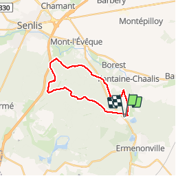
Randonnée V.T.T. de 19,4 km à découvrir à Hauts-de-France, Oise, Fontaine-Chaalis. Cette randonnée est proposée par tracegps.
Description
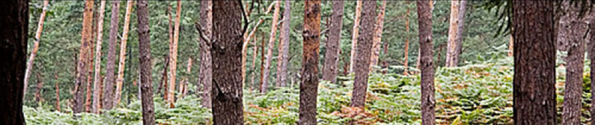
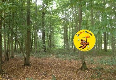
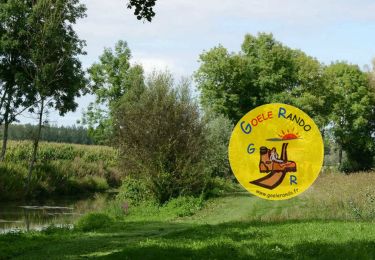
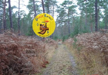
Circuit de 20 km dans la forêt d'Ermenonville , départ en face de la Mer de Sable ( musée Jacquemart). Pas de difficulté particulière. Circuit non boueux et agréable.
Localisation
Pays :
France
Région :
Hauts-de-France
Département/Province :
Oise
Commune :
Fontaine-Chaalis
Localité :
Unknown
Départ:(Dec)
Départ:(UTM)
476707 ; 5443818 (31U) N.
Commentaires
Randonnées à proximité
![Randonnée Marche Ermenonville - SM_ERMENONVILLE CHATEAU_NORD_8.1Km - Photo](https://media.geolcdn.com/t/375/260/7d446e19-5e6a-43bb-b3e7-8604a42003f5.jpg&format=jpg&maxdim=2)
![Marche Marche](https://static1.geolcdn.com/sitytour/trail-icons/101.png)
SM_ERMENONVILLE CHATEAU_NORD_8.1Km
Marche
Facile
(1)
Ermenonville,
Hauts-de-France,
Oise,
France
![](/images/other/stat-length.png)
8,1 km | 9,5 km-effort
2h 12min
![](https://static1.geolcdn.com/siteimages/upload/files/16400158638029165_repeat_loop_refresh_sync_direction_icon.png)
Oui
![Randonnée Marche Fontaine-Chaalis - SM_Abbaye de Chaalis OUEST_7,9Km - Photo](https://media.geolcdn.com/t/375/260/657f82f2-464a-46f3-a6d5-6815f63cb655.jpg&format=jpg&maxdim=2)
![Marche Marche](https://static1.geolcdn.com/sitytour/trail-icons/101.png)
SM_Abbaye de Chaalis OUEST_7,9Km
Marche
Moyen
(8)
Fontaine-Chaalis,
Hauts-de-France,
Oise,
France
![](/images/other/stat-length.png)
7,9 km | 9 km-effort
2h 2min
![](https://static1.geolcdn.com/siteimages/upload/files/16400158638029165_repeat_loop_refresh_sync_direction_icon.png)
Oui
![Randonnée Marche Ver-sur-Launette - SM_VER-sur-LAUNETTE_8.5Km - Photo](https://media.geolcdn.com/t/375/260/e4a0fe41-690f-4014-9611-5ec255c04f3d.jpg&format=jpg&maxdim=2)
![Marche Marche](https://static1.geolcdn.com/sitytour/trail-icons/101.png)
SM_VER-sur-LAUNETTE_8.5Km
Marche
Moyen
(8)
Ver-sur-Launette,
Hauts-de-France,
Oise,
France
![](/images/other/stat-length.png)
8,5 km | 9,6 km-effort
2h 6min
![](https://static1.geolcdn.com/siteimages/upload/files/16400158638029165_repeat_loop_refresh_sync_direction_icon.png)
Oui
![Randonnée Marche Fontaine-Chaalis - SM_Abbaye de Chaalis-NORD_8.4Km - Photo](https://media.geolcdn.com/t/375/260/15af4e3c-b372-40df-abf5-027cf19e5dd0.jpg&format=jpg&maxdim=2)
![Marche Marche](https://static1.geolcdn.com/sitytour/trail-icons/101.png)
SM_Abbaye de Chaalis-NORD_8.4Km
Marche
Moyen
(6)
Fontaine-Chaalis,
Hauts-de-France,
Oise,
France
![](/images/other/stat-length.png)
8,5 km | 9,5 km-effort
1h 56min
![](https://static1.geolcdn.com/siteimages/upload/files/16400158638029165_repeat_loop_refresh_sync_direction_icon.png)
Oui
![Randonnée Marche Ermenonville - MR_ERMENONVILLE-Chateau 5.8Km - Photo](https://media.geolcdn.com/t/375/260/4ced2ae2-3324-4103-b3b1-afffd891ea1f.jpg&format=jpg&maxdim=2)
![Marche Marche](https://static1.geolcdn.com/sitytour/trail-icons/101.png)
MR_ERMENONVILLE-Chateau 5.8Km
Marche
Moyen
(4)
Ermenonville,
Hauts-de-France,
Oise,
France
![](/images/other/stat-length.png)
5,8 km | 6,8 km-effort
1h 32min
![](https://static1.geolcdn.com/siteimages/upload/files/16400158638029165_repeat_loop_refresh_sync_direction_icon.png)
Oui
![Randonnée Marche Montagny-Sainte-Félicité - SM_MONTAGNY_Ste-FELECITE_8.5Km - Photo](https://media.geolcdn.com/t/375/260/7f77d429-995c-4fbd-8931-c05c864ab4aa.jpg&format=jpg&maxdim=2)
![Marche Marche](https://static1.geolcdn.com/sitytour/trail-icons/101.png)
SM_MONTAGNY_Ste-FELECITE_8.5Km
Marche
Moyen
(7)
Montagny-Sainte-Félicité,
Hauts-de-France,
Oise,
France
![](/images/other/stat-length.png)
8,6 km | 10,1 km-effort
2h 12min
![](https://static1.geolcdn.com/siteimages/upload/files/16400158638029165_repeat_loop_refresh_sync_direction_icon.png)
Oui
![Randonnée Marche Ver-sur-Launette - SM_LOISY_8.5Km - Photo](https://media.geolcdn.com/t/375/260/11537f1c-9100-4fb5-a43a-20a54cad8fb4.jpg&format=jpg&maxdim=2)
![Marche Marche](https://static1.geolcdn.com/sitytour/trail-icons/101.png)
SM_LOISY_8.5Km
Marche
Moyen
(3)
Ver-sur-Launette,
Hauts-de-France,
Oise,
France
![](/images/other/stat-length.png)
8,7 km | 9,7 km-effort
2h 12min
![](https://static1.geolcdn.com/siteimages/upload/files/16400158638029165_repeat_loop_refresh_sync_direction_icon.png)
Oui
![Randonnée Marche Fontaine-Chaalis - MR_ERMENONVILLE-Maison-Blanche_EST_5.8Km - Photo](https://media.geolcdn.com/t/375/260/9923fd81-5d90-403c-9e41-4a668aba5ad7.jpg&format=jpg&maxdim=2)
![Marche Marche](https://static1.geolcdn.com/sitytour/trail-icons/101.png)
MR_ERMENONVILLE-Maison-Blanche_EST_5.8Km
Marche
Moyen
(1)
Fontaine-Chaalis,
Hauts-de-France,
Oise,
France
![](/images/other/stat-length.png)
5,8 km | 6,6 km-effort
1h 30min
![](https://static1.geolcdn.com/siteimages/upload/files/16400158638029165_repeat_loop_refresh_sync_direction_icon.png)
Oui
![Randonnée Marche Fontaine-Chaalis - SM_ERMENONVILLE_CROIX-NEUVE_7.9Km - Photo](https://media.geolcdn.com/t/375/260/e4b09448-2536-463d-8b6c-9149eccb61cd.jpg&format=jpg&maxdim=2)
![Marche Marche](https://static1.geolcdn.com/sitytour/trail-icons/101.png)
SM_ERMENONVILLE_CROIX-NEUVE_7.9Km
Marche
Moyen
(7)
Fontaine-Chaalis,
Hauts-de-France,
Oise,
France
![](/images/other/stat-length.png)
7,3 km | 8,3 km-effort
1h 58min
![](https://static1.geolcdn.com/siteimages/upload/files/16400158638029165_repeat_loop_refresh_sync_direction_icon.png)
Oui