![](/images/other/stat-length.png)
![Randonnée Marche Villefranche-de-Lauragais - Tour du Télégraphe à Villefranche de Lauragais - Photo](https://media.geolcdn.com/t/1900/400/ext.pjpeg?maxdim=2&url=https%3A%2F%2Fservices.sitytrail.com%2FGeolivesWS%2FDownloadMedia.ashx%3FTrailID%3D106097%26Media%3D10321_1.jpg)
Tour du Télégraphe à Villefranche de Lauragais
tracegps
Utilisateur
![Longueur](/images/other/stat-length.png)
Longueur
12,6 km
![Altitude max](https://static1.geolcdn.com/siteimages/upload/files/1508320355ic_sort_altitude_max_24dp.png)
Altitude max
266 m
![Dénivelé positif](https://static1.geolcdn.com/siteimages/upload/files/1508320355ic_sort_den_pos_24dp.png)
Dénivelé positif
202 m
![Km-Effort](/images/other/stat-length.png)
Km-Effort
15,3 km
![Altitude min](https://static1.geolcdn.com/siteimages/upload/files/1508320355ic_sort_altitude_min_24dp.png)
Altitude min
182 m
![Dénivelé négatif](https://static1.geolcdn.com/siteimages/upload/files/1508320355ic_sort_den_neg_24dp.png)
Dénivelé négatif
199 m
![Boucle](https://static1.geolcdn.com/siteimages/upload/files/16400158638029165_repeat_loop_refresh_sync_direction_icon.png)
Boucle
Oui
Date de création :
2014-12-10 00:00:00.0
Dernière modification :
2014-12-10 00:00:00.0
![Marche](https://static1.geolcdn.com/sitytour/trail-icons/101.png)
3h10
Difficulté : Moyen
![Scannez ce code QR pour ouvrir la randonnée dans l'application SityTrail](https://capi.geolives.com/qq0zvz2zws4bq2lad0pu/sitytour/trails/106097/qr.png?size=200)
Application GPS de randonnée GRATUITE
À propos
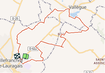
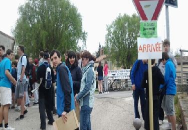
Randonnée Marche de 12,6 km à découvrir à Occitanie, Haute-Garonne, Villefranche-de-Lauragais. Cette randonnée est proposée par tracegps.
Description
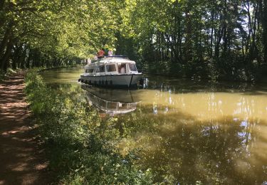
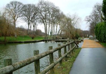
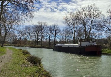
Une boucle dans le Lauragais au dessus de Villefranche en passant par une des Tours du Télégraphe de Chappe XVIIIème siècle (sur la ligne Toulouse -Marseille).
Localisation
Pays :
France
Région :
Occitanie
Département/Province :
Haute-Garonne
Commune :
Villefranche-de-Lauragais
Localité :
Unknown
Départ:(Dec)
Départ:(UTM)
396540 ; 4806098 (31T) N.
Commentaires
Randonnées à proximité
![Randonnée Marche Gardouch - Canal du Midi - Photo](https://media.geolcdn.com/t/375/260/ext.jpg?maxdim=2&url=https%3A%2F%2Fmedia.geolcdn.com%2Ff%2Fd8458df4-0ea1-46aa-a903-e9cd0d9f4c56.jpg)
![Marche Marche](https://static1.geolcdn.com/sitytour/trail-icons/101.png)
Canal du Midi
Marche
Difficile
Gardouch,
Occitanie,
Haute-Garonne,
France
![](/images/other/stat-length.png)
10,5 km | 12,7 km-effort
2h 32min
![](https://static1.geolcdn.com/siteimages/upload/files/16400158638029165_repeat_loop_refresh_sync_direction_icon.png)
Oui
![Randonnée Marche Avignonet-Lauragais - Avignonet - Donneville - Photo](https://media.geolcdn.com/t/375/260/ext.jpg?maxdim=2&url=https%3A%2F%2Fservices.sitytrail.com%2FGeolivesWS%2FDownloadMedia.ashx%3FTrailID%3D185856%26Media%3D20130418130935.jpeg)
![Marche Marche](https://static1.geolcdn.com/sitytour/trail-icons/101.png)
Avignonet - Donneville
Marche
Moyen
Avignonet-Lauragais,
Occitanie,
Haute-Garonne,
France
![](/images/other/stat-length.png)
29 km | 31 km-effort
Inconnu
![](https://static1.geolcdn.com/siteimages/upload/files/16400158638029165_repeat_loop_refresh_sync_direction_icon.png)
Non
![Randonnée Marche Gardouch - Le canal du Midi - Photo](https://media.geolcdn.com/t/375/260/ext.jpg?maxdim=2&url=https%3A%2F%2Fmedia.geolcdn.com%2Ff%2Faf9bcfd4-c626-4ab8-94b1-1fbe54078c4c.jpg)
![Marche Marche](https://static1.geolcdn.com/sitytour/trail-icons/101.png)
Le canal du Midi
Marche
Difficile
Gardouch,
Occitanie,
Haute-Garonne,
France
![](/images/other/stat-length.png)
11,2 km | 12,1 km-effort
2h 34min
![](https://static1.geolcdn.com/siteimages/upload/files/16400158638029165_repeat_loop_refresh_sync_direction_icon.png)
Non
![Randonnée Marche Gardouch - Les Collines du Lauragais - Photo](https://media.geolcdn.com/t/375/260/ext.jpg?maxdim=2&url=https%3A%2F%2Fmedia.geolcdn.com%2Ff%2F0a95eafd-6ea3-4caa-86c2-d396d6c9c7af.jpg)
![Marche Marche](https://static1.geolcdn.com/sitytour/trail-icons/101.png)
Les Collines du Lauragais
Marche
Gardouch,
Occitanie,
Haute-Garonne,
France
![](/images/other/stat-length.png)
8,3 km | 10,1 km-effort
2h 21min
![](https://static1.geolcdn.com/siteimages/upload/files/16400158638029165_repeat_loop_refresh_sync_direction_icon.png)
Oui
![Randonnée Marche Vieillevigne - lamarasse2h15 - Photo](https://media.geolcdn.com/t/375/260/ext.jpg?maxdim=2&url=https%3A%2F%2Fmedia.geolcdn.com%2Ff%2Feb4e540c-b81a-47ad-a382-5a62ea4fd489.jpg)
![Marche Marche](https://static1.geolcdn.com/sitytour/trail-icons/101.png)
lamarasse2h15
Marche
Très facile
Vieillevigne,
Occitanie,
Haute-Garonne,
France
![](/images/other/stat-length.png)
10,1 km | 10,9 km-effort
2h 9min
![](https://static1.geolcdn.com/siteimages/upload/files/16400158638029165_repeat_loop_refresh_sync_direction_icon.png)
Non
![Randonnée Vélo électrique Avignonet-Lauragais - Avignonet-Castelnaudary - Photo](https://media.geolcdn.com/t/375/260/ext.jpg?maxdim=2&url=https%3A%2F%2Fmedia.geolcdn.com%2Ff%2Ff9ea2a33-edbd-425e-b794-d8dd97cc8585.jpg)
![Vélo électrique Vélo électrique](https://static1.geolcdn.com/sitytour/trail-icons/205.png)
Avignonet-Castelnaudary
Vélo électrique
Avignonet-Lauragais,
Occitanie,
Haute-Garonne,
France
![](/images/other/stat-length.png)
40 km | 0 m-effort
3h 13min
![](https://static1.geolcdn.com/siteimages/upload/files/16400158638029165_repeat_loop_refresh_sync_direction_icon.png)
Oui
![Randonnée Marche Avignonet-Lauragais - Canal du Midi - En Cassan - Col de Naurouze - Photo](https://media.geolcdn.com/t/375/260/ext.jpg?maxdim=2&url=https%3A%2F%2Fservices.sitytrail.com%2FGeolivesWS%2FDownloadMedia.ashx%3FTrailID%3D108631%26Media%3D1541_2.jpg)
![Marche Marche](https://static1.geolcdn.com/sitytour/trail-icons/101.png)
Canal du Midi - En Cassan - Col de Naurouze
Marche
Facile
Avignonet-Lauragais,
Occitanie,
Haute-Garonne,
France
![](/images/other/stat-length.png)
6,8 km | 7,4 km-effort
1h 19min
![](https://static1.geolcdn.com/siteimages/upload/files/16400158638029165_repeat_loop_refresh_sync_direction_icon.png)
Non
![Randonnée Marche Gardouch - Canal du Midi - Ecluse de Laval - En Cassan - Photo](https://media.geolcdn.com/t/375/260/ext.jpg?maxdim=2&url=https%3A%2F%2Fservices.sitytrail.com%2FGeolivesWS%2FDownloadMedia.ashx%3FTrailID%3D108630%26Media%3D1540_1.jpg)
![Marche Marche](https://static1.geolcdn.com/sitytour/trail-icons/101.png)
Canal du Midi - Ecluse de Laval - En Cassan
Marche
Facile
Gardouch,
Occitanie,
Haute-Garonne,
France
![](/images/other/stat-length.png)
8,4 km | 8,9 km-effort
1h 40min
![](https://static1.geolcdn.com/siteimages/upload/files/16400158638029165_repeat_loop_refresh_sync_direction_icon.png)
Non
![Randonnée Course à pied Villenouvelle - Villenouvelle à Bazièges - Photo](https://media.geolcdn.com/t/375/260/ext.jpg?maxdim=2&url=https%3A%2F%2Fservices.sitytrail.com%2FGeolivesWS%2FDownloadMedia.ashx%3FTrailID%3D100839%26Media%3D340_1.jpg)
![Course à pied Course à pied](https://static1.geolcdn.com/sitytour/trail-icons/103.png)
Villenouvelle à Bazièges
Course à pied
Difficile
Villenouvelle,
Occitanie,
Haute-Garonne,
France
![](/images/other/stat-length.png)
19,2 km | 22 km-effort
2h 0min
![](https://static1.geolcdn.com/siteimages/upload/files/16400158638029165_repeat_loop_refresh_sync_direction_icon.png)
Oui