![](/images/other/stat-length.png)
![Randonnée Marche Plougrescant - Autour de Tréguier - Etape 4 - Photo](https://media.geolcdn.com/t/1900/400/ext.pjpeg?maxdim=2&url=https%3A%2F%2Fservices.sitytrail.com%2FGeolivesWS%2FDownloadMedia.ashx%3FTrailID%3D105817%26Media%3D9745_5.jpg)
Autour de Tréguier - Etape 4
tracegps
Utilisateur
![Longueur](/images/other/stat-length.png)
![Altitude max](https://static1.geolcdn.com/siteimages/upload/files/1508320355ic_sort_altitude_max_24dp.png)
![Dénivelé positif](https://static1.geolcdn.com/siteimages/upload/files/1508320355ic_sort_den_pos_24dp.png)
![Km-Effort](/images/other/stat-length.png)
![Altitude min](https://static1.geolcdn.com/siteimages/upload/files/1508320355ic_sort_altitude_min_24dp.png)
![Dénivelé négatif](https://static1.geolcdn.com/siteimages/upload/files/1508320355ic_sort_den_neg_24dp.png)
![Boucle](https://static1.geolcdn.com/siteimages/upload/files/16400158638029165_repeat_loop_refresh_sync_direction_icon.png)
![Marche](https://static1.geolcdn.com/sitytour/trail-icons/101.png)
4h45
Difficulté : Moyen
![Scannez ce code QR pour ouvrir la randonnée dans l'application SityTrail](https://capi.geolives.com/qq0zvz2zws4bq2lad0pu/sitytour/trails/105817/qr.png?size=200)
Application GPS de randonnée GRATUITE
À propos
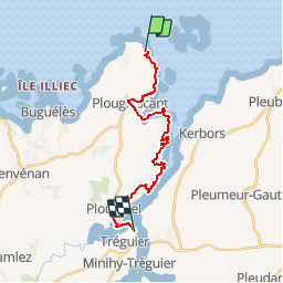
Randonnée Marche de 17,3 km à découvrir à Bretagne, Côtes-d'Armor, Plougrescant. Cette randonnée est proposée par tracegps.
Description
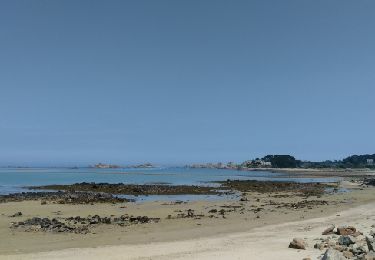
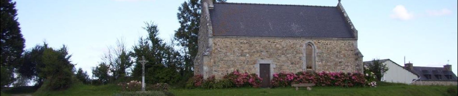
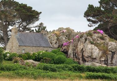
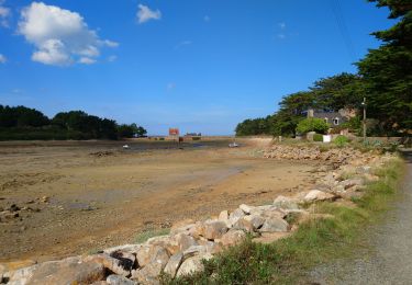
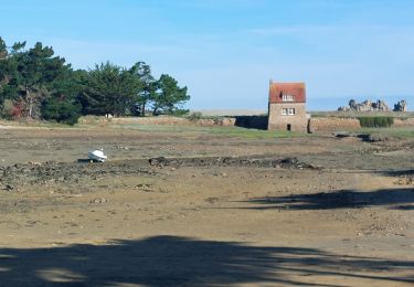
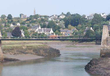
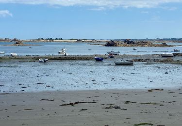
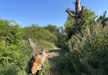
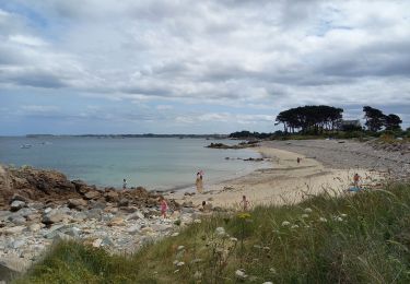
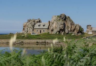
AUTOUR DE TREGUIER Etape N°4 PLOUGRESCANT-TREGUIER Cette randonnée est la quatrième d' un circuit en boucle relativement facile de 4 jours. Ce circuit convient à de bons marcheurs qui veulent débuter en randonnée itinérante. Trace préparée sur un logiciel cartographique. Il risque d'y avoir quelques écarts par rapport au terrain. Suivre le GR. Après la zone marécole on peut suivre l' ancien balisage GR qui passe par Plougrescant ( commerces ) et sa chapelle « tordue »( c' est ce que fait la trace proposée ) ou continuer par le nouveau balisage le long de la côte. Après la pointe jaune le GR suit la rivière au ras de la berge, consulter les horaires de marée ( on peut éventuellement remonter la route puis prendre à gauche ). Attention de ne pas dépasser le point de remontée peu visible à Crec'h Suillet en face de l' élevage aquacole. Suivre ensuite le GR jusqu' à Tréguier.
Localisation
Commentaires
Randonnées à proximité
![Randonnée Marche Plougrescant - Plougrescant - GR34 la Roche Jaune - 22.9km 260m 5h10 (45mn) - 2024 06 23 - Photo](https://media.geolcdn.com/t/375/260/2359623e-5d45-4bf5-bcc2-f64fe8f92be9.jpg&format=jpg&maxdim=2)
![Marche Marche](https://static1.geolcdn.com/sitytour/trail-icons/101.png)
Marche
![](/images/other/stat-length.png)
![](https://static1.geolcdn.com/siteimages/upload/files/16400158638029165_repeat_loop_refresh_sync_direction_icon.png)
![Randonnée Marche Penvénan - Buguélès Penvénan - GR34 Raluzet Placen Amic - 11.4km 160m 2h50 - 2023 09 15 - Photo](https://media.geolcdn.com/t/375/260/e4423474-b66f-4ea0-a231-fcf6eb14eb9f.jpg&format=jpg&maxdim=2)
![Marche Marche](https://static1.geolcdn.com/sitytour/trail-icons/101.png)
Marche
![](/images/other/stat-length.png)
![](https://static1.geolcdn.com/siteimages/upload/files/16400158638029165_repeat_loop_refresh_sync_direction_icon.png)
![Randonnée Marche Plougrescant - GR_34_DG_28_Plougrescant_Perros-Guirec_20240914 - Photo](https://media.geolcdn.com/t/375/260/e7f4cfc0-8327-4a35-8f91-6c420e8362fb.jpg&format=jpg&maxdim=2)
![Marche Marche](https://static1.geolcdn.com/sitytour/trail-icons/101.png)
Marche
![](/images/other/stat-length.png)
![](https://static1.geolcdn.com/siteimages/upload/files/16400158638029165_repeat_loop_refresh_sync_direction_icon.png)
![Randonnée Marche Kerbors - GR_34_DE_26_Kerbors_Plouguiel_20240819 - Photo](https://media.geolcdn.com/t/375/260/1c285370-a1d7-439a-878c-cb48dfe91862.jpg&format=jpg&maxdim=2)
![Marche Marche](https://static1.geolcdn.com/sitytour/trail-icons/101.png)
Marche
![](/images/other/stat-length.png)
![](https://static1.geolcdn.com/siteimages/upload/files/16400158638029165_repeat_loop_refresh_sync_direction_icon.png)
![Randonnée Marche Plougrescant - Plougrescant - Photo](https://media.geolcdn.com/t/375/260/2a9570bf-93d0-4b8a-a51c-944d451c40d8.jpg&format=jpg&maxdim=2)
![Marche Marche](https://static1.geolcdn.com/sitytour/trail-icons/101.png)
Marche
![](/images/other/stat-length.png)
![](https://static1.geolcdn.com/siteimages/upload/files/16400158638029165_repeat_loop_refresh_sync_direction_icon.png)
![Randonnée Marche Plougrescant - Plougrescant 10,3km - Photo](https://media.geolcdn.com/t/375/260/fb977883-8846-4363-88ce-e4ce215b4973.jpg&format=jpg&maxdim=2)
![Marche Marche](https://static1.geolcdn.com/sitytour/trail-icons/101.png)
Marche
![](/images/other/stat-length.png)
![](https://static1.geolcdn.com/siteimages/upload/files/16400158638029165_repeat_loop_refresh_sync_direction_icon.png)
![Randonnée Marche - Gouffre et Pointe du Château 10.7.23 - Photo](https://media.geolcdn.com/t/375/260/dc62eb0e-b462-4561-9e42-a4f6dbb58ee8.jpg&format=jpg&maxdim=2)
![Marche Marche](https://static1.geolcdn.com/sitytour/trail-icons/101.png)
Marche
![](/images/other/stat-length.png)
![](https://static1.geolcdn.com/siteimages/upload/files/16400158638029165_repeat_loop_refresh_sync_direction_icon.png)
![Randonnée Marche Plougrescant - Le grand tour de Plougrescant - Photo](https://media.geolcdn.com/t/375/260/02736515-1cc3-4ed0-86bb-76474d28f99a.jpg&format=jpg&maxdim=2)
![Marche Marche](https://static1.geolcdn.com/sitytour/trail-icons/101.png)
Marche
![](/images/other/stat-length.png)
![](https://static1.geolcdn.com/siteimages/upload/files/16400158638029165_repeat_loop_refresh_sync_direction_icon.png)
![Randonnée Marche Plouguiel - Bugelez - Photo](https://media.geolcdn.com/t/375/260/ext.jpg?maxdim=2&url=https%3A%2F%2Fservices.sitytrail.com%2FGeolivesWS%2FDownloadMedia.ashx%3FTrailID%3D770970%26Media%3Dfix__20170601140047.jpg)
![Marche Marche](https://static1.geolcdn.com/sitytour/trail-icons/101.png)