![](/images/other/stat-length.png)
![Randonnée Marche Chilhac - Le plateau d'Ally - Photo](https://media.geolcdn.com/t/1900/400/ext.pjpeg?maxdim=2&url=https%3A%2F%2Fservices.sitytrail.com%2FGeolivesWS%2FDownloadMedia.ashx%3FTrailID%3D105786%26Media%3D9687_2.jpg)
Le plateau d'Ally
tracegps
Utilisateur
![Longueur](/images/other/stat-length.png)
Longueur
23 km
![Altitude max](https://static1.geolcdn.com/siteimages/upload/files/1508320355ic_sort_altitude_max_24dp.png)
Altitude max
1062 m
![Dénivelé positif](https://static1.geolcdn.com/siteimages/upload/files/1508320355ic_sort_den_pos_24dp.png)
Dénivelé positif
845 m
![Km-Effort](/images/other/stat-length.png)
Km-Effort
33 km
![Altitude min](https://static1.geolcdn.com/siteimages/upload/files/1508320355ic_sort_altitude_min_24dp.png)
Altitude min
459 m
![Dénivelé négatif](https://static1.geolcdn.com/siteimages/upload/files/1508320355ic_sort_den_neg_24dp.png)
Dénivelé négatif
370 m
![Boucle](https://static1.geolcdn.com/siteimages/upload/files/16400158638029165_repeat_loop_refresh_sync_direction_icon.png)
Boucle
Non
Date de création :
2014-12-10 00:00:00.0
Dernière modification :
2014-12-10 00:00:00.0
![Marche](https://static1.geolcdn.com/sitytour/trail-icons/101.png)
6h00
Difficulté : Difficile
![Scannez ce code QR pour ouvrir la randonnée dans l'application SityTrail](https://capi.geolives.com/qq0zvz2zws4bq2lad0pu/sitytour/trails/105786/qr.png?size=200)
Application GPS de randonnée GRATUITE
À propos
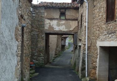
Randonnée Marche de 23 km à découvrir à Auvergne-Rhône-Alpes, Haute-Loire, Chilhac. Cette randonnée est proposée par tracegps.
Description
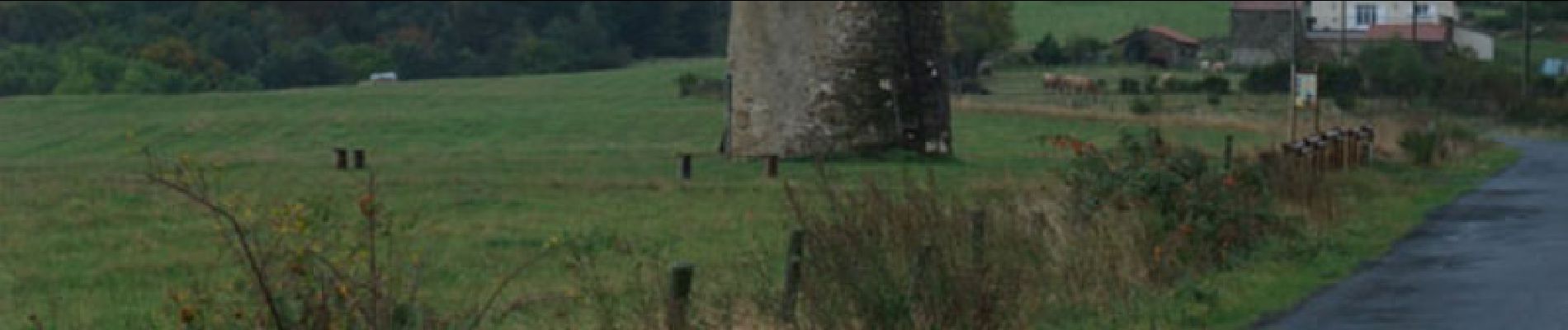
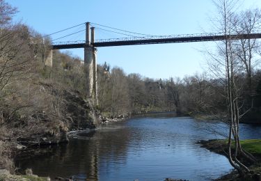
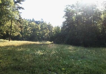
Une montée lente sur le plateau d'Ally dans le Cantal, en direction des fameuses éoliennes, depuis le village de Chilhac en haute-Loire. L'itinéraire à travers bois est propice à la découverte de multiples espèces de champignons... comestibles bien sur!
Localisation
Pays :
France
Région :
Auvergne-Rhône-Alpes
Département/Province :
Haute-Loire
Commune :
Chilhac
Localité :
Unknown
Départ:(Dec)
Départ:(UTM)
534327 ; 5000637 (31T) N.
Commentaires
Randonnées à proximité
![Randonnée Marche Villeneuve-d'Allier - Villeneuve d'allier - Lavoûte Chilhac - Photo](https://media.geolcdn.com/t/375/260/ext.jpg?maxdim=2&url=https%3A%2F%2Fmedia.geolcdn.com%2Ff%2Faffe3b51-ba5a-47cf-a3a3-bf1ec6e8569c.JPG)
![Marche Marche](https://static1.geolcdn.com/sitytour/trail-icons/101.png)
Villeneuve d'allier - Lavoûte Chilhac
Marche
Très difficile
Villeneuve-d'Allier,
Auvergne-Rhône-Alpes,
Haute-Loire,
France
![](/images/other/stat-length.png)
26 km | 36 km-effort
7h 36min
![](https://static1.geolcdn.com/siteimages/upload/files/16400158638029165_repeat_loop_refresh_sync_direction_icon.png)
Oui
![Randonnée V.T.T. Chilhac - vtt chilhac - langeac - Photo](https://media.geolcdn.com/t/375/260/ext.jpg?maxdim=2&url=https%3A%2F%2Fservices.sitytrail.com%2FGeolivesWS%2FDownloadMedia.ashx%3FTrailID%3D144457%26Media%3D20120807094502.jpeg)
![V.T.T. V.T.T.](https://static1.geolcdn.com/sitytour/trail-icons/202.png)
vtt chilhac - langeac
V.T.T.
Moyen
Chilhac,
Auvergne-Rhône-Alpes,
Haute-Loire,
France
![](/images/other/stat-length.png)
29 km | 38 km-effort
3h 9min
![](https://static1.geolcdn.com/siteimages/upload/files/16400158638029165_repeat_loop_refresh_sync_direction_icon.png)
Oui
![Randonnée V.T.T. Saint-Privat-du-Dragon - chilhac - lavaudieu - Photo](https://media.geolcdn.com/t/375/260/ext.jpg?maxdim=2&url=https%3A%2F%2Fservices.sitytrail.com%2FGeolivesWS%2FDownloadMedia.ashx%3FTrailID%3D145093%26Media%3D20120809085739.jpeg)
![V.T.T. V.T.T.](https://static1.geolcdn.com/sitytour/trail-icons/202.png)
chilhac - lavaudieu
V.T.T.
Moyen
Saint-Privat-du-Dragon,
Auvergne-Rhône-Alpes,
Haute-Loire,
France
![](/images/other/stat-length.png)
46 km | 60 km-effort
3h 56min
![](https://static1.geolcdn.com/siteimages/upload/files/16400158638029165_repeat_loop_refresh_sync_direction_icon.png)
Non
![Randonnée Marche Villeneuve-d'Allier - Villeneuve d'Allier - Photo](https://media.geolcdn.com/t/375/260/ext.jpg?maxdim=2&url=https%3A%2F%2Fservices.sitytrail.com%2FGeolivesWS%2FDownloadMedia.ashx%3FTrailID%3D105859%26Media%3D9836_2.jpg)
![Marche Marche](https://static1.geolcdn.com/sitytour/trail-icons/101.png)
Villeneuve d'Allier
Marche
Moyen
Villeneuve-d'Allier,
Auvergne-Rhône-Alpes,
Haute-Loire,
France
![](/images/other/stat-length.png)
14,2 km | 20 km-effort
4h 0min
![](https://static1.geolcdn.com/siteimages/upload/files/16400158638029165_repeat_loop_refresh_sync_direction_icon.png)
Oui
![Randonnée Marche Lavoûte-Chilhac - lavoute chillac Langeac - Photo](https://media.geolcdn.com/t/375/260/ext.jpg?maxdim=2&url=https%3A%2F%2Fstatic1.geolcdn.com%2Fsiteimages%2Fupload%2Ffiles%2F1553511878bg_sport_marche.png)
![Marche Marche](https://static1.geolcdn.com/sitytour/trail-icons/101.png)
lavoute chillac Langeac
Marche
Très difficile
Lavoûte-Chilhac,
Auvergne-Rhône-Alpes,
Haute-Loire,
France
![](/images/other/stat-length.png)
19,5 km | 28 km-effort
5h 30min
![](https://static1.geolcdn.com/siteimages/upload/files/16400158638029165_repeat_loop_refresh_sync_direction_icon.png)
Non
![Randonnée Marche Villeneuve-d'Allier - GORGES DE L ALLIER 2 - Photo](https://media.geolcdn.com/t/375/260/ext.jpg?maxdim=2&url=https%3A%2F%2Fstatic1.geolcdn.com%2Fsiteimages%2Fupload%2Ffiles%2F1553511878bg_sport_marche.png)
![Marche Marche](https://static1.geolcdn.com/sitytour/trail-icons/101.png)
GORGES DE L ALLIER 2
Marche
Très difficile
Villeneuve-d'Allier,
Auvergne-Rhône-Alpes,
Haute-Loire,
France
![](/images/other/stat-length.png)
14,7 km | 22 km-effort
5h 3min
![](https://static1.geolcdn.com/siteimages/upload/files/16400158638029165_repeat_loop_refresh_sync_direction_icon.png)
Non
![Randonnée Marche Lavoûte-Chilhac - GORGES DE L ALLIER 3 - Photo](https://media.geolcdn.com/t/375/260/ext.jpg?maxdim=2&url=https%3A%2F%2Fstatic1.geolcdn.com%2Fsiteimages%2Fupload%2Ffiles%2F1553511878bg_sport_marche.png)
![Marche Marche](https://static1.geolcdn.com/sitytour/trail-icons/101.png)
GORGES DE L ALLIER 3
Marche
Très difficile
Lavoûte-Chilhac,
Auvergne-Rhône-Alpes,
Haute-Loire,
France
![](/images/other/stat-length.png)
17,8 km | 26 km-effort
5h 58min
![](https://static1.geolcdn.com/siteimages/upload/files/16400158638029165_repeat_loop_refresh_sync_direction_icon.png)
Non
![Randonnée Marche Chilhac - Chilhac -Falaises du Blot -Chilhac - Photo](https://media.geolcdn.com/t/375/260/ext.jpg?maxdim=2&url=https%3A%2F%2Fstatic1.geolcdn.com%2Fsiteimages%2Fupload%2Ffiles%2F1553511878bg_sport_marche.png)
![Marche Marche](https://static1.geolcdn.com/sitytour/trail-icons/101.png)
Chilhac -Falaises du Blot -Chilhac
Marche
Moyen
Chilhac,
Auvergne-Rhône-Alpes,
Haute-Loire,
France
![](/images/other/stat-length.png)
8,7 km | 11,7 km-effort
2h 29min
![](https://static1.geolcdn.com/siteimages/upload/files/16400158638029165_repeat_loop_refresh_sync_direction_icon.png)
Oui
![Randonnée V.T.T. Chilhac - Boucle VTT Chilhac- St Ilpize- Lavaudieu- Domeyrat -Chilhac - Photo](https://media.geolcdn.com/t/375/260/ext.jpg?maxdim=2&url=https%3A%2F%2Fstatic1.geolcdn.com%2Fsiteimages%2Fupload%2Ffiles%2F1524743154velo.jpg)
![V.T.T. V.T.T.](https://static1.geolcdn.com/sitytour/trail-icons/202.png)
Boucle VTT Chilhac- St Ilpize- Lavaudieu- Domeyrat -Chilhac
V.T.T.
Très difficile
Chilhac,
Auvergne-Rhône-Alpes,
Haute-Loire,
France
![](/images/other/stat-length.png)
44 km | 59 km-effort
3h 54min
![](https://static1.geolcdn.com/siteimages/upload/files/16400158638029165_repeat_loop_refresh_sync_direction_icon.png)
Oui