![](/images/other/stat-length.png)
![Randonnée Marche Flassan - Randonnée autour de Flassan - Photo](https://media.geolcdn.com/t/1900/400/ext.pjpeg?maxdim=2&url=https%3A%2F%2Fservices.sitytrail.com%2FGeolivesWS%2FDownloadMedia.ashx%3FTrailID%3D105358%26Media%3D9060_2.jpg)
Randonnée autour de Flassan
tracegps
Utilisateur
![Longueur](/images/other/stat-length.png)
![Altitude max](https://static1.geolcdn.com/siteimages/upload/files/1508320355ic_sort_altitude_max_24dp.png)
![Dénivelé positif](https://static1.geolcdn.com/siteimages/upload/files/1508320355ic_sort_den_pos_24dp.png)
![Km-Effort](/images/other/stat-length.png)
![Altitude min](https://static1.geolcdn.com/siteimages/upload/files/1508320355ic_sort_altitude_min_24dp.png)
![Dénivelé négatif](https://static1.geolcdn.com/siteimages/upload/files/1508320355ic_sort_den_neg_24dp.png)
![Boucle](https://static1.geolcdn.com/siteimages/upload/files/16400158638029165_repeat_loop_refresh_sync_direction_icon.png)
![Marche](https://static1.geolcdn.com/sitytour/trail-icons/101.png)
4h00
Difficulté : Moyen
![Scannez ce code QR pour ouvrir la randonnée dans l'application SityTrail](https://capi.geolives.com/qq0zvz2zws4bq2lad0pu/sitytour/trails/105358/qr.png?size=200)
Application GPS de randonnée GRATUITE
À propos
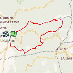
Randonnée Marche de 15,2 km à découvrir à Provence-Alpes-Côte d'Azur, Vaucluse, Flassan. Cette randonnée est proposée par tracegps.
Description
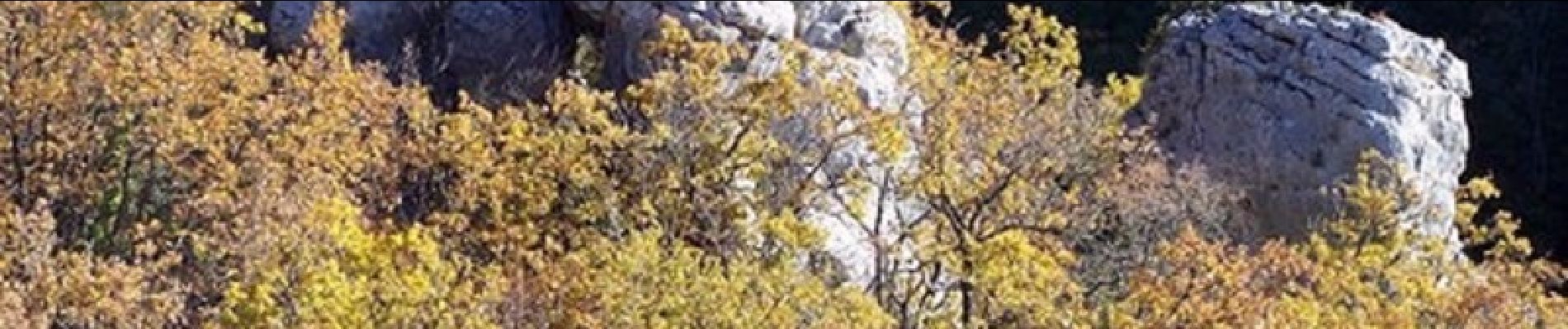
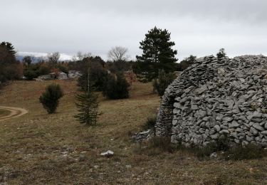
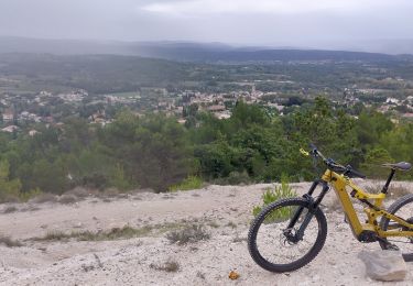
19 Mars 2009 Départ de la randonnée en empruntant le GR 91 direction Nord-Est que nous quittons pour emprunter la combe de la Canaud. Le chemin est facile, la pente douce, nous bavardons entre amis et ne voyons pas le temps passer. C'est le printemps, la végétation pousse, les amandiers commencent à fleurir dans la plaine. Nous arrivons enfin à la fontaine de la Canaud où nous nous désaltérons joyeusement, juste avant de quitter la combe pour grimper, par une pente assez raide jusqu'à la Chapelle St Jean, aux murs en belle pierre, mais fermée comme toutes les chapelles d'ici. C'est le sommet de notre périple, à 1041m d'altitude. Il nous suffit alors de reprendre la route vers le sud d'abord, puis vers le sud-est, traverser la D217 et poursuivre le chemin du retour jusqu'à Flassan. C'est une longue route avec des vues toujours superbes sur la face sud du Ventoux, qui est en majesté avec un magnifique et inhabituel chapeau de neige. En terminant notre périple nous passons devant une fontaine, la source de l'Auzon. Une bien belle journée, entre amis amoureux de ce coin de paradis, avec cette randonnée facile et propice à la contemplation de notre merveilleuse montagne, le Seigneur Ventoux.
Localisation
Commentaires
Randonnées à proximité
![Randonnée Marche Villes-sur-Auzon - villes sur auzon - Photo](https://media.geolcdn.com/t/375/260/0e280ec1-76df-4cda-81c1-92933dd2eb5d.jpg&format=jpg&maxdim=2)
![Marche Marche](https://static1.geolcdn.com/sitytour/trail-icons/101.png)
Marche
![](/images/other/stat-length.png)
![](https://static1.geolcdn.com/siteimages/upload/files/16400158638029165_repeat_loop_refresh_sync_direction_icon.png)
![Randonnée Marche Bédoin - DEMOISELLES COIFFEES A BEDOIN - Photo](https://media.geolcdn.com/t/375/260/019fb321-209a-41dd-ae41-5842e06d9c3c.jpg&format=jpg&maxdim=2)
![Marche Marche](https://static1.geolcdn.com/sitytour/trail-icons/101.png)
Marche
![](/images/other/stat-length.png)
![](https://static1.geolcdn.com/siteimages/upload/files/16400158638029165_repeat_loop_refresh_sync_direction_icon.png)
![Randonnée Marche Bédoin - Le Mont Ventoux en randonnée par Saint Colombe - Photo](https://media.geolcdn.com/t/375/260/ext.jpg?maxdim=2&url=https%3A%2F%2Fservices.sitytrail.com%2FGeolivesWS%2FDownloadMedia.ashx%3FTrailID%3D317282%26Media%3D16469_1.jpg)
![Marche Marche](https://static1.geolcdn.com/sitytour/trail-icons/101.png)
Marche
![](/images/other/stat-length.png)
![](https://static1.geolcdn.com/siteimages/upload/files/16400158638029165_repeat_loop_refresh_sync_direction_icon.png)
![Randonnée Marche Mormoiron - Ballade for Friends - Photo](https://media.geolcdn.com/t/375/260/ext.jpg?maxdim=2&url=https%3A%2F%2Fstatic1.geolcdn.com%2Fsiteimages%2Fupload%2Ffiles%2F1553511878bg_sport_marche.png)
![Marche Marche](https://static1.geolcdn.com/sitytour/trail-icons/101.png)
Marche
![](/images/other/stat-length.png)
![](https://static1.geolcdn.com/siteimages/upload/files/16400158638029165_repeat_loop_refresh_sync_direction_icon.png)
![Randonnée Marche Villes-sur-Auzon - LES ESCAMPEAUX - Photo](https://media.geolcdn.com/t/375/260/8e14f8aa-4eae-47ed-ac37-3fc4720c0e61.jpg&format=jpg&maxdim=2)
![Marche Marche](https://static1.geolcdn.com/sitytour/trail-icons/101.png)
Marche
![](/images/other/stat-length.png)
![](https://static1.geolcdn.com/siteimages/upload/files/16400158638029165_repeat_loop_refresh_sync_direction_icon.png)
![Randonnée V.T.T. Mormoiron - One more time 🚴♂️🚴♀️🚴 Territoire du Ventoux - Photo](https://media.geolcdn.com/t/375/260/f3f6b427-22dc-427b-ba25-3201b8e8cf01.jpg&format=jpg&maxdim=2)
![V.T.T. V.T.T.](https://static1.geolcdn.com/sitytour/trail-icons/202.png)
V.T.T.
![](/images/other/stat-length.png)
![](https://static1.geolcdn.com/siteimages/upload/files/16400158638029165_repeat_loop_refresh_sync_direction_icon.png)
![Randonnée Marche Flassan - Tricotage au Rocassou, à la recherche du sentier perdu !!!! - Photo](https://media.geolcdn.com/t/375/260/ad3b7676-f4f1-487c-b8df-3a57222b8e54.jpg&format=jpg&maxdim=2)
![Marche Marche](https://static1.geolcdn.com/sitytour/trail-icons/101.png)
Marche
![](/images/other/stat-length.png)
![](https://static1.geolcdn.com/siteimages/upload/files/16400158638029165_repeat_loop_refresh_sync_direction_icon.png)
![Randonnée Marche Mormoiron - Balladounette d après fêtes 🥳 - Photo](https://media.geolcdn.com/t/375/260/ecd5d04a-a53f-4421-b56c-9619fa1eb2e3.jpg&format=jpg&maxdim=2)
![Marche Marche](https://static1.geolcdn.com/sitytour/trail-icons/101.png)
Marche
![](/images/other/stat-length.png)
![](https://static1.geolcdn.com/siteimages/upload/files/16400158638029165_repeat_loop_refresh_sync_direction_icon.png)
![Randonnée V.T.T. Mormoiron - Fontaines et Pierres sèches - Photo](https://media.geolcdn.com/t/375/260/6430a8f2-0e99-4ba6-939d-500250c810cc.jpg&format=jpg&maxdim=2)
![V.T.T. V.T.T.](https://static1.geolcdn.com/sitytour/trail-icons/202.png)
V.T.T.
![](/images/other/stat-length.png)
![](https://static1.geolcdn.com/siteimages/upload/files/16400158638029165_repeat_loop_refresh_sync_direction_icon.png)
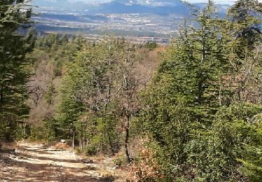
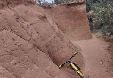
descente caillouteuse, par contre rando agréable, chapelle St Jean magnifique