![](/images/other/stat-length.png)
![Randonnée Marche Carcassonne - Variante de Cavayere Monze - Photo](https://media.geolcdn.com/t/1900/400/ext.pjpeg?maxdim=2&url=https%3A%2F%2Fservices.sitytrail.com%2FGeolivesWS%2FDownloadMedia.ashx%3FTrailID%3D104465%26Media%3D7743_6.jpg)
Variante de Cavayere Monze
tracegps
Utilisateur
![Longueur](/images/other/stat-length.png)
Longueur
22 km
![Altitude max](https://static1.geolcdn.com/siteimages/upload/files/1508320355ic_sort_altitude_max_24dp.png)
Altitude max
374 m
![Dénivelé positif](https://static1.geolcdn.com/siteimages/upload/files/1508320355ic_sort_den_pos_24dp.png)
Dénivelé positif
565 m
![Km-Effort](/images/other/stat-length.png)
Km-Effort
30 km
![Altitude min](https://static1.geolcdn.com/siteimages/upload/files/1508320355ic_sort_altitude_min_24dp.png)
Altitude min
137 m
![Dénivelé négatif](https://static1.geolcdn.com/siteimages/upload/files/1508320355ic_sort_den_neg_24dp.png)
Dénivelé négatif
564 m
![Boucle](https://static1.geolcdn.com/siteimages/upload/files/16400158638029165_repeat_loop_refresh_sync_direction_icon.png)
Boucle
Oui
Date de création :
2014-12-10 00:00:00.0
Dernière modification :
2014-12-10 00:00:00.0
![Marche](https://static1.geolcdn.com/sitytour/trail-icons/101.png)
4h30
Difficulté : Difficile
![Scannez ce code QR pour ouvrir la randonnée dans l'application SityTrail](https://capi.geolives.com/qq0zvz2zws4bq2lad0pu/sitytour/trails/104465/qr.png?size=200)
Application GPS de randonnée GRATUITE
À propos
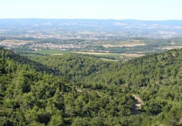
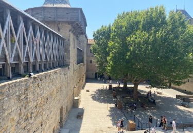
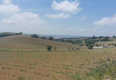
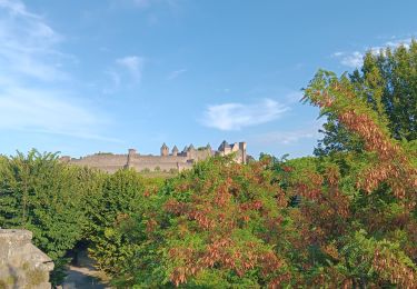
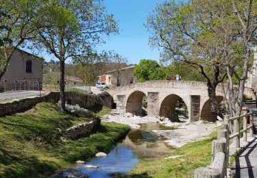
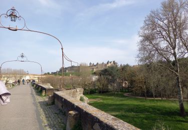
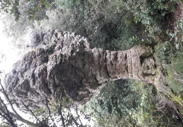
Randonnée Marche de 22 km à découvrir à Occitanie, Aude, Carcassonne. Cette randonnée est proposée par tracegps.
Description
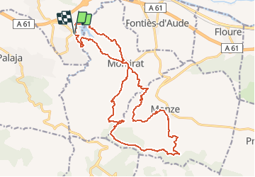
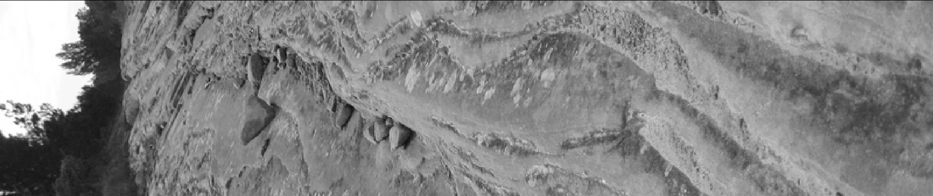
Ce circuit est une variante du premier car un passage avant Monze est interdit d'accès a cause de glissements de terrain et deuxièmement pour passer plus haut sur "Audouade"
Localisation
Pays :
France
Région :
Occitanie
Département/Province :
Aude
Commune :
Carcassonne
Localité :
Unknown
Départ:(Dec)
Départ:(UTM)
452421 ; 4781297 (31T) N.
Commentaires
Randonnées à proximité
![Randonnée Marche Palaja - Les crêtes aux portes de Carcassonne - Photo](https://media.geolcdn.com/t/375/260/ext.jpg?maxdim=2&url=https%3A%2F%2Fservices.sitytrail.com%2FGeolivesWS%2FDownloadMedia.ashx%3FTrailID%3D104795%26Media%3D8266_2.jpg)
![Marche Marche](https://static1.geolcdn.com/sitytour/trail-icons/101.png)
Les crêtes aux portes de Carcassonne
Marche
Difficile
(3)
Palaja,
Occitanie,
Aude,
France
![](/images/other/stat-length.png)
12,1 km | 17,3 km-effort
3h 0min
![](https://static1.geolcdn.com/siteimages/upload/files/16400158638029165_repeat_loop_refresh_sync_direction_icon.png)
Oui
![Randonnée Marche Carcassonne - Montlegun -montorgueil - Photo](https://media.geolcdn.com/t/375/260/ext.jpg?maxdim=2&url=https%3A%2F%2Fstatic1.geolcdn.com%2Fsiteimages%2Fupload%2Ffiles%2F1553511878bg_sport_marche.png)
![Marche Marche](https://static1.geolcdn.com/sitytour/trail-icons/101.png)
Montlegun -montorgueil
Marche
Moyen
(1)
Carcassonne,
Occitanie,
Aude,
France
![](/images/other/stat-length.png)
7,9 km | 10,6 km-effort
2h 24min
![](https://static1.geolcdn.com/siteimages/upload/files/16400158638029165_repeat_loop_refresh_sync_direction_icon.png)
Oui
![Randonnée Marche Rustiques - Rustiques - Canet VM - Photo](https://media.geolcdn.com/t/375/260/ext.jpg?maxdim=2&url=https%3A%2F%2Fstatic1.geolcdn.com%2Fsiteimages%2Fupload%2Ffiles%2F1553511878bg_sport_marche.png)
![Marche Marche](https://static1.geolcdn.com/sitytour/trail-icons/101.png)
Rustiques - Canet VM
Marche
Moyen
(1)
Rustiques,
Occitanie,
Aude,
France
![](/images/other/stat-length.png)
7,6 km | 9,1 km-effort
2h 3min
![](https://static1.geolcdn.com/siteimages/upload/files/16400158638029165_repeat_loop_refresh_sync_direction_icon.png)
Oui
![Randonnée Marche Carcassonne - Carcassonne Cité - Photo](https://media.geolcdn.com/t/375/260/766b6267-5f5b-495b-86c7-b7abf00d7485.jpg&format=jpg&maxdim=2)
![Marche Marche](https://static1.geolcdn.com/sitytour/trail-icons/101.png)
![Randonnée Marche Carcassonne - CC_Piemont_BA_06_Carcassonne_Montreal_20240617 - Photo](https://media.geolcdn.com/t/375/260/1839e542-ad89-4b07-b219-239a377f02e3.jpg&format=jpg&maxdim=2)
![Marche Marche](https://static1.geolcdn.com/sitytour/trail-icons/101.png)
CC_Piemont_BA_06_Carcassonne_Montreal_20240617
Marche
Très difficile
Carcassonne,
Occitanie,
Aude,
France
![](/images/other/stat-length.png)
26 km | 32 km-effort
7h 10min
![](https://static1.geolcdn.com/siteimages/upload/files/16400158638029165_repeat_loop_refresh_sync_direction_icon.png)
Non
![Randonnée Marche Carcassonne - carcassonne under the sun - Photo](https://media.geolcdn.com/t/375/260/1d11f81b-4918-433c-9d46-dc27b11daea1.jpg&format=jpg&maxdim=2)
![Marche Marche](https://static1.geolcdn.com/sitytour/trail-icons/101.png)
carcassonne under the sun
Marche
Facile
Carcassonne,
Occitanie,
Aude,
France
![](/images/other/stat-length.png)
7,7 km | 9,2 km-effort
3h 44min
![](https://static1.geolcdn.com/siteimages/upload/files/16400158638029165_repeat_loop_refresh_sync_direction_icon.png)
Non
![Randonnée Marche Monze - la boucle de Matelbine à Monze - Photo](https://media.geolcdn.com/t/375/260/44cd7791-ede8-43e9-9deb-17386311659e.jpg&format=jpg&maxdim=2)
![Marche Marche](https://static1.geolcdn.com/sitytour/trail-icons/101.png)
la boucle de Matelbine à Monze
Marche
Moyen
Monze,
Occitanie,
Aude,
France
![](/images/other/stat-length.png)
11,6 km | 15,8 km-effort
4h 3min
![](https://static1.geolcdn.com/siteimages/upload/files/16400158638029165_repeat_loop_refresh_sync_direction_icon.png)
Oui
![Randonnée Marche Carcassonne - Carcassonne 26-03-2022 - Photo](https://media.geolcdn.com/t/375/260/6a11179c-f997-4db0-be9d-ba7d1273df70.jpg&format=jpg&maxdim=2)
![Marche Marche](https://static1.geolcdn.com/sitytour/trail-icons/101.png)
Carcassonne 26-03-2022
Marche
Facile
Carcassonne,
Occitanie,
Aude,
France
![](/images/other/stat-length.png)
10 km | 11,6 km-effort
3h 0min
![](https://static1.geolcdn.com/siteimages/upload/files/16400158638029165_repeat_loop_refresh_sync_direction_icon.png)
Oui
![Randonnée Marche Monze - MONZE (11), Les bénitiers, le Miramont et le pas de Roland. - Photo](https://media.geolcdn.com/t/375/260/14db454a-0dbd-45a5-bd2f-b3aab01c109d.jpg&format=jpg&maxdim=2)
![Marche Marche](https://static1.geolcdn.com/sitytour/trail-icons/101.png)
MONZE (11), Les bénitiers, le Miramont et le pas de Roland.
Marche
Moyen
Monze,
Occitanie,
Aude,
France
![](/images/other/stat-length.png)
12,8 km | 19,1 km-effort
4h 20min
![](https://static1.geolcdn.com/siteimages/upload/files/16400158638029165_repeat_loop_refresh_sync_direction_icon.png)
Oui
Bon circuit de trail