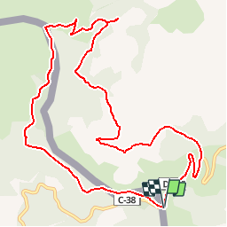
![](/images/other/stat-length.png)
![Randonnée V.T.T. Prats-de-Mollo-la-Preste - Espace VTT FFC Haut Vallespir - circuit n° 7 - Boucle des deux Catalognes - Photo](https://media.geolcdn.com/t/1900/400/ext.pjpeg?maxdim=2&url=https%3A%2F%2Fservices.sitytrail.com%2FGeolivesWS%2FDownloadMedia.ashx%3FTrailID%3D104348%26Media%3D7588_2.jpg)
Espace VTT FFC Haut Vallespir - circuit n° 7 - Boucle des deux Catalognes
tracegps
Utilisateur
![Longueur](/images/other/stat-length.png)
![Altitude max](https://static1.geolcdn.com/siteimages/upload/files/1508320355ic_sort_altitude_max_24dp.png)
![Dénivelé positif](https://static1.geolcdn.com/siteimages/upload/files/1508320355ic_sort_den_pos_24dp.png)
![Km-Effort](/images/other/stat-length.png)
![Altitude min](https://static1.geolcdn.com/siteimages/upload/files/1508320355ic_sort_altitude_min_24dp.png)
![Dénivelé négatif](https://static1.geolcdn.com/siteimages/upload/files/1508320355ic_sort_den_neg_24dp.png)
![Boucle](https://static1.geolcdn.com/siteimages/upload/files/16400158638029165_repeat_loop_refresh_sync_direction_icon.png)
![V.T.T.](https://static1.geolcdn.com/sitytour/trail-icons/202.png)
1h45
Difficulté : Moyen
![Scannez ce code QR pour ouvrir la randonnée dans l'application SityTrail](https://capi.geolives.com/qq0zvz2zws4bq2lad0pu/sitytour/trails/104348/qr.png?size=200)
Application GPS de randonnée GRATUITE
À propos
Randonnée V.T.T. de 13,3 km à découvrir à Occitanie, Pyrénées-Orientales, Prats-de-Mollo-la-Preste. Cette randonnée est proposée par tracegps.
Description
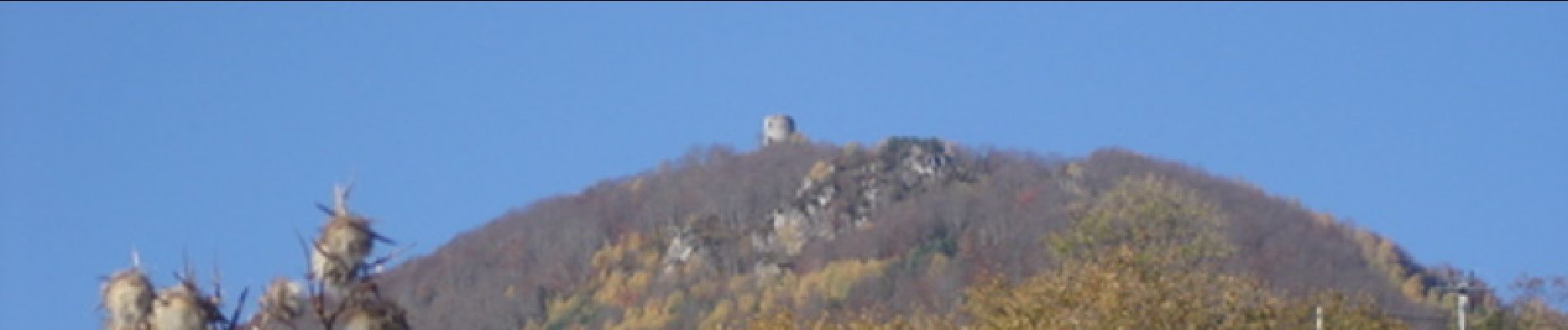
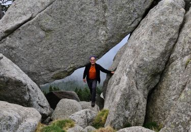
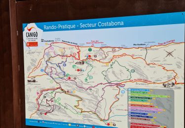
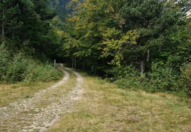
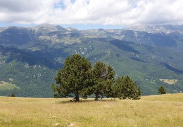
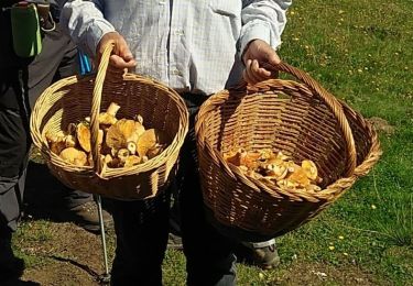
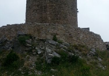
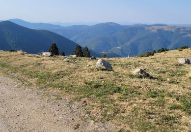
Espace VTT FFC Haut Vallespir - circuit n° 7 - Boucle des deux Catalognes Circuit officiel labellisé par la Fédération Française de Cyclisme. Un circuit transfrontalier, condensé de randonnée montagneuse : quelques rampes sèches face à la pente, du cheminement en alpage, un retour plus classique et commun avec le circuit n°3, puis 1,5 km de final sur la route du Col d’Ares. Circuit de haute montagne avec une longue traversée des crêtes frontières où les pâturages constituent un paysage d’exception. Durant la période estivale les troupeaux de vaches Gasconnes et Aubrac et les poulinières espagnoles se côtoient, témoin d’un riche passé où les frontières n’existaient pas entre la catalogne nord et sud. Au centre de cette boucle la Tour du Mir, l’une des nombreuses tour à signaux des Xe et XIe siècle qui émaille notre département, offre un point de vue exceptionnel sur toute la vallée du Tech.
Localisation
Commentaires
Randonnées à proximité
![Randonnée Marche Prats-de-Mollo-la-Preste - Parts de Mollo - Photo](https://media.geolcdn.com/t/375/260/a323d879-2e3b-49e8-a319-14cd0114ee0f.jpg&format=jpg&maxdim=2)
![Marche Marche](https://static1.geolcdn.com/sitytour/trail-icons/101.png)
Marche
![](/images/other/stat-length.png)
![](https://static1.geolcdn.com/siteimages/upload/files/16400158638029165_repeat_loop_refresh_sync_direction_icon.png)
![Randonnée Marche Prats-de-Mollo-la-Preste - col du miracle a pratiquement de mollo - Photo](https://media.geolcdn.com/t/375/260/7083b552-6fd4-47f6-9fb0-9d75c7868b46.jpg&format=jpg&maxdim=2)
![Marche Marche](https://static1.geolcdn.com/sitytour/trail-icons/101.png)
Marche
![](/images/other/stat-length.png)
![](https://static1.geolcdn.com/siteimages/upload/files/16400158638029165_repeat_loop_refresh_sync_direction_icon.png)
![Randonnée Marche Prats-de-Mollo-la-Preste - Costabone via Siern Esquerdes de roja Rocarodona La Preste - Photo](https://media.geolcdn.com/t/375/260/5a9b2aaa-e81c-4ab0-ba2f-ee276fb16f06.jpg&format=jpg&maxdim=2)
![Marche Marche](https://static1.geolcdn.com/sitytour/trail-icons/101.png)
Marche
![](/images/other/stat-length.png)
![](https://static1.geolcdn.com/siteimages/upload/files/16400158638029165_repeat_loop_refresh_sync_direction_icon.png)
![Randonnée Marche Prats-de-Mollo-la-Preste - Le Chalet -La Forge -Col Pregon -Col de Siern - Le Chalet . - Photo](https://media.geolcdn.com/t/375/260/3225b7ee-f250-49e8-b7c0-938203cb4be0.jpg&format=jpg&maxdim=2)
![Marche Marche](https://static1.geolcdn.com/sitytour/trail-icons/101.png)
Marche
![](/images/other/stat-length.png)
![](https://static1.geolcdn.com/siteimages/upload/files/16400158638029165_repeat_loop_refresh_sync_direction_icon.png)
![Randonnée Marche Prats-de-Mollo-la-Preste - La Preste - Col de Siern - Photo](https://media.geolcdn.com/t/375/260/7a1662cf-910c-4c82-998e-a66ceefc68dc.jpg&format=jpg&maxdim=2)
![Marche Marche](https://static1.geolcdn.com/sitytour/trail-icons/101.png)
Marche
![](/images/other/stat-length.png)
![](https://static1.geolcdn.com/siteimages/upload/files/16400158638029165_repeat_loop_refresh_sync_direction_icon.png)
![Randonnée Marche Prats-de-Mollo-la-Preste - Siern Pregon Tours de Mir_T - Photo](https://media.geolcdn.com/t/375/260/5ce8bc86-2789-489e-a485-8f5861c03fc4.jpg&format=jpg&maxdim=2)
![Marche Marche](https://static1.geolcdn.com/sitytour/trail-icons/101.png)
Marche
![](/images/other/stat-length.png)
![](https://static1.geolcdn.com/siteimages/upload/files/16400158638029165_repeat_loop_refresh_sync_direction_icon.png)
![Randonnée Marche Molló - Tour de Mir (20/9/2018) - Photo](https://media.geolcdn.com/t/375/260/ef1914cd-274d-423f-8146-4fa054ce416c.jpg&format=jpg&maxdim=2)
![Marche Marche](https://static1.geolcdn.com/sitytour/trail-icons/101.png)
Marche
![](/images/other/stat-length.png)
![](https://static1.geolcdn.com/siteimages/upload/files/16400158638029165_repeat_loop_refresh_sync_direction_icon.png)
![Randonnée Marche Prats-de-Mollo-la-Preste - La Preste_Tour du Mir_ Prats de Mollo_T - Photo](https://media.geolcdn.com/t/375/260/ext.jpg?maxdim=2&url=https%3A%2F%2Fservices.sitytrail.com%2FGeolivesWS%2FDownloadMedia.ashx%3FTrailID%3D442832%26Media%3Dfix__20150708140025.jpg)
![Marche Marche](https://static1.geolcdn.com/sitytour/trail-icons/101.png)
Marche
![](/images/other/stat-length.png)
![](https://static1.geolcdn.com/siteimages/upload/files/16400158638029165_repeat_loop_refresh_sync_direction_icon.png)
![Randonnée Marche Prats-de-Mollo-la-Preste - 5 et 6 rando sur 2 jours - Photo](https://media.geolcdn.com/t/375/260/2d263129-1a38-4ecd-bc7f-36ffcfe0b3f1.jpg&format=jpg&maxdim=2)
![Marche Marche](https://static1.geolcdn.com/sitytour/trail-icons/101.png)
Marche
![](/images/other/stat-length.png)
![](https://static1.geolcdn.com/siteimages/upload/files/16400158638029165_repeat_loop_refresh_sync_direction_icon.png)