![](/images/other/stat-length.png)
![Randonnée Marche Fabrezan - patrimoine1 - Photo](https://media.geolcdn.com/t/1900/400/ext.pjpeg?maxdim=2&url=https%3A%2F%2Fservices.sitytrail.com%2FGeolivesWS%2FDownloadMedia.ashx%3FTrailID%3D1042956%26Media%3D6daa2e05-af7c-4d57-a51e-f5b065b778d0.jpg)
patrimoine1
andre.rochet.ar
Utilisateur
![Longueur](/images/other/stat-length.png)
Longueur
3,2 km
![Altitude max](https://static1.geolcdn.com/siteimages/upload/files/1508320355ic_sort_altitude_max_24dp.png)
Altitude max
150 m
![Dénivelé positif](https://static1.geolcdn.com/siteimages/upload/files/1508320355ic_sort_den_pos_24dp.png)
Dénivelé positif
54 m
![Km-Effort](/images/other/stat-length.png)
Km-Effort
3,9 km
![Altitude min](https://static1.geolcdn.com/siteimages/upload/files/1508320355ic_sort_altitude_min_24dp.png)
Altitude min
111 m
![Dénivelé négatif](https://static1.geolcdn.com/siteimages/upload/files/1508320355ic_sort_den_neg_24dp.png)
Dénivelé négatif
56 m
![Boucle](https://static1.geolcdn.com/siteimages/upload/files/16400158638029165_repeat_loop_refresh_sync_direction_icon.png)
Boucle
Oui
Date de création :
2019-01-15 16:31:53.384
Dernière modification :
2019-01-15 16:31:53.384
![Marche](https://static1.geolcdn.com/sitytour/trail-icons/101.png)
51m
Difficulté : Facile
![Scannez ce code QR pour ouvrir la randonnée dans l'application SityTrail](https://capi.geolives.com/qq0zvz2zws4bq2lad0pu/sitytour/trails/1042956/qr.png?size=200)
Application GPS de randonnée GRATUITE
À propos
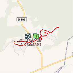
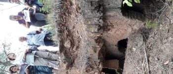
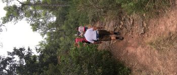
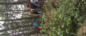
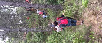
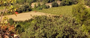
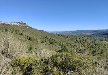
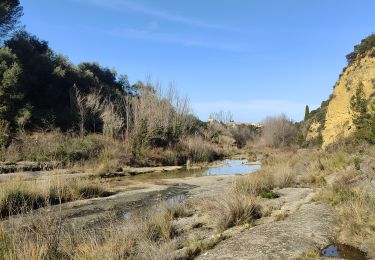
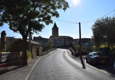
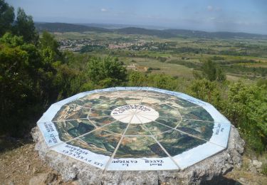
Randonnée Marche de 3,2 km à découvrir à Occitanie, Aude, Fabrezan. Cette randonnée est proposée par andre.rochet.ar.
Description
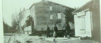
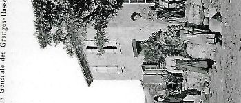
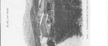
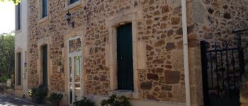
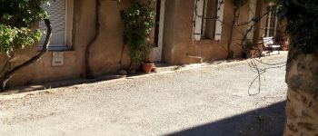
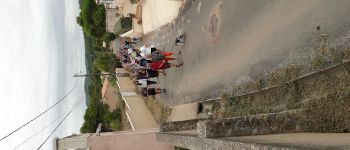
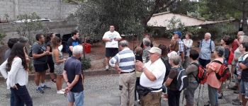
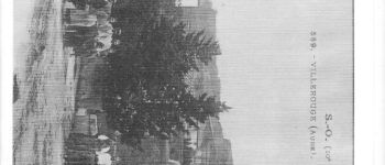
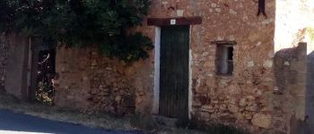
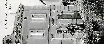
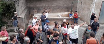
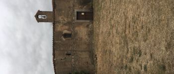
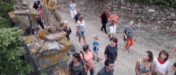
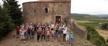
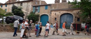
Promenade dans Villerouge la Crémade dans le village et dans le temps par G. Laval
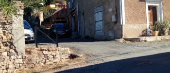
Points d'intérêt
Localisation
Pays :
France
Région :
Occitanie
Département/Province :
Aude
Commune :
Fabrezan
Localité :
Unknown
Départ:(Dec)
Départ:(UTM)
478751 ; 4773289 (31T) N.
Commentaires
Randonnées à proximité
![Randonnée Marche Thézan-des-Corbières - cirque de Viviès Chantal - Photo](https://media.geolcdn.com/t/375/260/fdf0fbe7-bcd8-4a01-a191-52c99b657a7a.jpg&format=jpg&maxdim=2)
![Marche Marche](https://static1.geolcdn.com/sitytour/trail-icons/101.png)
cirque de Viviès Chantal
Marche
Moyen
Thézan-des-Corbières,
Occitanie,
Aude,
France
![](/images/other/stat-length.png)
19,9 km | 27 km-effort
6h 6min
![](https://static1.geolcdn.com/siteimages/upload/files/16400158638029165_repeat_loop_refresh_sync_direction_icon.png)
Oui
![Randonnée Marche Thézan-des-Corbières - Thezan Cirque de Vivies - Photo](https://media.geolcdn.com/t/375/260/ext.jpg?maxdim=2&url=https%3A%2F%2Fstatic1.geolcdn.com%2Fsiteimages%2Fupload%2Ffiles%2F1553511878bg_sport_marche.png)
![Marche Marche](https://static1.geolcdn.com/sitytour/trail-icons/101.png)
Thezan Cirque de Vivies
Marche
Très difficile
(1)
Thézan-des-Corbières,
Occitanie,
Aude,
France
![](/images/other/stat-length.png)
20 km | 27 km-effort
6h 5min
![](https://static1.geolcdn.com/siteimages/upload/files/16400158638029165_repeat_loop_refresh_sync_direction_icon.png)
Oui
![Randonnée A pied Saint-Laurent-de-la-Cabrerisse - Le cirque de Viviès St Laurent de la Cabrerisse - Photo](https://media.geolcdn.com/t/375/260/ext.jpg?maxdim=2&url=https%3A%2F%2Fstatic1.geolcdn.com%2Fsiteimages%2Fupload%2Ffiles%2F1545311037marcheuse_200dpi.jpg)
![A pied A pied](https://static1.geolcdn.com/sitytour/trail-icons/100.png)
Le cirque de Viviès St Laurent de la Cabrerisse
A pied
Moyen
(1)
Saint-Laurent-de-la-Cabrerisse,
Occitanie,
Aude,
France
![](/images/other/stat-length.png)
11,2 km | 14,8 km-effort
2h 20min
![](https://static1.geolcdn.com/siteimages/upload/files/16400158638029165_repeat_loop_refresh_sync_direction_icon.png)
Oui
![Randonnée Marche Fabrezan - François et Nathalie 1 - Photo](https://media.geolcdn.com/t/375/260/ext.jpg?maxdim=2&url=https%3A%2F%2Fstatic1.geolcdn.com%2Fsiteimages%2Fupload%2Ffiles%2F1553511878bg_sport_marche.png)
![Marche Marche](https://static1.geolcdn.com/sitytour/trail-icons/101.png)
François et Nathalie 1
Marche
Moyen
(1)
Fabrezan,
Occitanie,
Aude,
France
![](/images/other/stat-length.png)
7,8 km | 10,1 km-effort
2h 11min
![](https://static1.geolcdn.com/siteimages/upload/files/16400158638029165_repeat_loop_refresh_sync_direction_icon.png)
Oui
![Randonnée Marche Saint-Laurent-de-la-Cabrerisse - Saint Laurent de la Cabrerisse - Photo](https://media.geolcdn.com/t/375/260/9193cc34-8575-4894-a2de-4b6fce4876bb.jpg&format=jpg&maxdim=2)
![Marche Marche](https://static1.geolcdn.com/sitytour/trail-icons/101.png)
Saint Laurent de la Cabrerisse
Marche
Moyen
Saint-Laurent-de-la-Cabrerisse,
Occitanie,
Aude,
France
![](/images/other/stat-length.png)
19,7 km | 26 km-effort
6h 2min
![](https://static1.geolcdn.com/siteimages/upload/files/16400158638029165_repeat_loop_refresh_sync_direction_icon.png)
Oui
![Randonnée A pied Saint-Laurent-de-la-Cabrerisse - Le Cirque De Viviès - Photo](https://media.geolcdn.com/t/375/260/4947ff3a-b691-4890-865d-de0986754cd3.jpeg&format=jpg&maxdim=2)
![A pied A pied](https://static1.geolcdn.com/sitytour/trail-icons/100.png)
Le Cirque De Viviès
A pied
Moyen
Saint-Laurent-de-la-Cabrerisse,
Occitanie,
Aude,
France
![](/images/other/stat-length.png)
23 km | 31 km-effort
6h 57min
![](https://static1.geolcdn.com/siteimages/upload/files/16400158638029165_repeat_loop_refresh_sync_direction_icon.png)
Oui
![Marche Marche](https://static1.geolcdn.com/sitytour/trail-icons/101.png)
ST LAURENT DE LA CABRERISSE - La roca dansaïra
Marche
Moyen
Saint-Laurent-de-la-Cabrerisse,
Occitanie,
Aude,
France
![](/images/other/stat-length.png)
7,2 km | 10,2 km-effort
2h 27min
![](https://static1.geolcdn.com/siteimages/upload/files/16400158638029165_repeat_loop_refresh_sync_direction_icon.png)
Oui
![Marche Marche](https://static1.geolcdn.com/sitytour/trail-icons/101.png)
VILLEROUGE LA CREMADE - Le Grangeot
Marche
Moyen
Fabrezan,
Occitanie,
Aude,
France
![](/images/other/stat-length.png)
8,1 km | 10,4 km-effort
1h 53min
![](https://static1.geolcdn.com/siteimages/upload/files/16400158638029165_repeat_loop_refresh_sync_direction_icon.png)
Oui
![Randonnée Marche Boutenac - BOUTENAC - Circuit des combes par la chapelle St Siméon - Photo](https://media.geolcdn.com/t/375/260/6d952a44-6ab0-4a19-85d3-879d77425b43.jpg&format=jpg&maxdim=2)
![Marche Marche](https://static1.geolcdn.com/sitytour/trail-icons/101.png)
BOUTENAC - Circuit des combes par la chapelle St Siméon
Marche
Moyen
(3)
Boutenac,
Occitanie,
Aude,
France
![](/images/other/stat-length.png)
7 km | 9,5 km-effort
1h 39min
![](https://static1.geolcdn.com/siteimages/upload/files/16400158638029165_repeat_loop_refresh_sync_direction_icon.png)
Oui