![](/images/other/stat-length.png)
![Randonnée Marche Gouy-en-Artois - Le sentier des loups - Gouy en Artois - Photo](https://media.geolcdn.com/t/1900/400/ext.pjpeg?maxdim=2&url=https%3A%2F%2Fservices.sitytrail.com%2FGeolivesWS%2FDownloadMedia.ashx%3FTrailID%3D104254%26Media%3D7449_2.jpg)
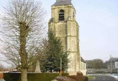
Le sentier des loups - Gouy en Artois
tracegps
Utilisateur
![Longueur](/images/other/stat-length.png)
Longueur
14,2 km
![Altitude max](https://static1.geolcdn.com/siteimages/upload/files/1508320355ic_sort_altitude_max_24dp.png)
Altitude max
146 m
![Dénivelé positif](https://static1.geolcdn.com/siteimages/upload/files/1508320355ic_sort_den_pos_24dp.png)
Dénivelé positif
129 m
![Km-Effort](/images/other/stat-length.png)
Km-Effort
15,9 km
![Altitude min](https://static1.geolcdn.com/siteimages/upload/files/1508320355ic_sort_altitude_min_24dp.png)
Altitude min
103 m
![Dénivelé négatif](https://static1.geolcdn.com/siteimages/upload/files/1508320355ic_sort_den_neg_24dp.png)
Dénivelé négatif
129 m
![Boucle](https://static1.geolcdn.com/siteimages/upload/files/16400158638029165_repeat_loop_refresh_sync_direction_icon.png)
Boucle
Oui
Date de création :
2014-12-10 00:00:00.0
Dernière modification :
2014-12-10 00:00:00.0
![Marche](https://static1.geolcdn.com/sitytour/trail-icons/101.png)
3h34
Difficulté : Difficile
![Scannez ce code QR pour ouvrir la randonnée dans l'application SityTrail](https://capi.geolives.com/qq0zvz2zws4bq2lad0pu/sitytour/trails/104254/qr.png?size=200)
Application GPS de randonnée GRATUITE
À propos
Randonnée Marche de 14,2 km à découvrir à Hauts-de-France, Pas-de-Calais, Gouy-en-Artois. Cette randonnée est proposée par tracegps.
Description
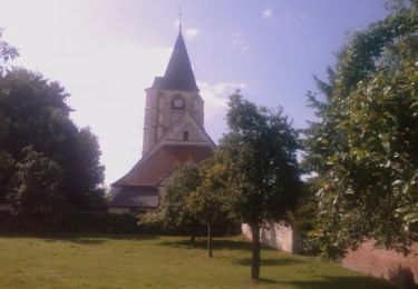
Circuit proposé par la Communauté de Communes des Vertes Vallées. Départ de l’église de Gouy en Artois. Retrouvez le circuit sur le site de la Communauté de Communes.
Localisation
Pays :
France
Région :
Hauts-de-France
Département/Province :
Pas-de-Calais
Commune :
Gouy-en-Artois
Localité :
Unknown
Départ:(Dec)
Départ:(UTM)
470973 ; 5566249 (31U) N.
Commentaires
Randonnées à proximité
![Randonnée V.T.T. Avesnes-le-Comte - Les 6 châteaux - Avesnes le Comte - Photo](https://media.geolcdn.com/t/375/260/ext.jpg?maxdim=2&url=https%3A%2F%2Fstatic1.geolcdn.com%2Fsiteimages%2Fupload%2Ffiles%2F1524743154velo.jpg)
![V.T.T. V.T.T.](https://static1.geolcdn.com/sitytour/trail-icons/202.png)
Les 6 châteaux - Avesnes le Comte
V.T.T.
Difficile
(1)
Avesnes-le-Comte,
Hauts-de-France,
Pas-de-Calais,
France
![](/images/other/stat-length.png)
44 km | 50 km-effort
2h 10min
![](https://static1.geolcdn.com/siteimages/upload/files/16400158638029165_repeat_loop_refresh_sync_direction_icon.png)
Oui
![Randonnée V.T.T. Fosseux - Lucheux - Photo](https://media.geolcdn.com/t/375/260/ext.jpg?maxdim=2&url=https%3A%2F%2Fstatic1.geolcdn.com%2Fsiteimages%2Fupload%2Ffiles%2F1524743154velo.jpg)
![V.T.T. V.T.T.](https://static1.geolcdn.com/sitytour/trail-icons/202.png)
Lucheux
V.T.T.
Moyen
(2)
Fosseux,
Hauts-de-France,
Pas-de-Calais,
France
![](/images/other/stat-length.png)
44 km | 50 km-effort
3h 0min
![](https://static1.geolcdn.com/siteimages/upload/files/16400158638029165_repeat_loop_refresh_sync_direction_icon.png)
Oui
![Randonnée Marche Simencourt - Sentier du bout du monde - Simencourt - Photo](https://media.geolcdn.com/t/375/260/ext.jpg?maxdim=2&url=https%3A%2F%2Fservices.sitytrail.com%2FGeolivesWS%2FDownloadMedia.ashx%3FTrailID%3D104253%26Media%3D7448_5.jpg)
![Marche Marche](https://static1.geolcdn.com/sitytour/trail-icons/101.png)
Sentier du bout du monde - Simencourt
Marche
Moyen
Simencourt,
Hauts-de-France,
Pas-de-Calais,
France
![](/images/other/stat-length.png)
9,1 km | 10,3 km-effort
2h 15min
![](https://static1.geolcdn.com/siteimages/upload/files/16400158638029165_repeat_loop_refresh_sync_direction_icon.png)
Oui
![Randonnée Marche Avesnes-le-Comte - Avesnes le Comte, Noyelle-Vion, Manin, Beaufort-Blavincourt - Photo](https://media.geolcdn.com/t/375/260/ext.jpg?maxdim=2&url=https%3A%2F%2Fservices.sitytrail.com%2FGeolivesWS%2FDownloadMedia.ashx%3FTrailID%3D191466%26Media%3D15058_1.jpg)
![Marche Marche](https://static1.geolcdn.com/sitytour/trail-icons/101.png)
Avesnes le Comte, Noyelle-Vion, Manin, Beaufort-Blavincourt
Marche
Moyen
Avesnes-le-Comte,
Hauts-de-France,
Pas-de-Calais,
France
![](/images/other/stat-length.png)
10,8 km | 12,2 km-effort
2h 30min
![](https://static1.geolcdn.com/siteimages/upload/files/16400158638029165_repeat_loop_refresh_sync_direction_icon.png)
Oui
![Randonnée Marche Hauteville - Randonnée autour de Hauteville - Barly - Fosseux - Photo](https://media.geolcdn.com/t/375/260/ext.jpg?maxdim=2&url=https%3A%2F%2Fservices.sitytrail.com%2FGeolivesWS%2FDownloadMedia.ashx%3FTrailID%3D106984%26Media%3D11756_1.jpg)
![Marche Marche](https://static1.geolcdn.com/sitytour/trail-icons/101.png)
Randonnée autour de Hauteville - Barly - Fosseux
Marche
Moyen
Hauteville,
Hauts-de-France,
Pas-de-Calais,
France
![](/images/other/stat-length.png)
10,4 km | 11,8 km-effort
2h 0min
![](https://static1.geolcdn.com/siteimages/upload/files/16400158638029165_repeat_loop_refresh_sync_direction_icon.png)
Oui
![Randonnée Marche Simencourt - Simencourt - Gouy en Artois - Photo](https://media.geolcdn.com/t/375/260/ext.jpg?maxdim=2&url=https%3A%2F%2Fservices.sitytrail.com%2FGeolivesWS%2FDownloadMedia.ashx%3FTrailID%3D106278%26Media%3D10636_1.jpg)
![Marche Marche](https://static1.geolcdn.com/sitytour/trail-icons/101.png)
Simencourt - Gouy en Artois
Marche
Moyen
Simencourt,
Hauts-de-France,
Pas-de-Calais,
France
![](/images/other/stat-length.png)
9,3 km | 10,3 km-effort
2h 0min
![](https://static1.geolcdn.com/siteimages/upload/files/16400158638029165_repeat_loop_refresh_sync_direction_icon.png)
Oui
![Randonnée Marche Basseux - Basseux - Bailleulmont - Berles au Bois - Photo](https://media.geolcdn.com/t/375/260/ext.jpg?maxdim=2&url=https%3A%2F%2Fservices.sitytrail.com%2FGeolivesWS%2FDownloadMedia.ashx%3FTrailID%3D105912%26Media%3D9931_1.jpg)
![Marche Marche](https://static1.geolcdn.com/sitytour/trail-icons/101.png)
Basseux - Bailleulmont - Berles au Bois
Marche
Moyen
Basseux,
Hauts-de-France,
Pas-de-Calais,
France
![](/images/other/stat-length.png)
9,7 km | 11,1 km-effort
2h 0min
![](https://static1.geolcdn.com/siteimages/upload/files/16400158638029165_repeat_loop_refresh_sync_direction_icon.png)
Oui
![Randonnée Marche Bavincourt - Le sentier de la longue Borne - Bavincourt - Photo](https://media.geolcdn.com/t/375/260/ext.jpg?maxdim=2&url=https%3A%2F%2Fservices.sitytrail.com%2FGeolivesWS%2FDownloadMedia.ashx%3FTrailID%3D104255%26Media%3D7450_1.jpg)
![Marche Marche](https://static1.geolcdn.com/sitytour/trail-icons/101.png)
Le sentier de la longue Borne - Bavincourt
Marche
Moyen
Bavincourt,
Hauts-de-France,
Pas-de-Calais,
France
![](/images/other/stat-length.png)
9,8 km | 10,9 km-effort
2h 30min
![](https://static1.geolcdn.com/siteimages/upload/files/16400158638029165_repeat_loop_refresh_sync_direction_icon.png)
Oui
![Randonnée V.T.T. Beaumetz-lès-Loges - Beaumetz les Loges - Photo](https://media.geolcdn.com/t/375/260/ext.jpg?maxdim=2&url=https%3A%2F%2Fstatic1.geolcdn.com%2Fsiteimages%2Fupload%2Ffiles%2F1524743154velo.jpg)
![V.T.T. V.T.T.](https://static1.geolcdn.com/sitytour/trail-icons/202.png)
Beaumetz les Loges
V.T.T.
Moyen
Beaumetz-lès-Loges,
Hauts-de-France,
Pas-de-Calais,
France
![](/images/other/stat-length.png)
59 km | 66 km-effort
2h 45min
![](https://static1.geolcdn.com/siteimages/upload/files/16400158638029165_repeat_loop_refresh_sync_direction_icon.png)
Oui