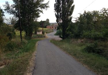
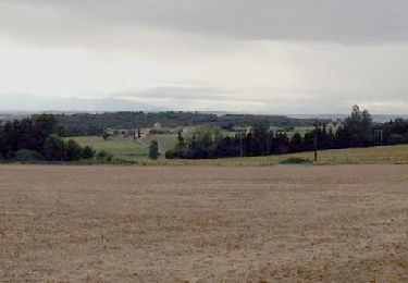
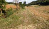
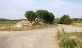
Randonnée Marche Raissac-sur-Lampy - Raissac to Villelongue via La Combe Belle - Photo

Raissac to Villelongue via La Combe Belle

 livfoss
livfoss

Utilisateur

© OpenStreetMap contributors
Longueur
Longueur
13,4 km
Altitude max
Altitude max
254 m
Dénivelé positif
Dénivelé positif
259 m
Km-Effort
Km-Effort  
16,9 km
Altitude min
Altitude min
131 m
Dénivelé négatif
Dénivelé négatif
259 m
Boucle
Boucle
Oui
Date de création :
2019-01-15 16:29:27.609
Dernière modification :
2019-01-15 16:29:27.609

(0 Avis)

Marche
Marche
3h38
Difficulté : Moyen

Scannez ce code QR pour ouvrir la randonnée dans l'application SityTrail

Application GPS de randonnée GRATUITE

Logo SityTrail SityTrail

IGN / Instituts géographiques

Télécharger SityTrail sur l'App Store Télécharger SityTrail sur Google Play

Logo SityTrail SityTrail World

Le monde est à vous

Télécharger SityTrail sur l'App Store Télécharger SityTrail sur Google Play Télécharger SityTrail sur Huawei AppGallery

À propos

Randonnée Marche de 13,4 km à découvrir à Occitanie, Aude, Raissac-sur-Lampy. Cette randonnée est proposée par livfoss.

Description

A variation on the Raissac -> La Migance -> Villelongue route. Plenty of height. Unusually this walk is in the anticlockwise direction.

Profil altimétrique

Photos

Points d'intérêt

Point d'intérêt Raissac-sur-Lampy - Raissac Church - Photo
livfoss
RAISSAC-SUR-LAMPY 
Point d'intérêt Raissac-sur-Lampy - Turn right at the pile of stones - Photo
livfoss
Point d'intérêt Raissac-sur-Lampy - Hut with Saint - Photo
livfoss
RAISSAC-SUR-LAMPY 
Point d'intérêt Alzonne - Cattle above La Migance - Photo
livfoss
Point d'intérêt Alzonne - Ford over Vernassonne - Photo
livfoss
Point d'intérêt Alzonne - La Migance Farm - Photo
livfoss
Point d'intérêt Alzonne - Leaving the road - Photo
livfoss
Point d'intérêt Alzonne - Top of the hill - Photo
livfoss
Point d'intérêt Saint-Martin-le-Vieil - Beehives - Photo
livfoss
SAINT-MARTIN-LE-VIEIL 
Point d'intérêt Saint-Martin-le-Vieil - Starting descent - Photo
livfoss
SAINT-MARTIN-LE-VIEIL 
Point d'intérêt Saint-Martin-le-Vieil - Towards Villelongue - Photo
livfoss
SAINT-MARTIN-LE-VIEIL 
Point d'intérêt Saint-Martin-le-Vieil - Crossroads - Photo
livfoss
SAINT-MARTIN-LE-VIEIL 
Point d'intérêt Saint-Martin-le-Vieil - Abbaye de Villelongue - Photo
livfoss
SAINT-MARTIN-LE-VIEIL 
Point d'intérêt Saint-Martin-le-Vieil - Low route towards St Martin - Photo
livfoss
SAINT-MARTIN-LE-VIEIL 
Point d'intérêt Saint-Martin-le-Vieil - Aude valley panorama - Photo
livfoss
SAINT-MARTIN-LE-VIEIL 
Point d'intérêt Saint-Martin-le-Vieil - Raissac in the distance? - Photo
livfoss
SAINT-MARTIN-LE-VIEIL 
Point d'intérêt Raissac-sur-Lampy - La Piousou - Photo
livfoss
RAISSAC-SUR-LAMPY 

Localisation

Pays :
France
Région :
Occitanie
Département/Province :
Aude
Commune :
Raissac-sur-Lampy
Localité :
Unknown
Départ:(Dec)
Départ:(UTM)
431835 ; 4791904 (31T) N.

Randonnées à proximité

Randonnée Marche Montolieu - Montolieu Moulins de la Dure - Photo
Marche
dufland

Marche

Facile
(1)
Montolieu, Occitanie, Aude, France
6,6 km | 8,7 km-effort
2h 0min
Oui
Randonnée Marche Saint-Martin-le-Vieil - 11_Saint Martin le Vieil - Photo
Marche
jab31

Marche

Moyen
(1)
Saint-Martin-le-Vieil, Occitanie, Aude, France
17,6 km | 23 km-effort
4h 31min
Oui
Randonnée Marche Saint-Martin-le-Vieil - le sentier de St Martin  - Photo
Marche
bernardbelmas

Marche

Facile
Saint-Martin-le-Vieil, Occitanie, Aude, France
31 km | 38 km-effort
3h 35min
Non
Randonnée Marche Raissac-sur-Lampy - Raissac to Villelongue via La Combe Belle - Photo
Marche
livfoss

Marche

Moyen
Raissac-sur-Lampy, Occitanie, Aude, France
13,4 km | 16,8 km-effort
3h 38min
Oui
Randonnée Marche Raissac-sur-Lampy - Raissac to Villelongue via La Combe Belle - Photo
Marche
livfoss

Marche

Moyen
Raissac-sur-Lampy, Occitanie, Aude, France
13,4 km | 16,9 km-effort
3h 38min
Oui
Randonnée Marche Raissac-sur-Lampy - Pacerpoles First Outing - Photo
Marche
livfoss

Marche

Facile
(1)
Raissac-sur-Lampy, Occitanie, Aude, France
11,2 km | 13,5 km-effort
2h 57min
Oui
Randonnée Vélo électrique Bram - 2024_07_20_bram_Trebes - Photo
Vélo électrique
jpborto

Vélo électrique

Très facile
Bram, Occitanie, Aude, France
40 km | 43 km-effort
Inconnu
Non
Randonnée Marche Villespy - Villespy - St-Martin-le-Viel - Photo
Marche
jpp2caunes

Marche

Très facile
Villespy, Occitanie, Aude, France
13,8 km | 16,9 km-effort
6h 56min
Oui
Randonnée Marche Montolieu - Cap de Pic - Photo
Marche
Mascart

Marche

Moyen
Montolieu, Occitanie, Aude, France
11,1 km | 14 km-effort
3h 16min
Oui


Fermer
Mes abonnements