![](/images/other/stat-length.png)
![Randonnée Marche Gouézec - Circuit du pont Coblant - Gouézec - Photo](https://media.geolcdn.com/t/1900/400/ext.pjpeg?maxdim=2&url=https%3A%2F%2Fservices.sitytrail.com%2FGeolivesWS%2FDownloadMedia.ashx%3FTrailID%3D104098%26Media%3D7143_6.jpg)
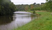
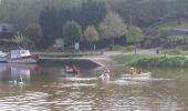
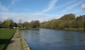
Circuit du pont Coblant - Gouézec
tracegps
Utilisateur
![Longueur](/images/other/stat-length.png)
Longueur
11,6 km
![Altitude max](https://static1.geolcdn.com/siteimages/upload/files/1508320355ic_sort_altitude_max_24dp.png)
Altitude max
113 m
![Dénivelé positif](https://static1.geolcdn.com/siteimages/upload/files/1508320355ic_sort_den_pos_24dp.png)
Dénivelé positif
173 m
![Km-Effort](/images/other/stat-length.png)
Km-Effort
13,9 km
![Altitude min](https://static1.geolcdn.com/siteimages/upload/files/1508320355ic_sort_altitude_min_24dp.png)
Altitude min
25 m
![Dénivelé négatif](https://static1.geolcdn.com/siteimages/upload/files/1508320355ic_sort_den_neg_24dp.png)
Dénivelé négatif
174 m
![Boucle](https://static1.geolcdn.com/siteimages/upload/files/16400158638029165_repeat_loop_refresh_sync_direction_icon.png)
Boucle
Oui
Date de création :
2014-12-10 00:00:00.0
Dernière modification :
2014-12-10 00:00:00.0
![Marche](https://static1.geolcdn.com/sitytour/trail-icons/101.png)
3h00
Difficulté : Moyen
![Scannez ce code QR pour ouvrir la randonnée dans l'application SityTrail](https://capi.geolives.com/qq0zvz2zws4bq2lad0pu/sitytour/trails/104098/qr.png?size=200)
Application GPS de randonnée GRATUITE
À propos
Randonnée Marche de 11,6 km à découvrir à Bretagne, Finistère, Gouézec. Cette randonnée est proposée par tracegps.
Description
Circuit proposé par la Communauté de Communes de la région de Pleyben. Départ du parking de l’Eglise de Gouézec. Retrouvez le circuit sur le site de la communauté de communes de la région de Pleyben . Ce circuit a été numérisé par les randonneurs du CODEPEM. Merci à Jean-Marie.
Localisation
Pays :
France
Région :
Bretagne
Département/Province :
Finistère
Commune :
Gouézec
Localité :
Unknown
Départ:(Dec)
Départ:(UTM)
427670 ; 5335592 (30U) N.
Commentaires
Randonnées à proximité
![Randonnée Marche Gouézec - Carreck an Tan - Gouézec - Photo](https://media.geolcdn.com/t/375/260/ext.jpg?maxdim=2&url=https%3A%2F%2Fservices.sitytrail.com%2FGeolivesWS%2FDownloadMedia.ashx%3FTrailID%3D129788%26Media%3D13333_4.jpg)
![Marche Marche](https://static1.geolcdn.com/sitytour/trail-icons/101.png)
Carreck an Tan - Gouézec
Marche
Moyen
(1)
Gouézec,
Bretagne,
Finistère,
France
![](/images/other/stat-length.png)
17,3 km | 22 km-effort
3h 0min
![](https://static1.geolcdn.com/siteimages/upload/files/16400158638029165_repeat_loop_refresh_sync_direction_icon.png)
Oui
![Randonnée Marche Pleyben - pont coblant - Photo](https://media.geolcdn.com/t/375/260/fb1df358-f110-4cbb-8e79-e631d8a0a8f9.jpg&format=jpg&maxdim=2)
![Marche Marche](https://static1.geolcdn.com/sitytour/trail-icons/101.png)
![Randonnée Marche Pleyben - Pont Coblan à Gouézec et les rives de l'Aulne - Photo](https://media.geolcdn.com/t/375/260/ext.jpg?maxdim=2&url=https%3A%2F%2Fservices.sitytrail.com%2FGeolivesWS%2FDownloadMedia.ashx%3FTrailID%3D109173%26Media%3D3216_1.jpg)
![Marche Marche](https://static1.geolcdn.com/sitytour/trail-icons/101.png)
Pont Coblan à Gouézec et les rives de l'Aulne
Marche
Difficile
Pleyben,
Bretagne,
Finistère,
France
![](/images/other/stat-length.png)
20 km | 26 km-effort
4h 0min
![](https://static1.geolcdn.com/siteimages/upload/files/16400158638029165_repeat_loop_refresh_sync_direction_icon.png)
Oui
![Randonnée V.T.C. Pleyben - Pont Comblanc Port Carhaix - Photo](https://media.geolcdn.com/t/375/260/6417cd47-48c0-42e3-bed8-7eb80f8cce6f.jpg&format=jpg&maxdim=2)
![V.T.C. V.T.C.](https://static1.geolcdn.com/sitytour/trail-icons/203.png)
Pont Comblanc Port Carhaix
V.T.C.
Facile
Pleyben,
Bretagne,
Finistère,
France
![](/images/other/stat-length.png)
61 km | 72 km-effort
3h 27min
![](https://static1.geolcdn.com/siteimages/upload/files/16400158638029165_repeat_loop_refresh_sync_direction_icon.png)
Non
![Randonnée Marche Lothey - Le circuit de l'Aulne 08-07-2019 - Photo](https://media.geolcdn.com/t/375/260/8d975fba-5daf-433a-926b-5fa9bfb3266d.jpg&format=jpg&maxdim=2)
![Marche Marche](https://static1.geolcdn.com/sitytour/trail-icons/101.png)
Le circuit de l'Aulne 08-07-2019
Marche
Facile
Lothey,
Bretagne,
Finistère,
France
![](/images/other/stat-length.png)
12,9 km | 15,4 km-effort
3h 14min
![](https://static1.geolcdn.com/siteimages/upload/files/16400158638029165_repeat_loop_refresh_sync_direction_icon.png)
Oui
![Randonnée Marche Gouézec - Pont Coblant - Photo](https://media.geolcdn.com/t/375/260/ext.jpg?maxdim=2&url=https%3A%2F%2Fstatic1.geolcdn.com%2Fsiteimages%2Fupload%2Ffiles%2F1553511878bg_sport_marche.png)
![Marche Marche](https://static1.geolcdn.com/sitytour/trail-icons/101.png)
![Randonnée Marche Edern - éden s'y Symphorien - Photo](https://media.geolcdn.com/t/375/260/ext.jpg?maxdim=2&url=https%3A%2F%2Fstatic1.geolcdn.com%2Fsiteimages%2Fupload%2Ffiles%2F1553511878bg_sport_marche.png)
![Marche Marche](https://static1.geolcdn.com/sitytour/trail-icons/101.png)
éden s'y Symphorien
Marche
Très facile
Edern,
Bretagne,
Finistère,
France
![](/images/other/stat-length.png)
8,4 km | 10,6 km-effort
1h 55min
![](https://static1.geolcdn.com/siteimages/upload/files/16400158638029165_repeat_loop_refresh_sync_direction_icon.png)
Oui
![Randonnée Marche Lothey - lothey - Photo](https://media.geolcdn.com/t/375/260/ext.jpg?maxdim=2&url=https%3A%2F%2Fstatic1.geolcdn.com%2Fsiteimages%2Fupload%2Ffiles%2F1553511878bg_sport_marche.png)
![Marche Marche](https://static1.geolcdn.com/sitytour/trail-icons/101.png)
![Randonnée Marche Gouézec - Canal Nantes/Brest à Lennon - Photo](https://media.geolcdn.com/t/375/260/ext.jpg?maxdim=2&url=https%3A%2F%2Fstatic1.geolcdn.com%2Fsiteimages%2Fupload%2Ffiles%2F1553511878bg_sport_marche.png)
![Marche Marche](https://static1.geolcdn.com/sitytour/trail-icons/101.png)
Canal Nantes/Brest à Lennon
Marche
Très facile
Gouézec,
Bretagne,
Finistère,
France
![](/images/other/stat-length.png)
10,2 km | 12,1 km-effort
2h 32min
![](https://static1.geolcdn.com/siteimages/upload/files/16400158638029165_repeat_loop_refresh_sync_direction_icon.png)
Oui