

Zentinela depuis le Col de Lizarieta

georgein
Utilisateur

Longueur
12,9 km

Altitude max
671 m

Dénivelé positif
524 m

Km-Effort
19,9 km

Altitude min
385 m

Dénivelé négatif
523 m
Boucle
Oui
Date de création :
2019-08-04 09:20:31.195
Dernière modification :
2020-01-31 20:30:01.995
4h07
Difficulté : Inconnu

Application GPS de randonnée GRATUITE
À propos
Randonnée Marche de 12,9 km à découvrir à Navarre, Inconnu, Etxalar. Cette randonnée est proposée par georgein.
Description
Belle randonnée permettant de profiter de vues superbes sur les sommets alentours ainsi que sur l'océan au loin.
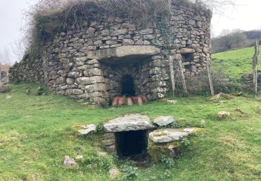
De plus, vous traverserez un site archéologique émouvant
Points d'intérêt
Localisation
Pays :
Espagne
Région :
Navarre
Département/Province :
Inconnu
Commune :
Etxalar
Localité :
Unknown
Départ:(Dec)
Départ:(UTM)
612093 ; 4790658 (30T) N.
Commentaires
Randonnées à proximité
SL-NA 5 Argarata - Santa Krutz


A pied
Facile
Etxalar,
Navarre,
Inconnu,
Espagne

4,5 km | 5,7 km-effort
1h 17min
Oui

La rhune par la face EST


Marche
Moyen
(1)
Sare,
Nouvelle-Aquitaine,
Pyrénées-Atlantiques,
France

13,8 km | 26 km-effort
5h 10min
Oui
sare les palombieres


Marche
Facile
Sare,
Nouvelle-Aquitaine,
Pyrénées-Atlantiques,
France

15,8 km | 24 km-effort
4h 44min
Oui

atxuria zugaramurdi


Marche
Très facile
(3)
Sare,
Nouvelle-Aquitaine,
Pyrénées-Atlantiques,
France

10,3 km | 18,7 km-effort
3h 50min
Oui
Lizarieta descente par palombieres


Marche
Très facile
Sare,
Nouvelle-Aquitaine,
Pyrénées-Atlantiques,
France

8,9 km | 11,9 km-effort
2h 49min
Non
col de lizarrieta et col des 3 bornes


Marche
Difficile
Sare,
Nouvelle-Aquitaine,
Pyrénées-Atlantiques,
France

13 km | 18,5 km-effort
3h 45min
Oui
Lizarrieta, Zentinel, col des 3 bornes, 2024 03 04.


Marche
Difficile
Sare,
Nouvelle-Aquitaine,
Pyrénées-Atlantiques,
France

12,4 km | 17,8 km-effort
4h 3min
Oui
Palombieres ibantelli


Marche
Facile
Sare,
Nouvelle-Aquitaine,
Pyrénées-Atlantiques,
France

14,8 km | 0 m-effort
5h 6min
Oui
Atxuria tour par zugaramurdi


Marche
Facile
Sare,
Nouvelle-Aquitaine,
Pyrénées-Atlantiques,
France

14,7 km | 24 km-effort
4h 43min
Oui


 SityTrail


