![](/images/other/stat-length.png)
![Randonnée Marche Évisa - Forêt d'Aïtone - Evisa - Photo](https://media.geolcdn.com/t/1900/400/ext.pjpeg?maxdim=2&url=https%3A%2F%2Fservices.sitytrail.com%2FGeolivesWS%2FDownloadMedia.ashx%3FTrailID%3D103624%26Media%3D6014_1.jpg)
Forêt d'Aïtone - Evisa
tracegps
Utilisateur
![Longueur](/images/other/stat-length.png)
Longueur
5,2 km
![Altitude max](https://static1.geolcdn.com/siteimages/upload/files/1508320355ic_sort_altitude_max_24dp.png)
Altitude max
1132 m
![Dénivelé positif](https://static1.geolcdn.com/siteimages/upload/files/1508320355ic_sort_den_pos_24dp.png)
Dénivelé positif
268 m
![Km-Effort](/images/other/stat-length.png)
Km-Effort
8,9 km
![Altitude min](https://static1.geolcdn.com/siteimages/upload/files/1508320355ic_sort_altitude_min_24dp.png)
Altitude min
940 m
![Dénivelé négatif](https://static1.geolcdn.com/siteimages/upload/files/1508320355ic_sort_den_neg_24dp.png)
Dénivelé négatif
283 m
![Boucle](https://static1.geolcdn.com/siteimages/upload/files/16400158638029165_repeat_loop_refresh_sync_direction_icon.png)
Boucle
Non
Date de création :
2014-12-10 00:00:00.0
Dernière modification :
2014-12-10 00:00:00.0
![Marche](https://static1.geolcdn.com/sitytour/trail-icons/101.png)
3h00
Difficulté : Difficile
![Scannez ce code QR pour ouvrir la randonnée dans l'application SityTrail](https://capi.geolives.com/qq0zvz2zws4bq2lad0pu/sitytour/trails/103624/qr.png?size=200)
Application GPS de randonnée GRATUITE
À propos
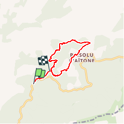
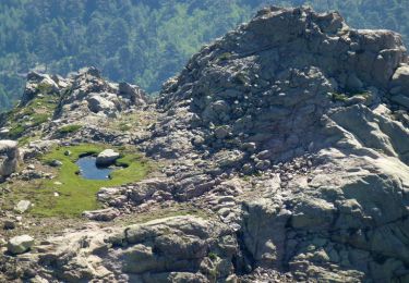
Randonnée Marche de 5,2 km à découvrir à Corse, Corse-du-Sud, Évisa. Cette randonnée est proposée par tracegps.
Description
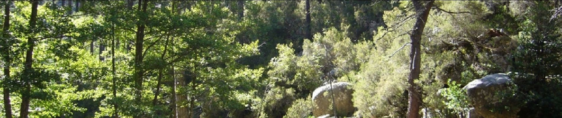
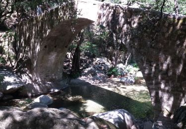
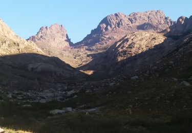
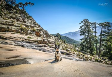
Une belle rando dans une forêt magnifique qui mène à un super panorama. Les piscines naturelles à l'arrivée permettent de se rafraichir et même de se baigner pour les plus motivés.
Localisation
Pays :
France
Région :
Corse
Département/Province :
Corse-du-Sud
Commune :
Évisa
Localité :
Unknown
Départ:(Dec)
Départ:(UTM)
485612 ; 4679095 (32T) N.
Commentaires
Randonnées à proximité
![Randonnée Marche Albertacce - Guy Goujon - Photo](https://media.geolcdn.com/t/375/260/ext.jpg?maxdim=2&url=https%3A%2F%2Fstatic1.geolcdn.com%2Fsiteimages%2Fupload%2Ffiles%2F1553511878bg_sport_marche.png)
![Marche Marche](https://static1.geolcdn.com/sitytour/trail-icons/101.png)
![Randonnée Marche Évisa - Corse 2023: Evisa - Refuge de Puscaghia - Photo](https://media.geolcdn.com/t/375/260/fb30a792-f923-4082-8f8f-351b3293aa77.jpeg&format=jpg&maxdim=2)
![Marche Marche](https://static1.geolcdn.com/sitytour/trail-icons/101.png)
Corse 2023: Evisa - Refuge de Puscaghia
Marche
Difficile
Évisa,
Corse,
Corse-du-Sud,
France
![](/images/other/stat-length.png)
16,6 km | 29 km-effort
6h 35min
![](https://static1.geolcdn.com/siteimages/upload/files/16400158638029165_repeat_loop_refresh_sync_direction_icon.png)
Non
![Randonnée Marche Évisa - Evisa forêt d’aitone - Photo](https://media.geolcdn.com/t/375/260/08798ad8-3986-4664-8380-dace3a816c80.jpg&format=jpg&maxdim=2)
![Marche Marche](https://static1.geolcdn.com/sitytour/trail-icons/101.png)
Evisa forêt d’aitone
Marche
Facile
Évisa,
Corse,
Corse-du-Sud,
France
![](/images/other/stat-length.png)
13,4 km | 19,7 km-effort
4h 11min
![](https://static1.geolcdn.com/siteimages/upload/files/16400158638029165_repeat_loop_refresh_sync_direction_icon.png)
Oui
![Randonnée Marche Évisa - gorges spelunca - Photo](https://media.geolcdn.com/t/375/260/2ba82175-16ea-471a-af7d-9a429f43496d.jpg&format=jpg&maxdim=2)
![Marche Marche](https://static1.geolcdn.com/sitytour/trail-icons/101.png)
gorges spelunca
Marche
Facile
Évisa,
Corse,
Corse-du-Sud,
France
![](/images/other/stat-length.png)
4,7 km | 7,5 km-effort
1h 46min
![](https://static1.geolcdn.com/siteimages/upload/files/16400158638029165_repeat_loop_refresh_sync_direction_icon.png)
Non
![Randonnée Marche Albertacce - Trou du diable du capu tafunatu - Photo](https://media.geolcdn.com/t/375/260/3c70327f-8683-4ca1-930f-102d3079b734.jpg&format=jpg&maxdim=2)
![Marche Marche](https://static1.geolcdn.com/sitytour/trail-icons/101.png)
Trou du diable du capu tafunatu
Marche
Moyen
Albertacce,
Corse,
Haute-Corse,
France
![](/images/other/stat-length.png)
15,4 km | 29 km-effort
5h 40min
![](https://static1.geolcdn.com/siteimages/upload/files/16400158638029165_repeat_loop_refresh_sync_direction_icon.png)
Oui
![Randonnée Marche Albertacce - col de Vergio refuge Ciuttulu di i mori GR 20 A/R - Photo](https://media.geolcdn.com/t/375/260/ext.jpg?maxdim=2&url=https%3A%2F%2Fstatic1.geolcdn.com%2Fsiteimages%2Fupload%2Ffiles%2F1553511878bg_sport_marche.png)
![Marche Marche](https://static1.geolcdn.com/sitytour/trail-icons/101.png)
col de Vergio refuge Ciuttulu di i mori GR 20 A/R
Marche
Très difficile
(1)
Albertacce,
Corse,
Haute-Corse,
France
![](/images/other/stat-length.png)
14,3 km | 24 km-effort
4h 57min
![](https://static1.geolcdn.com/siteimages/upload/files/16400158638029165_repeat_loop_refresh_sync_direction_icon.png)
Oui
![Randonnée Marche Albertacce - Cascade de Radule - Photo](https://media.geolcdn.com/t/375/260/d84039b1-6488-4df1-8b83-1aadca7886d4.jpg&format=jpg&maxdim=2)
![Marche Marche](https://static1.geolcdn.com/sitytour/trail-icons/101.png)
Cascade de Radule
Marche
Facile
(1)
Albertacce,
Corse,
Haute-Corse,
France
![](/images/other/stat-length.png)
3,8 km | 5,7 km-effort
1h 11min
![](https://static1.geolcdn.com/siteimages/upload/files/16400158638029165_repeat_loop_refresh_sync_direction_icon.png)
Oui
![Randonnée Marche Évisa - Cascades de la Radule - Photo](https://media.geolcdn.com/t/375/260/ext.jpg?maxdim=2&url=https%3A%2F%2Fservices.sitytrail.com%2FGeolivesWS%2FDownloadMedia.ashx%3FTrailID%3D838608%26Media%3Dfix__20170930150758.jpg)
![Marche Marche](https://static1.geolcdn.com/sitytour/trail-icons/101.png)
Cascades de la Radule
Marche
Facile
(2)
Évisa,
Corse,
Corse-du-Sud,
France
![](/images/other/stat-length.png)
8,4 km | 12,4 km-effort
3h 25min
![](https://static1.geolcdn.com/siteimages/upload/files/16400158638029165_repeat_loop_refresh_sync_direction_icon.png)
Oui
![Randonnée Marche Albertacce - Punta di e Cricche et le vallon de Catamalzi - Photo](https://media.geolcdn.com/t/375/260/ext.jpg?maxdim=2&url=https%3A%2F%2Fservices.sitytrail.com%2FGeolivesWS%2FDownloadMedia.ashx%3FTrailID%3D317016%26Media%3D16158_4.jpg)
![Marche Marche](https://static1.geolcdn.com/sitytour/trail-icons/101.png)
Punta di e Cricche et le vallon de Catamalzi
Marche
Moyen
Albertacce,
Corse,
Haute-Corse,
France
![](/images/other/stat-length.png)
6 km | 13,4 km-effort
6h 0min
![](https://static1.geolcdn.com/siteimages/upload/files/16400158638029165_repeat_loop_refresh_sync_direction_icon.png)
Oui
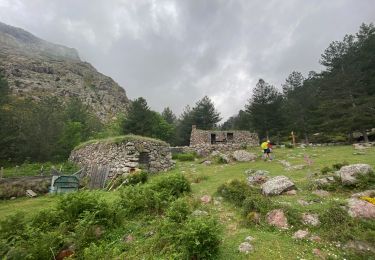
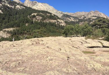
Nous n avons pas pu faire la boucle le retour n étant plus balisé et passant par une zone interdite (protection captage des eaux ) nous avons poursuivi jusqu'au col de Vergio. très belle balade