Randonnée V.T.T. Galié - VTT-FFC Pyrénées Comminges nº 12 - Photo

VTT-FFC Pyrénées Comminges nº 12

 tracegps
tracegps

Utilisateur

© OpenStreetMap contributors
Longueur
Longueur
10,7 km
Altitude max
Altitude max
466 m
Dénivelé positif
Dénivelé positif
61 m
Km-Effort
Km-Effort  
11,5 km
Altitude min
Altitude min
445 m
Dénivelé négatif
Dénivelé négatif
60 m
Boucle
Boucle
Oui
Date de création :
2014-12-10 00:00:00.0
Dernière modification :
2014-12-10 00:00:00.0

(0 Avis)

V.T.T.
V.T.T.
1h00
Difficulté : Facile

Scannez ce code QR pour ouvrir la randonnée dans l'application SityTrail

Application GPS de randonnée GRATUITE

Logo SityTrail SityTrail

IGN / Instituts géographiques

Télécharger SityTrail sur l'App Store Télécharger SityTrail sur Google Play

Logo SityTrail SityTrail World

Le monde est à vous

Télécharger SityTrail sur l'App Store Télécharger SityTrail sur Google Play Télécharger SityTrail sur Huawei AppGallery

À propos

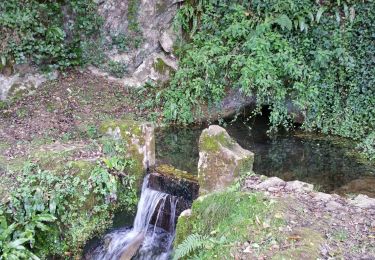
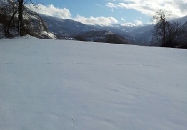
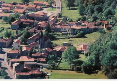
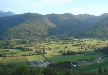
Randonnée V.T.T. de 10,7 km à découvrir à Occitanie, Haute-Garonne, Galié. Cette randonnée est proposée par tracegps.

Description

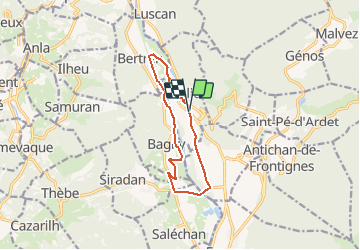
Galié-Ore-Bagiry-Bertren 12 Km. Dénivelé 50m.

Profil altimétrique

Points d'intérêt

Point d'intérêt Bertren - Cruce enlace a 13 - Photo
tracegps

Localisation

Pays :
France
Région :
Occitanie
Département/Province :
Haute-Garonne
Commune :
Galié
Localité :
Unknown
Départ:(Dec)
Départ:(UTM)
307173 ; 4762021 (31T) N.

Randonnées à proximité

Randonnée Marche Saint-Pé-d'Ardet - Chemin des Palombières  - Saint-Pé-d'Ardet - Photo
Marche
tracegps

Marche

Difficile
(1)
Saint-Pé-d'Ardet, Occitanie, Haute-Garonne, France
8,2 km | 14,2 km-effort
3h 30min
Oui
Randonnée Marche Antichan - sommet d'Herbe Rouge en boucle depuis Antichan  - Photo
Marche
GUIDE
lhomme.ph

Marche

Moyen
Antichan, Occitanie, Hautes-Pyrénées, France
11,4 km | 20 km-effort
5h 47min
Oui
Randonnée Marche Bramevaque - randonnée sur le Touroc depuis Bramevaque  - Photo
Marche
GUIDE
lhomme.ph

Marche

Moyen
Bramevaque, Occitanie, Hautes-Pyrénées, France
9,3 km | 16,7 km-effort
3h 38min
Oui
Randonnée Autre activité Antichan - Chapelle de Brouls en boucle depuis Antichan  - Photo
Autre activité
GUIDE
lhomme.ph

Autre activité

Très facile
Antichan, Occitanie, Hautes-Pyrénées, France
75 km | 92 km-effort
7h 27min
Oui
Randonnée Marche Antichan - Antichan - Photo
Marche
GUIDE
lhomme.ph

Marche

Très facile
Antichan, Occitanie, Hautes-Pyrénées, France
5,8 km | 8 km-effort
1h 44min
Oui
Randonnée V.T.T. Bertren - Galié - Ore - Bagiry - Bertren  n° 12  -  Bertren - Photo
V.T.T.
tracegps

V.T.T.

Facile
Bertren, Occitanie, Hautes-Pyrénées, France
10,5 km | 11,3 km-effort
1h 0min
Oui
Randonnée V.T.T. Sauveterre-de-Comminges - Le tour du Barry - Sauveterre de Comminges - Photo
V.T.T.
tracegps

V.T.T.

Moyen
Sauveterre-de-Comminges, Occitanie, Haute-Garonne, France
15,3 km | 19,1 km-effort
1h 30min
Oui
Randonnée V.T.T. Sauveterre-de-Comminges - Cap d'Aristou - Sauveterre-de-Comminges n°9 - Photo
V.T.T.
tracegps

V.T.T.

Difficile
Sauveterre-de-Comminges, Occitanie, Haute-Garonne, France
18,2 km | 25 km-effort
2h 0min
Oui
Randonnée V.T.T. Sauveterre-de-Comminges - Autour de Sauveterre-de-Comminges n° 10 - Photo
V.T.T.
tracegps

V.T.T.

Très difficile
Sauveterre-de-Comminges, Occitanie, Haute-Garonne, France
33 km | 45 km-effort
3h 0min
Oui


Fermer
Mes abonnements