


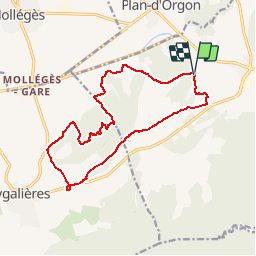


16,3 km | 21 km-effort

Utilisateur


Application GPS de randonnée GRATUITE
 SityTrail
IGN / Instituts géographiques
SityTrail World
Le monde est à vous
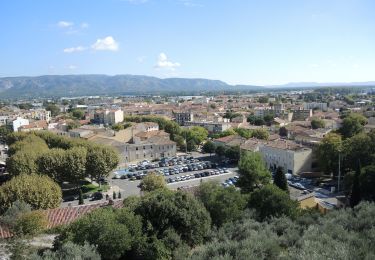
Randonnée Marche de 15,7 km à découvrir à Provence-Alpes-Côte d'Azur, Bouches-du-Rhône, Orgon. Cette randonnée est proposée par tracegps.
Parcours assez facile prés des Alpilles au beau milieu de la Provence (superbe). Le parcours convient à des enfants à partir de 10/12 ans


Marche

Vélo

Vélo

Vélo

Marche
Marche
Marche

Marche
Marche