


11,4 km | 24 km-effort


Utilisateur


Application GPS de randonnée GRATUITE
 SityTrail
IGN / Instituts géographiques
SityTrail World
Le monde est à vous
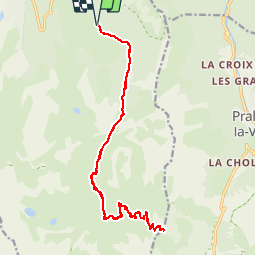
Randonnée V.T.T. de 21 km à découvrir à Auvergne-Rhône-Alpes, Savoie, Courchevel. Cette randonnée est proposée par tracegps.
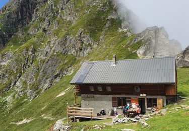
Randonnée peu difficile se déroulant en grande partie au fond du Vallon des Avals à partir de Courchevel 1650 au niveau du Belvédère. Jusqu'à la ferme de la Grande-Val, vous utilisez une piste forestière peu pentue. La piste se poursuit jusqu'au col des Saulces, mais devient plus raide. Un poussage pour les vététistes est nécessaire. La partie finale se déroule sur un petit sentier. Une table d'orientation vous fera découvrir tous les sommets environnants dont les Glaciers de la Vanoise qui sont tout proches. La descente demande une grande attention pour les vététistes. Voire même une notion de pilotage est nécessaire. Ensuite, à partir du col des Saulces, tout roule. Il faudra juste négocier une petite remontée pour rejoindre Courchevel 1650.

Marche

Marche

Marche

Marche

Marche
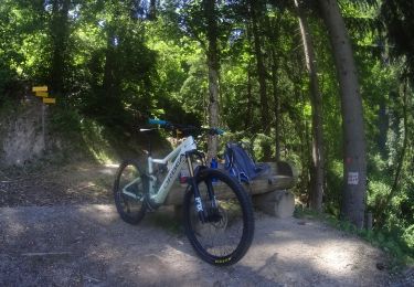
V.T.T.
Marche

Marche
Marche