48 km | 56 km-effort
NOGENT LE ROTROU 18.55
Martine28240
Utilisateur
Longueur
18,6 km
Altitude max
222 m
Dénivelé positif
290 m
Km-Effort
22 km
Altitude min
108 m
Dénivelé négatif
290 m
Boucle
Oui
Date de création :
2018-12-21 14:49:43.096
Dernière modification :
2019-06-06 13:27:25.138
4h00
Difficulté : Moyen
Application GPS de randonnée GRATUITE
À propos
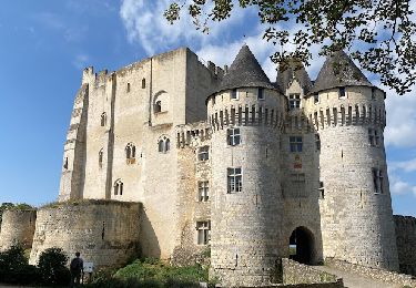
Randonnée Autre activité de 18,6 km à découvrir à Centre-Val de Loire, Eure-et-Loir, Nogent-le-Rotrou. Cette randonnée est proposée par Martine28240.
Localisation
Pays :
France
Région :
Centre-Val de Loire
Département/Province :
Eure-et-Loir
Commune :
Nogent-le-Rotrou
Localité :
Unknown
Départ:(Dec)
Départ:(UTM)
338479 ; 5353543 (31U) N.
Commentaires
Randonnées à proximité
100 Kms Perche Boucle B
Marche
Difficile
(2)
Trizay-Coutretot-Saint-Serge,
Centre-Val de Loire,
Eure-et-Loir,
France
12h 1min
Oui
NOGENT LE ROTROU
Marche
Moyen
Nogent-le-Rotrou,
Centre-Val de Loire,
Eure-et-Loir,
France
5,8 km | 6,9 km-effort
1h 33min
Oui
Ozée 9,1 km
Marche
Moyen
(1)
Arcisses,
Centre-Val de Loire,
Eure-et-Loir,
France
9,1 km | 11,2 km-effort
2h 32min
Oui
Nogent-le-Rotrou - Saint-Victor-de-Buthon 19 km
Marche
Très difficile
Nogent-le-Rotrou,
Centre-Val de Loire,
Eure-et-Loir,
France
19 km | 23 km-effort
5h 5min
Non
Nogent-le-Rotrou - Thiron-Gardais via La Gaudaine 22 km
Marche
Très difficile
Nogent-le-Rotrou,
Centre-Val de Loire,
Eure-et-Loir,
France
22 km | 26 km-effort
6h 0min
Non
Nogent-le-Rotrou - Saint-Pierre-la-Bruyère 5,5 km
Marche
Facile
Nogent-le-Rotrou,
Centre-Val de Loire,
Eure-et-Loir,
France
5,5 km | 6,9 km-effort
3h 42min
Non
Nogent-le-Rotrou - Rémalard 18 km
Marche
Facile
Nogent-le-Rotrou,
Centre-Val de Loire,
Eure-et-Loir,
France
18 km | 21 km-effort
4h 24min
Non
Autour de Margon
Marche
Moyen
Arcisses,
Centre-Val de Loire,
Eure-et-Loir,
France
18,2 km | 21 km-effort
3h 25min
Oui
Nogent-le -Rotrou, une ville à la campagne 8,6km
Marche
Moyen
Nogent-le-Rotrou,
Centre-Val de Loire,
Eure-et-Loir,
France
8,6 km | 10,2 km-effort
2h 18min
Oui