![](/images/other/stat-length.png)
![Randonnée Marche Saint-Prix - Béthemont la Forêt - Photo](https://media.geolcdn.com/t/1900/400/ext.pjpeg?maxdim=2&url=https%3A%2F%2Fstatic1.geolcdn.com%2Fsiteimages%2Fupload%2Ffiles%2F1553511878bg_sport_marche.png)
Béthemont la Forêt
tracegps
Utilisateur
![Longueur](/images/other/stat-length.png)
Longueur
8,9 km
![Altitude max](https://static1.geolcdn.com/siteimages/upload/files/1508320355ic_sort_altitude_max_24dp.png)
Altitude max
200 m
![Dénivelé positif](https://static1.geolcdn.com/siteimages/upload/files/1508320355ic_sort_den_pos_24dp.png)
Dénivelé positif
195 m
![Km-Effort](/images/other/stat-length.png)
Km-Effort
11,5 km
![Altitude min](https://static1.geolcdn.com/siteimages/upload/files/1508320355ic_sort_altitude_min_24dp.png)
Altitude min
128 m
![Dénivelé négatif](https://static1.geolcdn.com/siteimages/upload/files/1508320355ic_sort_den_neg_24dp.png)
Dénivelé négatif
195 m
![Boucle](https://static1.geolcdn.com/siteimages/upload/files/16400158638029165_repeat_loop_refresh_sync_direction_icon.png)
Boucle
Oui
Date de création :
2014-12-10 00:00:00.0
Dernière modification :
2014-12-10 00:00:00.0
![Marche](https://static1.geolcdn.com/sitytour/trail-icons/101.png)
3h00
Difficulté : Moyen
![Scannez ce code QR pour ouvrir la randonnée dans l'application SityTrail](https://capi.geolives.com/qq0zvz2zws4bq2lad0pu/sitytour/trails/102957/qr.png?size=200)
Application GPS de randonnée GRATUITE
À propos
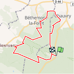
Randonnée Marche de 8,9 km à découvrir à Île-de-France, Val-d'Oise, Saint-Prix. Cette randonnée est proposée par tracegps.
Description
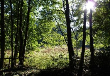
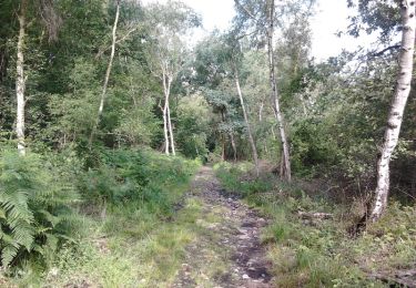
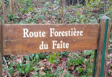
Départ et arrivée au parking du "faisan doré" sur la route de Chauvry. Passage par Chauvry et sur les hauteurs de Bethemont avant de revenir vers le parking. Promenade en sous-bois avec quelques passages très boueux.
Localisation
Pays :
France
Région :
Île-de-France
Département/Province :
Val-d'Oise
Commune :
Saint-Prix
Localité :
Unknown
Départ:(Dec)
Départ:(UTM)
446155 ; 5432009 (31U) N.
Commentaires
Randonnées à proximité
![Randonnée Marche Frépillon - GRP CV-IDF 07R Frépillon à Montmorency - Photo](https://media.geolcdn.com/t/375/260/cd8022c7-e75e-42b2-b52b-fdfab1f12efc.jpg&format=jpg&maxdim=2)
![Marche Marche](https://static1.geolcdn.com/sitytour/trail-icons/101.png)
GRP CV-IDF 07R Frépillon à Montmorency
Marche
Très difficile
(1)
Frépillon,
Île-de-France,
Val-d'Oise,
France
![](/images/other/stat-length.png)
16 km | 20 km-effort
4h 32min
![](https://static1.geolcdn.com/siteimages/upload/files/16400158638029165_repeat_loop_refresh_sync_direction_icon.png)
Non
![Randonnée V.T.T. Taverny - La Tabernacienne 2013 - Taverny - Photo](https://media.geolcdn.com/t/375/260/ext.jpg?maxdim=2&url=https%3A%2F%2Fservices.sitytrail.com%2FGeolivesWS%2FDownloadMedia.ashx%3FTrailID%3D191578%26Media%3D15203_6.jpg)
![V.T.T. V.T.T.](https://static1.geolcdn.com/sitytour/trail-icons/202.png)
La Tabernacienne 2013 - Taverny
V.T.T.
Moyen
(1)
Taverny,
Île-de-France,
Val-d'Oise,
France
![](/images/other/stat-length.png)
32 km | 39 km-effort
2h 30min
![](https://static1.geolcdn.com/siteimages/upload/files/16400158638029165_repeat_loop_refresh_sync_direction_icon.png)
Oui
![Randonnée Marche Taverny - Boucle en forêt à partir de Taverny - Photo](https://media.geolcdn.com/t/375/260/ext.jpg?maxdim=2&url=https%3A%2F%2Fservices.sitytrail.com%2FGeolivesWS%2FDownloadMedia.ashx%3FTrailID%3D106699%26Media%3D11336_3.jpg)
![Marche Marche](https://static1.geolcdn.com/sitytour/trail-icons/101.png)
Boucle en forêt à partir de Taverny
Marche
Moyen
(1)
Taverny,
Île-de-France,
Val-d'Oise,
France
![](/images/other/stat-length.png)
12,3 km | 15,8 km-effort
3h 30min
![](https://static1.geolcdn.com/siteimages/upload/files/16400158638029165_repeat_loop_refresh_sync_direction_icon.png)
Oui
![Randonnée Cheval Taverny - Rando testé Montmorency l'isle adam 23km - Photo](https://media.geolcdn.com/t/375/260/ext.jpg?maxdim=2&url=https%3A%2F%2Fstatic1.geolcdn.com%2Fsiteimages%2Fupload%2Ffiles%2F1524743154cheval.jpg)
![Cheval Cheval](https://static1.geolcdn.com/sitytour/trail-icons/300.png)
Rando testé Montmorency l'isle adam 23km
Cheval
Moyen
(2)
Taverny,
Île-de-France,
Val-d'Oise,
France
![](/images/other/stat-length.png)
25 km | 31 km-effort
3h 51min
![](https://static1.geolcdn.com/siteimages/upload/files/16400158638029165_repeat_loop_refresh_sync_direction_icon.png)
Oui
![Randonnée V.T.T. Saint-Leu-la-Forêt - Montmorency - Photo](https://media.geolcdn.com/t/375/260/ext.jpg?maxdim=2&url=https%3A%2F%2Fstatic1.geolcdn.com%2Fsiteimages%2Fupload%2Ffiles%2F1524743154velo.jpg)
![V.T.T. V.T.T.](https://static1.geolcdn.com/sitytour/trail-icons/202.png)
Montmorency
V.T.T.
Moyen
(2)
Saint-Leu-la-Forêt,
Île-de-France,
Val-d'Oise,
France
![](/images/other/stat-length.png)
23 km | 30 km-effort
Inconnu
![](https://static1.geolcdn.com/siteimages/upload/files/16400158638029165_repeat_loop_refresh_sync_direction_icon.png)
Oui
![Randonnée Marche Villiers-Adam - Villiers Adam - Photo](https://media.geolcdn.com/t/375/260/ed080b68-c869-473e-8e17-09c21255ad1c.jpg&format=jpg&maxdim=2)
![Marche Marche](https://static1.geolcdn.com/sitytour/trail-icons/101.png)
Villiers Adam
Marche
Moyen
Villiers-Adam,
Île-de-France,
Val-d'Oise,
France
![](/images/other/stat-length.png)
8,2 km | 10,2 km-effort
1h 57min
![](https://static1.geolcdn.com/siteimages/upload/files/16400158638029165_repeat_loop_refresh_sync_direction_icon.png)
Oui
![Randonnée Marche Chauvry - Foutue route vers Baillet - Photo](https://media.geolcdn.com/t/375/260/ext.jpg?maxdim=2&url=https%3A%2F%2Fstatic1.geolcdn.com%2Fsiteimages%2Fupload%2Ffiles%2F1553511878bg_sport_marche.png)
![Marche Marche](https://static1.geolcdn.com/sitytour/trail-icons/101.png)
Foutue route vers Baillet
Marche
Moyen
(1)
Chauvry,
Île-de-France,
Val-d'Oise,
France
![](/images/other/stat-length.png)
19,1 km | 24 km-effort
5h 20min
![](https://static1.geolcdn.com/siteimages/upload/files/16400158638029165_repeat_loop_refresh_sync_direction_icon.png)
Oui
![Randonnée Marche Mériel - Meriel Villierrs Adam - Photo](https://media.geolcdn.com/t/375/260/c2a0a3e3-f2a3-4c00-b07c-627fe0936e05.jpg&format=jpg&maxdim=2)
![Marche Marche](https://static1.geolcdn.com/sitytour/trail-icons/101.png)
Meriel Villierrs Adam
Marche
Très facile
Mériel,
Île-de-France,
Val-d'Oise,
France
![](/images/other/stat-length.png)
14,1 km | 17,2 km-effort
3h 29min
![](https://static1.geolcdn.com/siteimages/upload/files/16400158638029165_repeat_loop_refresh_sync_direction_icon.png)
Oui
![Randonnée Marche Frépillon - FREPILLON > PARMAIN 18 KM - Photo](https://media.geolcdn.com/t/375/260/ext.jpg?maxdim=2&url=https%3A%2F%2Fstatic1.geolcdn.com%2Fsiteimages%2Fupload%2Ffiles%2F1553511878bg_sport_marche.png)
![Marche Marche](https://static1.geolcdn.com/sitytour/trail-icons/101.png)
FREPILLON > PARMAIN 18 KM
Marche
Très difficile
(1)
Frépillon,
Île-de-France,
Val-d'Oise,
France
![](/images/other/stat-length.png)
18 km | 21 km-effort
4h 49min
![](https://static1.geolcdn.com/siteimages/upload/files/16400158638029165_repeat_loop_refresh_sync_direction_icon.png)
Non
trace juste en segment (endroits faux apres le fay)
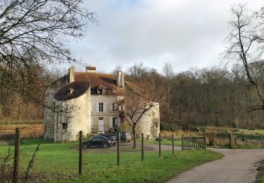
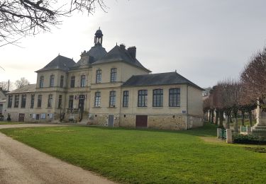
De beaux passages hors des sentiers battus ou trop fréquentés. Une halte à la ferme de Chauvry pour les chèvres et leurs fromages.