10,1 km | 11,1 km-effort
chatenoy inverse
michelleverdier
Utilisateur
Longueur
21 km
Altitude max
144 m
Dénivelé positif
144 m
Km-Effort
22 km
Altitude min
114 m
Dénivelé négatif
144 m
Boucle
Oui
Date de création :
2019-01-15 15:17:59.994
Dernière modification :
2019-01-15 15:17:59.994
5h00
Difficulté : Inconnu
Application GPS de randonnée GRATUITE
À propos
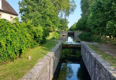
Randonnée Marche de 21 km à découvrir à Centre-Val de Loire, Loiret, Châtenoy. Cette randonnée est proposée par michelleverdier.
Localisation
Pays :
France
Région :
Centre-Val de Loire
Département/Province :
Loiret
Commune :
Châtenoy
Localité :
Unknown
Départ:(Dec)
Départ:(UTM)
454935 ; 5307400 (31T) N.
Commentaires
Randonnées à proximité
Grignon
Marche
Très facile
Vieilles-Maisons-sur-Joudry,
Centre-Val de Loire,
Loiret,
France
2h 39min
Oui
Grignon 45 Gin
Marche
Facile
Vieilles-Maisons-sur-Joudry,
Centre-Val de Loire,
Loiret,
France
10,8 km | 11,7 km-effort
2h 54min
Oui
Les écluses de Grignon aout 2024
A pied
Facile
(1)
Vieilles-Maisons-sur-Joudry,
Centre-Val de Loire,
Loiret,
France
7,8 km | 8,4 km-effort
1h 54min
Oui
Sury Aux Bois Donnery
Marche
Facile
Sury-aux-Bois,
Centre-Val de Loire,
Loiret,
France
49 km | 52 km-effort
5h 37min
Non
Sury Aux Bois Donnery
Marche
Facile
Sury-aux-Bois,
Centre-Val de Loire,
Loiret,
France
49 km | 52 km-effort
5h 37min
Non
Sury Aux Bois Donnery
Marche
Facile
Sury-aux-Bois,
Centre-Val de Loire,
Loiret,
France
49 km | 52 km-effort
5h 37min
Non
Sury Aux Bois Donnery
Marche
Facile
Sury-aux-Bois,
Centre-Val de Loire,
Loiret,
France
49 km | 52 km-effort
5h 37min
Non
Sury Aux Bois Donnery
Marche
Facile
Sury-aux-Bois,
Centre-Val de Loire,
Loiret,
France
49 km | 52 km-effort
5h 37min
Non
Sury Aux Bois Donnery
Marche
Facile
Sury-aux-Bois,
Centre-Val de Loire,
Loiret,
France
49 km | 52 km-effort
5h 37min
Non