![](/images/other/stat-length.png)
![Randonnée Marche Arvière-en-Valromey - La pierre Chanduraz, 1218m - Photo](https://media.geolcdn.com/t/1900/400/ext.pjpeg?maxdim=2&url=https%3A%2F%2Fservices.sitytrail.com%2FGeolivesWS%2FDownloadMedia.ashx%3FTrailID%3D102914%26Media%3D4169_1.jpg)
La pierre Chanduraz, 1218m
tracegps
Utilisateur
![Longueur](/images/other/stat-length.png)
![Altitude max](https://static1.geolcdn.com/siteimages/upload/files/1508320355ic_sort_altitude_max_24dp.png)
![Dénivelé positif](https://static1.geolcdn.com/siteimages/upload/files/1508320355ic_sort_den_pos_24dp.png)
![Km-Effort](/images/other/stat-length.png)
![Altitude min](https://static1.geolcdn.com/siteimages/upload/files/1508320355ic_sort_altitude_min_24dp.png)
![Dénivelé négatif](https://static1.geolcdn.com/siteimages/upload/files/1508320355ic_sort_den_neg_24dp.png)
![Boucle](https://static1.geolcdn.com/siteimages/upload/files/16400158638029165_repeat_loop_refresh_sync_direction_icon.png)
![Marche](https://static1.geolcdn.com/sitytour/trail-icons/101.png)
4h00
Difficulté : Facile
![Scannez ce code QR pour ouvrir la randonnée dans l'application SityTrail](https://capi.geolives.com/qq0zvz2zws4bq2lad0pu/sitytour/trails/102914/qr.png?size=200)
Application GPS de randonnée GRATUITE
À propos
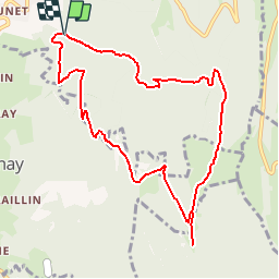
Randonnée Marche de 9,8 km à découvrir à Auvergne-Rhône-Alpes, Ain, Arvière-en-Valromey. Cette randonnée est proposée par tracegps.
Description
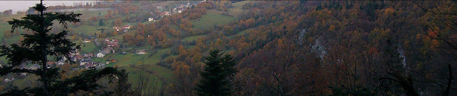
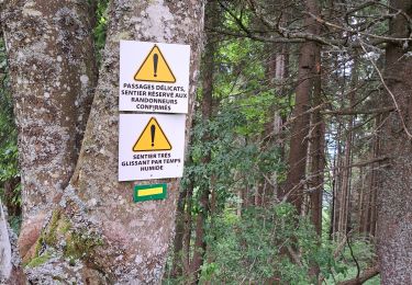
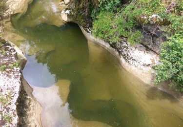
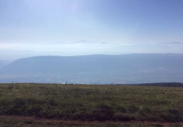
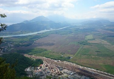
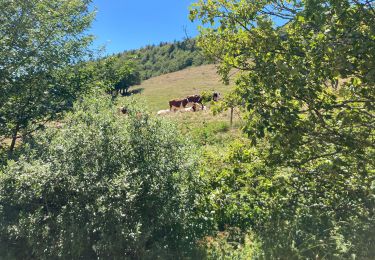
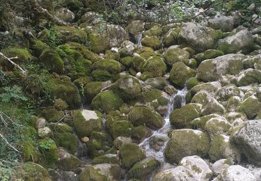
Au départ de Munet, hameau de Virieu-le-Petit, la découverte du massif du Grand Colombier a motivé un nouveau parcours à travers les alpages de Planapose et en Pryse. Le brouillard et les nuages n'ont pas permis de profiter de la superbe vue sur la vallée du Haut-Rhône et la chaîne des Alpes qu'offre normalement le belvédère de la pierre Chanduraz. Le retour par la combe du ruisseau de Brançon est pittoresque. Et, dans son oratoire creusé dans la falaise, la Vierge de la Combe apporterait toujours l'espoir de sa protection au voyageur traversant le passage encaissé… Un ciel dégagé sera l'occasion de revenir, les paysages et l'ambiance de ces montagnes sont très attachants, tranquilles et sauvages. Description complète sur sentier-nature.com : La pierre Chanduraz, 1218m
Localisation
Commentaires
Randonnées à proximité
![Randonnée Marche Béon - Pierre chandruraz. - Photo](https://media.geolcdn.com/t/375/260/074e1b1a-8d87-46da-8de1-124fb8fd4758.jpg&format=jpg&maxdim=2)
![Marche Marche](https://static1.geolcdn.com/sitytour/trail-icons/101.png)
Marche
![](/images/other/stat-length.png)
![](https://static1.geolcdn.com/siteimages/upload/files/16400158638029165_repeat_loop_refresh_sync_direction_icon.png)
![Randonnée sport Culoz - Fenestre - Photo](https://media.geolcdn.com/t/375/260/1a8b0045-a978-442c-8ec1-037d85e229c2.jpg&format=jpg&maxdim=2)
sport
![](/images/other/stat-length.png)
![](https://static1.geolcdn.com/siteimages/upload/files/16400158638029165_repeat_loop_refresh_sync_direction_icon.png)
![Randonnée Marche Artemare - cascade de cerveyrieu - Photo](https://media.geolcdn.com/t/375/260/1fba5c6d-151e-4091-a127-1969b57d4eed.jpg&format=jpg&maxdim=2)
![Marche Marche](https://static1.geolcdn.com/sitytour/trail-icons/101.png)
Marche
![](/images/other/stat-length.png)
![](https://static1.geolcdn.com/siteimages/upload/files/16400158638029165_repeat_loop_refresh_sync_direction_icon.png)
![Randonnée Marche Arvière-en-Valromey - GR 9 - Étape 13 - Chalet d’Arvières - Chanaz - Photo](https://media.geolcdn.com/t/375/260/e124169d-20c4-4d49-b21c-03de29e41215.jpg&format=jpg&maxdim=2)
![Marche Marche](https://static1.geolcdn.com/sitytour/trail-icons/101.png)
Marche
![](/images/other/stat-length.png)
![](https://static1.geolcdn.com/siteimages/upload/files/16400158638029165_repeat_loop_refresh_sync_direction_icon.png)
![Randonnée Marche Béon - Roche percée - Photo](https://media.geolcdn.com/t/375/260/ext.jpg?maxdim=2&url=https%3A%2F%2Fservices.sitytrail.com%2FGeolivesWS%2FDownloadMedia.ashx%3FTrailID%3D273975%26Media%3Dfix__20140504124416.jpg)
![Marche Marche](https://static1.geolcdn.com/sitytour/trail-icons/101.png)
Marche
![](/images/other/stat-length.png)
![](https://static1.geolcdn.com/siteimages/upload/files/16400158638029165_repeat_loop_refresh_sync_direction_icon.png)
![Randonnée Marche Arvière-en-Valromey - GTJ 13 Chalet d'Arviere/Culoz - Photo](https://media.geolcdn.com/t/375/260/95e569a8-40e4-4cb8-99dd-166dae94e18d.jpg&format=jpg&maxdim=2)
![Marche Marche](https://static1.geolcdn.com/sitytour/trail-icons/101.png)
Marche
![](/images/other/stat-length.png)
![](https://static1.geolcdn.com/siteimages/upload/files/16400158638029165_repeat_loop_refresh_sync_direction_icon.png)
![Randonnée Marche Arvière-en-Valromey - Colombier - Photo](https://media.geolcdn.com/t/375/260/546e152b-a190-483a-88e2-1d49977a1ac8.jpg&format=jpg&maxdim=2)
![Marche Marche](https://static1.geolcdn.com/sitytour/trail-icons/101.png)
Marche
![](/images/other/stat-length.png)
![](https://static1.geolcdn.com/siteimages/upload/files/16400158638029165_repeat_loop_refresh_sync_direction_icon.png)
![Randonnée Marche Culoz - le grand colombier - Photo](https://media.geolcdn.com/t/375/260/962ad064-ea14-4f30-9afe-caca11863645.jpg&format=jpg&maxdim=2)
![Marche Marche](https://static1.geolcdn.com/sitytour/trail-icons/101.png)
Marche
![](/images/other/stat-length.png)
![](https://static1.geolcdn.com/siteimages/upload/files/16400158638029165_repeat_loop_refresh_sync_direction_icon.png)
![Randonnée Marche Arvière-en-Valromey - Le Grand Colombier 1531m depuis Fivole - Photo](https://media.geolcdn.com/t/375/260/ext.jpg?maxdim=2&url=https%3A%2F%2Fservices.sitytrail.com%2FGeolivesWS%2FDownloadMedia.ashx%3FTrailID%3D317813%26Media%3D17142_1.jpg)
![Marche Marche](https://static1.geolcdn.com/sitytour/trail-icons/101.png)
Marche
![](/images/other/stat-length.png)
![](https://static1.geolcdn.com/siteimages/upload/files/16400158638029165_repeat_loop_refresh_sync_direction_icon.png)