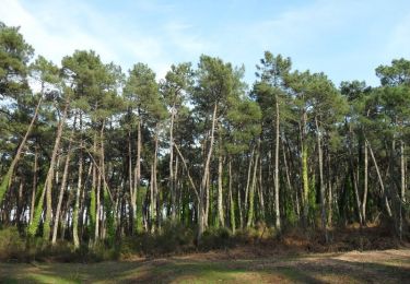
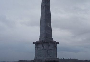
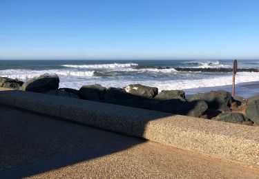
Randonnée Marche Bayonne - Bayonne Hendaye - Photo
 tracegps
tracegps

Utilisateur

© OpenStreetMap contributors
Longueur
Longueur
48 km
Altitude max
Altitude max
78 m
Dénivelé positif
Dénivelé positif
828 m
Km-Effort
Km-Effort  
59 km
Altitude min
Altitude min
-3 m
Dénivelé négatif
Dénivelé négatif
830 m
Boucle
Boucle
Non
Date de création :
2014-12-10 00:00:00.0
Dernière modification :
2014-12-10 00:00:00.0

(0 Avis)

Marche
Marche
12h00
Difficulté : Difficile

Scannez ce code QR pour ouvrir la randonnée dans l'application SityTrail

Application GPS de randonnée GRATUITE

Logo SityTrail SityTrail

IGN / Instituts géographiques

Télécharger SityTrail sur l'App Store Télécharger SityTrail sur Google Play

Logo SityTrail SityTrail World

Le monde est à vous

Télécharger SityTrail sur l'App Store Télécharger SityTrail sur Google Play Télécharger SityTrail sur Huawei AppGallery

À propos

Randonnée Marche de 48 km à découvrir à Nouvelle-Aquitaine, Pyrénées-Atlantiques, Bayonne. Cette randonnée est proposée par tracegps.

Description

Circuit reliant Bayonne à Hendaye en suivant au plus près la Cote Basque. Évidement la sente du douanier n'a pu être partout reconstitué en particulier du coté de St Jean de luz et du golf de Bidart puisque le passage par le bord de l'océan est déconseillé (éboulement). Depuis la plage d'Erretegia à Bidart jusqu'au domaine d'Abbadia à Hendaye, le conseil général du 64 a aménagé un sentier côtier qui longe en grande partie la route de la corniche (créée en 1947). Nous terminerons par la plage d'Hendaye pour rejoindre ensuite l'embarcadère de Sokoburu puisque ce chemin à une suite. Depuis Hondarribia il rejoint Donostia (san sebastien) en passant au plus prés du rivage par un circuit lui aussi très difficile comportant quelques pas d'escalade.

Profil altimétrique

Points d'intérêt

Point d'intérêt Hendaye - pointe_ste_anne - Photo
tracegps
Point d'intérêt Hendaye - maison_de_la_lande - Photo
tracegps
Point d'intérêt Bidart - erretegia - Photo
tracegps
BIDART 
Point d'intérêt Saint-Jean-de-Luz - chapelle_chevalier_van_bree - Photo
tracegps
SAINT-JEAN-DE-LUZ 
Point d'intérêt Anglet - bois_du_lazaret - Photo
tracegps
Point d'intérêt Anglet - brise_lame - Photo
tracegps
ANGLET 
Point d'intérêt Biarritz - phare_de_Biarritz - Photo
tracegps
Point d'intérêt Biarritz - port_de_Biarritz - Photo
tracegps
Point d'intérêt Biarritz - Port_Vieux_playa - Photo
tracegps
Point d'intérêt Biarritz - Villa_Belza - Photo
tracegps
BIARRITZ 
Point d'intérêt Biarritz - maison_de_Henry_Russell - Photo
tracegps
Point d'intérêt Biarritz - cote_des_basques - Photo
tracegps
Point d'intérêt Anglet - promenade_Lazaret - Photo
tracegps
Point d'intérêt Anglet - ruiseau - Photo
tracegps
ANGLET 
Point d'intérêt Guéthary - Port_de_guethary_Getaria - Photo
tracegps
Point d'intérêt Guéthary - Senix - Photo
tracegps
GUÉTHARY 
Point d'intérêt Saint-Jean-de-Luz - maiarko - Photo
tracegps
SAINT-JEAN-DE-LUZ 
Point d'intérêt Saint-Jean-de-Luz - erromardi - Photo
tracegps
SAINT-JEAN-DE-LUZ 
Point d'intérêt Saint-Jean-de-Luz - Ign_Arxilua - Photo
tracegps
SAINT-JEAN-DE-LUZ 
Point d'intérêt Saint-Jean-de-Luz - Balise_puerto_san_juan_de_luz - Photo
tracegps
Point d'intérêt Saint-Jean-de-Luz - Balise_puerto_san_juan_de_luz - Photo
tracegps

Localisation

Pays :
France
Région :
Nouvelle-Aquitaine
Département/Province :
Pyrénées-Atlantiques
Commune :
Bayonne
Localité :
Unknown
Départ:(Dec)
Départ:(UTM)
623842 ; 4816383 (30T) N.

Randonnées à proximité

Randonnée Marche Anglet - Forêts de Pignada et Chiberta - Anglet - Photo
Marche
tracegps

Marche

Moyen
(2)
Anglet, Nouvelle-Aquitaine, Pyrénées-Atlantiques, France
8,1 km | 9,6 km-effort
2h 0min
Oui
Randonnée Marche Mouguerre - La croix de Mouguerre  - Photo
Marche
tracegps

Marche

Facile
(2)
Mouguerre, Nouvelle-Aquitaine, Pyrénées-Atlantiques, France
6,5 km | 8,8 km-effort
1h 45min
Oui
Randonnée Marche Bayonne - Plaine d'ANSOT Bayonne - Photo
Marche
jaja64

Marche

Facile
Bayonne, Nouvelle-Aquitaine, Pyrénées-Atlantiques, France
8,4 km | 9 km-effort
2h 13min
Oui
Randonnée Marche Anglet - Promenade Victor Mendiboure Anglet - Photo
Marche
jaja64

Marche

Facile
Anglet, Nouvelle-Aquitaine, Pyrénées-Atlantiques, France
9,1 km | 9,7 km-effort
1h 43min
Oui
Randonnée Marche Saint-Pierre-d'Irube - balade decouverte Mouguerre - Photo
Marche
alex12r

Marche

Difficile
Saint-Pierre-d'Irube, Nouvelle-Aquitaine, Pyrénées-Atlantiques, France
5,7 km | 7,6 km-effort
1h 56min
Oui
Randonnée Marche Bayonne - coeur - Photo
Marche
muratkiki

Marche

Facile
Bayonne, Nouvelle-Aquitaine, Pyrénées-Atlantiques, France
4,1 km | 4,7 km-effort
1h 14min
Non
Randonnée Marche Anglet - 2024/07/10 - Photo
Marche
DECHAMPD

Marche

Très facile
Anglet, Nouvelle-Aquitaine, Pyrénées-Atlantiques, France
11,6 km | 12,8 km-effort
2h 12min
Non
Randonnée Marche Bayonne - Bayonne-,Anglet Chambre d'Amour - Photo
Marche
rigol05

Marche

Moyen
Bayonne, Nouvelle-Aquitaine, Pyrénées-Atlantiques, France
12,3 km | 13,1 km-effort
2h 59min
Non
Randonnée Marche Bayonne - jour 12, le 06/07/2023 - Photo
Marche
Céline Charbonnieras

Marche

Difficile
Bayonne, Nouvelle-Aquitaine, Pyrénées-Atlantiques, France
14,8 km | 16,8 km-effort
3h 26min
Non


Fermer
Mes abonnements