![](/images/other/stat-length.png)
![Randonnée V.T.T. Retjons - Autour de Retjons - Photo](https://media.geolcdn.com/t/1900/400/ext.pjpeg?maxdim=2&url=https%3A%2F%2Fservices.sitytrail.com%2FGeolivesWS%2FDownloadMedia.ashx%3FTrailID%3D102821%26Media%3D3981_1.jpg)
Autour de Retjons
tracegps
Utilisateur
![Longueur](/images/other/stat-length.png)
Longueur
19,9 km
![Altitude max](https://static1.geolcdn.com/siteimages/upload/files/1508320355ic_sort_altitude_max_24dp.png)
Altitude max
108 m
![Dénivelé positif](https://static1.geolcdn.com/siteimages/upload/files/1508320355ic_sort_den_pos_24dp.png)
Dénivelé positif
143 m
![Km-Effort](/images/other/stat-length.png)
Km-Effort
22 km
![Altitude min](https://static1.geolcdn.com/siteimages/upload/files/1508320355ic_sort_altitude_min_24dp.png)
Altitude min
81 m
![Dénivelé négatif](https://static1.geolcdn.com/siteimages/upload/files/1508320355ic_sort_den_neg_24dp.png)
Dénivelé négatif
142 m
![Boucle](https://static1.geolcdn.com/siteimages/upload/files/16400158638029165_repeat_loop_refresh_sync_direction_icon.png)
Boucle
Oui
Date de création :
2014-12-10 00:00:00.0
Dernière modification :
2014-12-10 00:00:00.0
![V.T.T.](https://static1.geolcdn.com/sitytour/trail-icons/202.png)
2h30
Difficulté : Moyen
![Scannez ce code QR pour ouvrir la randonnée dans l'application SityTrail](https://capi.geolives.com/qq0zvz2zws4bq2lad0pu/sitytour/trails/102821/qr.png?size=200)
Application GPS de randonnée GRATUITE
À propos
Randonnée V.T.T. de 19,9 km à découvrir à Nouvelle-Aquitaine, Landes, Retjons. Cette randonnée est proposée par tracegps.
Description
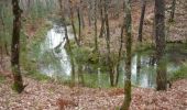
Autour de Retjons. Intérêt : architecture traditionnelle landaise, village de landais, église de Lugaut, forêt. Retrouvez d’autres photos et la description complète sur Ciron VTT, des circuits de randonnées VTT et traces GPS dans la vallée du Ciron (Gironde, Landes) et au-delà …
Localisation
Pays :
France
Région :
Nouvelle-Aquitaine
Département/Province :
Landes
Commune :
Retjons
Localité :
Unknown
Départ:(Dec)
Départ:(UTM)
716496 ; 4886778 (30T) N.
Commentaires
Randonnées à proximité
![Randonnée V.T.T. Arue - Arue_Belis - Photo](https://media.geolcdn.com/t/375/260/ext.jpg?maxdim=2&url=https%3A%2F%2Fstatic1.geolcdn.com%2Fsiteimages%2Fupload%2Ffiles%2F1524743154velo.jpg)
![V.T.T. V.T.T.](https://static1.geolcdn.com/sitytour/trail-icons/202.png)
Arue_Belis
V.T.T.
Très facile
Arue,
Nouvelle-Aquitaine,
Landes,
France
![](/images/other/stat-length.png)
18,5 km | 21 km-effort
2h 54min
![](https://static1.geolcdn.com/siteimages/upload/files/16400158638029165_repeat_loop_refresh_sync_direction_icon.png)
Non
![Randonnée Marche Bourriot-Bergonce - 13042024 - Photo](https://media.geolcdn.com/t/375/260/ext.jpg?maxdim=2&url=https%3A%2F%2Fstatic1.geolcdn.com%2Fsiteimages%2Fupload%2Ffiles%2F1553511878bg_sport_marche.png)
![Marche Marche](https://static1.geolcdn.com/sitytour/trail-icons/101.png)
13042024
Marche
Moyen
Bourriot-Bergonce,
Nouvelle-Aquitaine,
Landes,
France
![](/images/other/stat-length.png)
25 km | 27 km-effort
5h 10min
![](https://static1.geolcdn.com/siteimages/upload/files/16400158638029165_repeat_loop_refresh_sync_direction_icon.png)
Non
![Randonnée Marche Arue - Boucle de Nabias - Photo](https://media.geolcdn.com/t/375/260/ext.jpg?maxdim=2&url=https%3A%2F%2Fstatic1.geolcdn.com%2Fsiteimages%2Fupload%2Ffiles%2F1553511878bg_sport_marche.png)
![Marche Marche](https://static1.geolcdn.com/sitytour/trail-icons/101.png)
Boucle de Nabias
Marche
Très facile
Arue,
Nouvelle-Aquitaine,
Landes,
France
![](/images/other/stat-length.png)
5,5 km | 6 km-effort
1h 52min
![](https://static1.geolcdn.com/siteimages/upload/files/16400158638029165_repeat_loop_refresh_sync_direction_icon.png)
Oui
![Randonnée Marche Retjons - Retjons chapelle de lugaut - Photo](https://media.geolcdn.com/t/375/260/ext.jpg?maxdim=2&url=https%3A%2F%2Fstatic1.geolcdn.com%2Fsiteimages%2Fupload%2Ffiles%2F1553511878bg_sport_marche.png)
![Marche Marche](https://static1.geolcdn.com/sitytour/trail-icons/101.png)
Retjons chapelle de lugaut
Marche
Facile
(1)
Retjons,
Nouvelle-Aquitaine,
Landes,
France
![](/images/other/stat-length.png)
10,9 km | 11,9 km-effort
2h 45min
![](https://static1.geolcdn.com/siteimages/upload/files/16400158638029165_repeat_loop_refresh_sync_direction_icon.png)
Oui
![Randonnée Marche Saint-Gor - P11 Eglise de Vialotte-Bostens - Photo](https://media.geolcdn.com/t/375/260/ext.jpg?maxdim=2&url=https%3A%2F%2Fstatic1.geolcdn.com%2Fsiteimages%2Fupload%2Ffiles%2F1553511878bg_sport_marche.png)
![Marche Marche](https://static1.geolcdn.com/sitytour/trail-icons/101.png)
P11 Eglise de Vialotte-Bostens
Marche
Très difficile
Saint-Gor,
Nouvelle-Aquitaine,
Landes,
France
![](/images/other/stat-length.png)
23 km | 26 km-effort
5h 49min
![](https://static1.geolcdn.com/siteimages/upload/files/16400158638029165_repeat_loop_refresh_sync_direction_icon.png)
Non
![Randonnée Marche Bourriot-Bergonce - P11a Bourriot Bergonce-Bostens - Photo](https://media.geolcdn.com/t/375/260/ext.jpg?maxdim=2&url=https%3A%2F%2Fstatic1.geolcdn.com%2Fsiteimages%2Fupload%2Ffiles%2F1553511878bg_sport_marche.png)
![Marche Marche](https://static1.geolcdn.com/sitytour/trail-icons/101.png)
P11a Bourriot Bergonce-Bostens
Marche
Très difficile
Bourriot-Bergonce,
Nouvelle-Aquitaine,
Landes,
France
![](/images/other/stat-length.png)
24 km | 27 km-effort
5h 55min
![](https://static1.geolcdn.com/siteimages/upload/files/16400158638029165_repeat_loop_refresh_sync_direction_icon.png)
Non