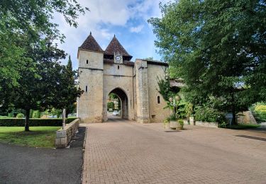

Autour de Gabarret

tracegps
Utilisateur

Longueur
29 km

Altitude max
184 m

Dénivelé positif
282 m

Km-Effort
33 km

Altitude min
116 m

Dénivelé négatif
282 m
Boucle
Oui
Date de création :
2014-12-10 00:00:00.0
Dernière modification :
2014-12-10 00:00:00.0
3h00
Difficulté : Moyen

Application GPS de randonnée GRATUITE
À propos
Randonnée V.T.T. de 29 km à découvrir à Nouvelle-Aquitaine, Landes, Gabarret. Cette randonnée est proposée par tracegps.
Description
Autour de Gabarret. Intérêt : forêt, collines du Gabardan, architecture traditionnelle. Retrouvez d’autres photos et la description complète sur Ciron VTT, des circuits de randonnées VTT et traces GPS dans la vallée du Ciron (Gironde, Landes) et au-delà …
Localisation
Pays :
France
Région :
Nouvelle-Aquitaine
Département/Province :
Landes
Commune :
Gabarret
Localité :
Unknown
Départ:(Dec)
Départ:(UTM)
260283 ; 4874541 (31T) N.
Commentaires
Randonnées à proximité

bardotan ballade


Marche
Facile
(3)
Cazaubon,
Occitanie,
Gers,
France

5,1 km | 6 km-effort
1h 39min
Oui

Boucle Barbotan - Nord Est


Marche
Très facile
Cazaubon,
Occitanie,
Gers,
France

14,2 km | 15,9 km-effort
3h 5min
Oui

barbotan ouest


Marche
Difficile
Cazaubon,
Occitanie,
Gers,
France

12,5 km | 14,3 km-effort
3h 8min
Oui

barbotan église St Christau Cazaubon sud 17km


Marche
Très difficile
Cazaubon,
Occitanie,
Gers,
France

17,2 km | 20 km-effort
4h 56min
Oui

Barbotan " le Loungat"


Marche
Facile
(2)
Cazaubon,
Occitanie,
Gers,
France

5,9 km | 7,2 km-effort
1h 33min
Oui


barbotan Lagrange 15.7km par petites routes


Marche
Difficile
Cazaubon,
Occitanie,
Gers,
France

15,8 km | 18,1 km-effort
3h 43min
Oui

barbotan Cazaubon 10km


Marche
Moyen
Cazaubon,
Occitanie,
Gers,
France

9,9 km | 11,7 km-effort
3h 12min
Oui


 SityTrail


