![](/images/other/stat-length.png)
![Randonnée V.T.T. Lubbon - Lubbon, au pays des lagunes oubliées - Photo](https://media.geolcdn.com/t/1900/400/ext.pjpeg?maxdim=2&url=https%3A%2F%2Fservices.sitytrail.com%2FGeolivesWS%2FDownloadMedia.ashx%3FTrailID%3D102789%26Media%3D3951_1.jpg)
Lubbon, au pays des lagunes oubliées
tracegps
Utilisateur
![Longueur](/images/other/stat-length.png)
![Altitude max](https://static1.geolcdn.com/siteimages/upload/files/1508320355ic_sort_altitude_max_24dp.png)
![Dénivelé positif](https://static1.geolcdn.com/siteimages/upload/files/1508320355ic_sort_den_pos_24dp.png)
![Km-Effort](/images/other/stat-length.png)
![Altitude min](https://static1.geolcdn.com/siteimages/upload/files/1508320355ic_sort_altitude_min_24dp.png)
![Dénivelé négatif](https://static1.geolcdn.com/siteimages/upload/files/1508320355ic_sort_den_neg_24dp.png)
![Boucle](https://static1.geolcdn.com/siteimages/upload/files/16400158638029165_repeat_loop_refresh_sync_direction_icon.png)
![V.T.T.](https://static1.geolcdn.com/sitytour/trail-icons/202.png)
3h00
Difficulté : Moyen
![Scannez ce code QR pour ouvrir la randonnée dans l'application SityTrail](https://capi.geolives.com/qq0zvz2zws4bq2lad0pu/sitytour/trails/102789/qr.png?size=200)
Application GPS de randonnée GRATUITE
À propos
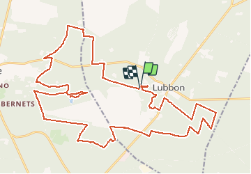
Randonnée V.T.T. de 32 km à découvrir à Nouvelle-Aquitaine, Landes, Lubbon. Cette randonnée est proposée par tracegps.
Description
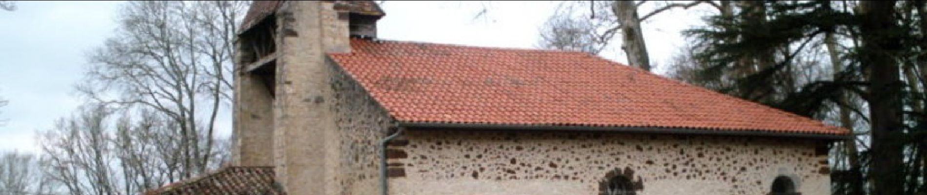
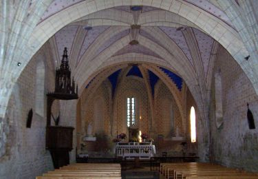
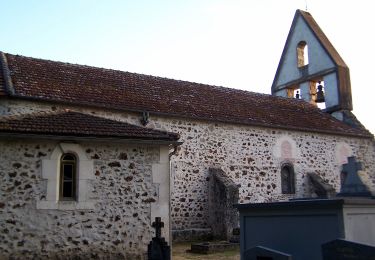
Lubbon, au pays des lagunes oubliées!! ntérêt : lagune de Roustouze, anciennes lagunes, sources du Ciron, église landaise, forêt, grues cendrées, cerf (c'est un peu avant la tombée de la nuit, que vous aurez peut-être le bonheur de croiser cet animal magestueux) Retrouvez d’autres photos et la description complète sur Ciron VTT, des circuits de randonnées VTT et traces GPS dans la vallée du Ciron (Gironde, Landes) et au-delà …
Localisation
Commentaires
Randonnées à proximité
![Randonnée A pied Poudenas - Poudenas, une ambiance de Toscane 10.8 km - Photo](https://media.geolcdn.com/t/375/260/ef3687dd-33b2-428d-9c76-911af79325b2.jpeg&format=jpg&maxdim=2)
![A pied A pied](https://static1.geolcdn.com/sitytour/trail-icons/100.png)
A pied
![](/images/other/stat-length.png)
![](https://static1.geolcdn.com/siteimages/upload/files/16400158638029165_repeat_loop_refresh_sync_direction_icon.png)
![Randonnée A pied Poudenas - Poudenas, une ambiance de Toscane variante 7.8 km - Photo](https://media.geolcdn.com/t/375/260/ef3687dd-33b2-428d-9c76-911af79325b2.jpeg&format=jpg&maxdim=2)
![A pied A pied](https://static1.geolcdn.com/sitytour/trail-icons/100.png)
A pied
![](/images/other/stat-length.png)
![](https://static1.geolcdn.com/siteimages/upload/files/16400158638029165_repeat_loop_refresh_sync_direction_icon.png)
![Randonnée A pied Poudenas - De Mézin, la Médiévale à Poudenas, l'Italienne 14.3 km - Photo](https://media.geolcdn.com/t/375/260/4931e991-4f88-4037-bc7e-658247d6e79b.jpeg&format=jpg&maxdim=2)
![A pied A pied](https://static1.geolcdn.com/sitytour/trail-icons/100.png)
A pied
![](/images/other/stat-length.png)
![](https://static1.geolcdn.com/siteimages/upload/files/16400158638029165_repeat_loop_refresh_sync_direction_icon.png)
![Randonnée A pied Sos - De Sos à Poudenas sur le chemin de Gélise 17.2 km - Photo](https://media.geolcdn.com/t/375/260/ef3687dd-33b2-428d-9c76-911af79325b2.jpeg&format=jpg&maxdim=2)
![A pied A pied](https://static1.geolcdn.com/sitytour/trail-icons/100.png)
A pied
![](/images/other/stat-length.png)
![](https://static1.geolcdn.com/siteimages/upload/files/16400158638029165_repeat_loop_refresh_sync_direction_icon.png)
![Randonnée A pied Sauméjan - Sauméjan, vacances au « milieu de la forêt » - 9.9 km - Photo](https://media.geolcdn.com/t/375/260/7e8ffff5-1db4-4879-93a3-100007b84c67.jpeg&format=jpg&maxdim=2)
![A pied A pied](https://static1.geolcdn.com/sitytour/trail-icons/100.png)
A pied
![](/images/other/stat-length.png)
![](https://static1.geolcdn.com/siteimages/upload/files/16400158638029165_repeat_loop_refresh_sync_direction_icon.png)
![Randonnée A pied Pompogne - Pompogne, le clocher et le pin - 12.3 km - Photo](https://media.geolcdn.com/t/375/260/fef962c1-d5fc-4a67-8889-38c146f9717a.jpeg&format=jpg&maxdim=2)
![A pied A pied](https://static1.geolcdn.com/sitytour/trail-icons/100.png)
A pied
![](/images/other/stat-length.png)
![](https://static1.geolcdn.com/siteimages/upload/files/16400158638029165_repeat_loop_refresh_sync_direction_icon.png)
![Randonnée A pied Houeillès - Houeillès, dans la forêt des Lugues - 16.1 km - Photo](https://media.geolcdn.com/t/375/260/dc960556-4d92-48cf-98f9-ba4f2df05f5c.jpeg&format=jpg&maxdim=2)
![A pied A pied](https://static1.geolcdn.com/sitytour/trail-icons/100.png)
A pied
![](/images/other/stat-length.png)
![](https://static1.geolcdn.com/siteimages/upload/files/16400158638029165_repeat_loop_refresh_sync_direction_icon.png)
![Randonnée A pied Houeillès - Houeillès, balade en forêt - 9.4 km - Photo](https://media.geolcdn.com/t/375/260/dc960556-4d92-48cf-98f9-ba4f2df05f5c.jpeg&format=jpg&maxdim=2)
![A pied A pied](https://static1.geolcdn.com/sitytour/trail-icons/100.png)
A pied
![](/images/other/stat-length.png)
![](https://static1.geolcdn.com/siteimages/upload/files/16400158638029165_repeat_loop_refresh_sync_direction_icon.png)
![Randonnée A pied Allons - Allons, en Forêt et sur une Ancienne Voie Ferrée - 20.7 km - Photo](https://media.geolcdn.com/t/375/260/74fd1a10-2e67-416a-9ca8-8d8f7e180993.jpeg&format=jpg&maxdim=2)
![A pied A pied](https://static1.geolcdn.com/sitytour/trail-icons/100.png)
A pied
![](/images/other/stat-length.png)
![](https://static1.geolcdn.com/siteimages/upload/files/16400158638029165_repeat_loop_refresh_sync_direction_icon.png)