


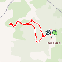

15,4 km | 31 km-effort

Utilisateur


Application GPS de randonnée GRATUITE
 SityTrail
IGN / Instituts géographiques
SityTrail World
Le monde est à vous
Randonnée Marche de 10,6 km à découvrir à Provence-Alpes-Côte d'Azur, Hautes-Alpes, Embrun. Cette randonnée est proposée par gildascb.
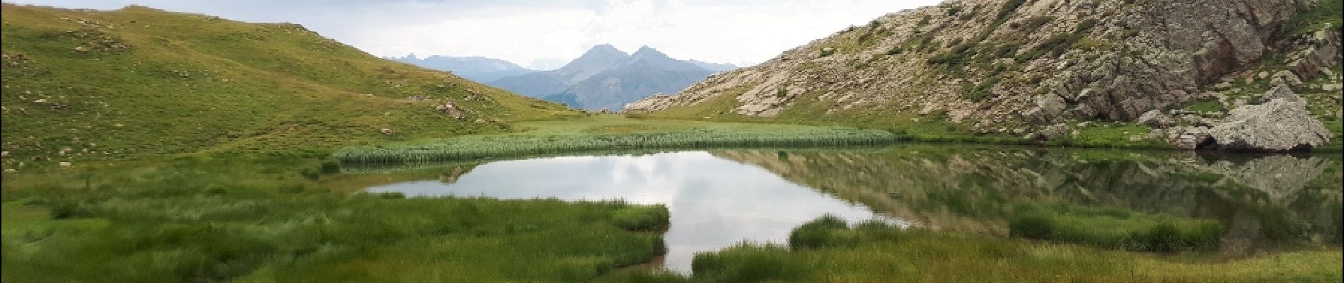
Un joli petit lac dans un écrin de verdure au dessus d'Embrun et au pied de la Tête de l'Hivernet (2824m).
Parking au bout de la route venant de Caléyère. Aucun problème d'accès (route jusqu'au parking).


Marche

Marche

Marche

Marche

Marche

Marche

Marche

Marche
Raquettes à neige
Bonne base de travail