![](/images/other/stat-length.png)
![Randonnée Marche Cayeux-sur-Mer - LP80_Brighton-Cayeux-sur-Mer_8km - Photo](https://media.geolcdn.com/t/1900/400/0e21d744-f60f-4439-8a99-1886a4e10335.jpg&format=pjpeg&maxdim=2)
LP80_Brighton-Cayeux-sur-Mer_8km
BAIE de SOMME & alentours
Autour de la Baie à pieds
![Longueur](/images/other/stat-length.png)
Longueur
8 km
![Altitude max](https://static1.geolcdn.com/siteimages/upload/files/1508320355ic_sort_altitude_max_24dp.png)
Altitude max
15 m
![Dénivelé positif](https://static1.geolcdn.com/siteimages/upload/files/1508320355ic_sort_den_pos_24dp.png)
Dénivelé positif
30 m
![Km-Effort](/images/other/stat-length.png)
Km-Effort
8,4 km
![Altitude min](https://static1.geolcdn.com/siteimages/upload/files/1508320355ic_sort_altitude_min_24dp.png)
Altitude min
2 m
![Dénivelé négatif](https://static1.geolcdn.com/siteimages/upload/files/1508320355ic_sort_den_neg_24dp.png)
Dénivelé négatif
30 m
![Boucle](https://static1.geolcdn.com/siteimages/upload/files/16400158638029165_repeat_loop_refresh_sync_direction_icon.png)
Boucle
Oui
Date de création :
2019-03-04 12:57:47.873
Dernière modification :
2023-10-03 18:55:00.942
![Marche](https://static1.geolcdn.com/sitytour/trail-icons/101.png)
1h53
Difficulté : Moyen
![Scannez ce code QR pour ouvrir la randonnée dans l'application SityTrail](https://capi.geolives.com/qq0zvz2zws4bq2lad0pu/sitytour/trails/1027457/qr.png?size=200)
Application GPS de randonnée GRATUITE
À propos
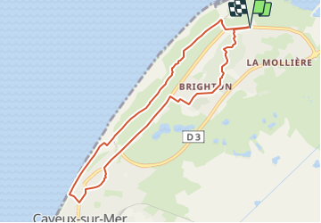
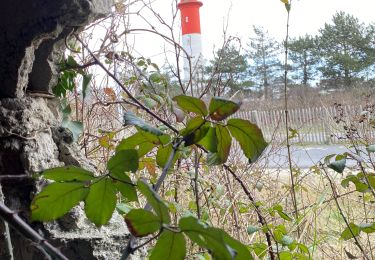
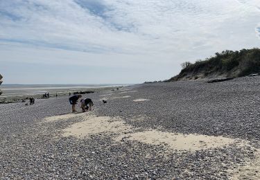
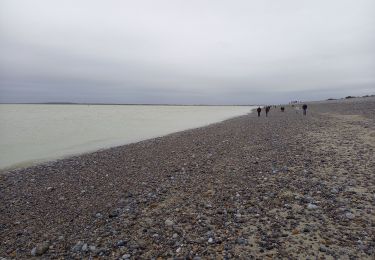
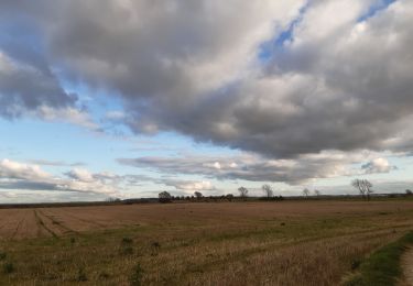
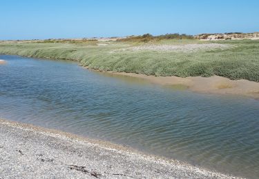
Randonnée Marche de 8 km à découvrir à Hauts-de-France, Somme, Cayeux-sur-Mer. Cette randonnée est proposée par BAIE de SOMME & alentours.
Description
Départ / Arrivée
Parking de la Molière, Rue Faidherbe, 80410 Cayeux-sur-Mer
(50.202842, 1.524313)
Localisation
Pays :
France
Région :
Hauts-de-France
Département/Province :
Somme
Commune :
Cayeux-sur-Mer
Localité :
Unknown
Départ:(Dec)
Départ:(UTM)
394822 ; 5562234 (31U) N.
Commentaires
Randonnées à proximité
![Randonnée Marche Cayeux-sur-Mer - Le Hourdel V2 - Photo](https://media.geolcdn.com/t/375/260/ext.jpg?maxdim=2&url=https%3A%2F%2Fservices.sitytrail.com%2FGeolivesWS%2FDownloadMedia.ashx%3FTrailID%3D108609%26Media%3D1517_1.jpg)
![Marche Marche](https://static1.geolcdn.com/sitytour/trail-icons/101.png)
Le Hourdel V2
Marche
Difficile
(1)
Cayeux-sur-Mer,
Hauts-de-France,
Somme,
France
![](/images/other/stat-length.png)
8 km | 8,4 km-effort
2h 30min
![](https://static1.geolcdn.com/siteimages/upload/files/16400158638029165_repeat_loop_refresh_sync_direction_icon.png)
Oui
![Randonnée V.T.T. Cayeux-sur-Mer - Baie de Somme - Cayeux-sur-Mer, Hourdel - Photo](https://media.geolcdn.com/t/375/260/dfc5e36a-a876-4158-8d07-2ca8055ddf3f.jpeg&format=jpg&maxdim=2)
![V.T.T. V.T.T.](https://static1.geolcdn.com/sitytour/trail-icons/202.png)
Baie de Somme - Cayeux-sur-Mer, Hourdel
V.T.T.
Facile
Cayeux-sur-Mer,
Hauts-de-France,
Somme,
France
![](/images/other/stat-length.png)
17 km | 17,7 km-effort
1h 13min
![](https://static1.geolcdn.com/siteimages/upload/files/16400158638029165_repeat_loop_refresh_sync_direction_icon.png)
Oui
![Randonnée Marche Cayeux-sur-Mer - entre le Hourdel et Cailleux - Photo](https://media.geolcdn.com/t/375/260/b237faa7-5642-4003-8111-9e6140f1adf8.jpg&format=jpg&maxdim=2)
![Marche Marche](https://static1.geolcdn.com/sitytour/trail-icons/101.png)
entre le Hourdel et Cailleux
Marche
Moyen
Cayeux-sur-Mer,
Hauts-de-France,
Somme,
France
![](/images/other/stat-length.png)
9,7 km | 10,3 km-effort
2h 28min
![](https://static1.geolcdn.com/siteimages/upload/files/16400158638029165_repeat_loop_refresh_sync_direction_icon.png)
Non
![Randonnée Marche Cayeux-sur-Mer - Crayeux sur mer - Photo](https://media.geolcdn.com/t/375/260/e74086ef-56e3-4ae1-8a72-f13407de6209.jpg&format=jpg&maxdim=2)
![Marche Marche](https://static1.geolcdn.com/sitytour/trail-icons/101.png)
Crayeux sur mer
Marche
Facile
Cayeux-sur-Mer,
Hauts-de-France,
Somme,
France
![](/images/other/stat-length.png)
4,6 km | 4,8 km-effort
50min
![](https://static1.geolcdn.com/siteimages/upload/files/16400158638029165_repeat_loop_refresh_sync_direction_icon.png)
Oui
![Randonnée A pied Cayeux-sur-Mer - Le Hourdel - Photo](https://media.geolcdn.com/t/375/260/e02b6736-5598-4803-9f59-ea4f4aaa2d0c.jpeg&format=jpg&maxdim=2)
![A pied A pied](https://static1.geolcdn.com/sitytour/trail-icons/100.png)
Le Hourdel
A pied
Facile
Cayeux-sur-Mer,
Hauts-de-France,
Somme,
France
![](/images/other/stat-length.png)
3,3 km | 3,4 km-effort
46min
![](https://static1.geolcdn.com/siteimages/upload/files/16400158638029165_repeat_loop_refresh_sync_direction_icon.png)
Non
![Randonnée Marche Cayeux-sur-Mer - Pointe du Hourdel (Baie de Somme) - Photo](https://media.geolcdn.com/t/375/260/f4197274-2126-494d-824f-85d2cdf45160.jpg&format=jpg&maxdim=2)
![Marche Marche](https://static1.geolcdn.com/sitytour/trail-icons/101.png)
Pointe du Hourdel (Baie de Somme)
Marche
Très facile
Cayeux-sur-Mer,
Hauts-de-France,
Somme,
France
![](/images/other/stat-length.png)
6,8 km | 7,3 km-effort
2h 8min
![](https://static1.geolcdn.com/siteimages/upload/files/16400158638029165_repeat_loop_refresh_sync_direction_icon.png)
Non
![Randonnée Marche Cayeux-sur-Mer - lac de caouaisse . brighton . pointe de hourdel . lac de caouzisse - Photo](https://media.geolcdn.com/t/375/260/a2e73a68-b7d3-4fba-9ddd-e4c4d3c209b6.jpg&format=jpg&maxdim=2)
![Marche Marche](https://static1.geolcdn.com/sitytour/trail-icons/101.png)
lac de caouaisse . brighton . pointe de hourdel . lac de caouzisse
Marche
Facile
Cayeux-sur-Mer,
Hauts-de-France,
Somme,
France
![](/images/other/stat-length.png)
12,4 km | 13,1 km-effort
4h 28min
![](https://static1.geolcdn.com/siteimages/upload/files/16400158638029165_repeat_loop_refresh_sync_direction_icon.png)
Oui
![Randonnée Marche Pendé - Pendé estreboeuf Tilloy - Photo](https://media.geolcdn.com/t/375/260/d2a135ea-c31a-4482-9f9d-620e60386ea4.jpg&format=jpg&maxdim=2)
![Marche Marche](https://static1.geolcdn.com/sitytour/trail-icons/101.png)
Pendé estreboeuf Tilloy
Marche
Difficile
Pendé,
Hauts-de-France,
Somme,
France
![](/images/other/stat-length.png)
12,7 km | 13,8 km-effort
3h 7min
![](https://static1.geolcdn.com/siteimages/upload/files/16400158638029165_repeat_loop_refresh_sync_direction_icon.png)
Oui
![Randonnée Marche Cayeux-sur-Mer - le long de la baie - Photo](https://media.geolcdn.com/t/375/260/085e6ceb-afc3-446c-9c3b-0c4b27c69095.jpg&format=jpg&maxdim=2)
![Marche Marche](https://static1.geolcdn.com/sitytour/trail-icons/101.png)
le long de la baie
Marche
Très facile
Cayeux-sur-Mer,
Hauts-de-France,
Somme,
France
![](/images/other/stat-length.png)
6,3 km | 6,7 km-effort
2h 1min
![](https://static1.geolcdn.com/siteimages/upload/files/16400158638029165_repeat_loop_refresh_sync_direction_icon.png)
Non