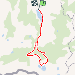
![](/images/other/stat-length.png)
![Randonnée Marche Aston - Les Etangs de Fontargente - Photo](https://media.geolcdn.com/t/1900/400/ext.pjpeg?maxdim=2&url=https%3A%2F%2Fservices.sitytrail.com%2FGeolivesWS%2FDownloadMedia.ashx%3FTrailID%3D102722%26Media%3D3835_3.jpg)
Les Etangs de Fontargente
tracegps
Utilisateur
![Longueur](/images/other/stat-length.png)
![Altitude max](https://static1.geolcdn.com/siteimages/upload/files/1508320355ic_sort_altitude_max_24dp.png)
![Dénivelé positif](https://static1.geolcdn.com/siteimages/upload/files/1508320355ic_sort_den_pos_24dp.png)
![Km-Effort](/images/other/stat-length.png)
![Altitude min](https://static1.geolcdn.com/siteimages/upload/files/1508320355ic_sort_altitude_min_24dp.png)
![Dénivelé négatif](https://static1.geolcdn.com/siteimages/upload/files/1508320355ic_sort_den_neg_24dp.png)
![Boucle](https://static1.geolcdn.com/siteimages/upload/files/16400158638029165_repeat_loop_refresh_sync_direction_icon.png)
![Marche](https://static1.geolcdn.com/sitytour/trail-icons/101.png)
4h00
Difficulté : Moyen
![Scannez ce code QR pour ouvrir la randonnée dans l'application SityTrail](https://capi.geolives.com/qq0zvz2zws4bq2lad0pu/sitytour/trails/102722/qr.png?size=200)
Application GPS de randonnée GRATUITE
À propos
Randonnée Marche de 15,2 km à découvrir à Occitanie, Ariège, Aston. Cette randonnée est proposée par tracegps.
Description
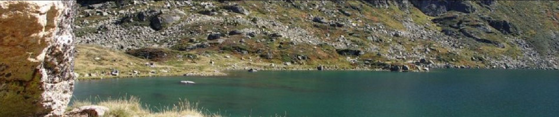
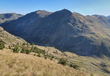
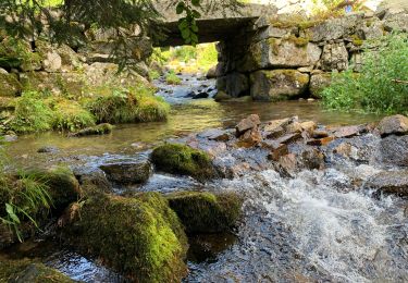
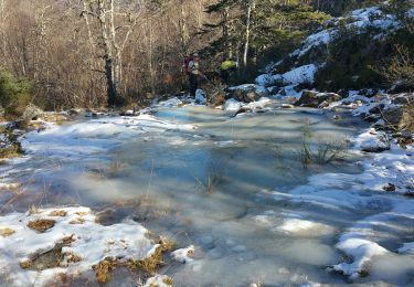
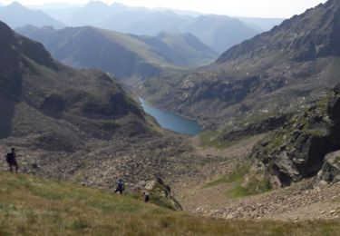
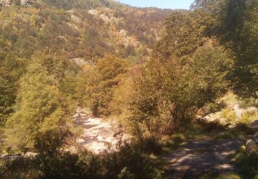
Les Etangs de Fontargente Départ du barrage de Laparan, même si la route continue jusqu'au Plat des Peyres, elle est en mauvais état, et on peut marcher ! Attention, elle n'est ouverte que le we, contacter la mairie des Cabannes. Pas de difficultés particulières pour cette rando, mais des lacs magnifiques. Des Etangs de Fontargente, on peut rejoindre le refuge du Rhule en partant vers l’Est, en traversant les éboulis puis remontant vers le refuge.
Localisation
Commentaires
Randonnées à proximité
![Randonnée Marche Aston - GR10-4 - Photo](https://media.geolcdn.com/t/375/260/ext.jpg?maxdim=2&url=https%3A%2F%2Fstatic1.geolcdn.com%2Fsiteimages%2Fupload%2Ffiles%2F1553511878bg_sport_marche.png)
![Marche Marche](https://static1.geolcdn.com/sitytour/trail-icons/101.png)
![Randonnée Marche Aston - Etangs de Mirabail et La Peyre - Photo](https://media.geolcdn.com/t/375/260/ext.jpg?maxdim=2&url=https%3A%2F%2Fstatic1.geolcdn.com%2Fsiteimages%2Fupload%2Ffiles%2F1553511878bg_sport_marche.png)
![Marche Marche](https://static1.geolcdn.com/sitytour/trail-icons/101.png)
Marche
![](/images/other/stat-length.png)
![](https://static1.geolcdn.com/siteimages/upload/files/16400158638029165_repeat_loop_refresh_sync_direction_icon.png)
![Randonnée Marche Aston - Etangs de Fontargenta - Photo](https://media.geolcdn.com/t/375/260/ext.jpg?maxdim=2&url=https%3A%2F%2Fstatic1.geolcdn.com%2Fsiteimages%2Fupload%2Ffiles%2F1553511878bg_sport_marche.png)
![Marche Marche](https://static1.geolcdn.com/sitytour/trail-icons/101.png)
Marche
![](/images/other/stat-length.png)
![](https://static1.geolcdn.com/siteimages/upload/files/16400158638029165_repeat_loop_refresh_sync_direction_icon.png)
![Randonnée Marche Aston - pic de caballiere - Photo](https://media.geolcdn.com/t/375/260/ac578392-d2d8-4e5c-b5e8-60dc1946d257.jpg&format=jpg&maxdim=2)
![Marche Marche](https://static1.geolcdn.com/sitytour/trail-icons/101.png)
![Randonnée Marche Savignac-les-Ormeaux - 2022 TRANSPYRÉNÉENNE : Auberge de Ruhle - Mèrens les Vals ( Auberge du N’abréger) - Photo](https://media.geolcdn.com/t/375/260/030ead4a-424d-42b8-99b3-0c613609bb01.jpg&format=jpg&maxdim=2)
![Marche Marche](https://static1.geolcdn.com/sitytour/trail-icons/101.png)
Marche
![](/images/other/stat-length.png)
![](https://static1.geolcdn.com/siteimages/upload/files/16400158638029165_repeat_loop_refresh_sync_direction_icon.png)
![Randonnée Marche Aston - Massayres janvier 2020 - Photo](https://media.geolcdn.com/t/375/260/bb411948-71b3-4a92-a42a-79e20006fb67.jpg&format=jpg&maxdim=2)
![Marche Marche](https://static1.geolcdn.com/sitytour/trail-icons/101.png)
Marche
![](/images/other/stat-length.png)
![](https://static1.geolcdn.com/siteimages/upload/files/16400158638029165_repeat_loop_refresh_sync_direction_icon.png)
![Randonnée Marche Aston - pic de rulhe - Photo](https://media.geolcdn.com/t/375/260/d80e4e79-6a3c-40a9-8315-aa68a85f61bb.jpg&format=jpg&maxdim=2)
![Marche Marche](https://static1.geolcdn.com/sitytour/trail-icons/101.png)
![Randonnée Marche Aston - Refuge de Ruhle - Photo](https://media.geolcdn.com/t/375/260/ext.jpg?maxdim=2&url=https%3A%2F%2Fstatic1.geolcdn.com%2Fsiteimages%2Fupload%2Ffiles%2F1553511878bg_sport_marche.png)
![Marche Marche](https://static1.geolcdn.com/sitytour/trail-icons/101.png)
Marche
![](/images/other/stat-length.png)
![](https://static1.geolcdn.com/siteimages/upload/files/16400158638029165_repeat_loop_refresh_sync_direction_icon.png)
![Randonnée Marche Aston - Le chemin de Jojo - Photo](https://media.geolcdn.com/t/375/260/9894e6ba-9a6b-4843-9f23-9027ee786df5.jpg&format=jpg&maxdim=2)
![Marche Marche](https://static1.geolcdn.com/sitytour/trail-icons/101.png)
tres beau beaucoup de monde