


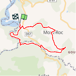


6 km | 9,1 km-effort


Utilisateur


Application GPS de randonnée GRATUITE
 SityTrail
IGN / Instituts géographiques
SityTrail World
Le monde est à vous
Randonnée Marche de 8,8 km à découvrir à Occitanie, Tarn, Mont-Roc. Cette randonnée est proposée par jpipacific.
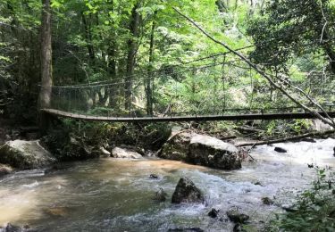
chemin en forêt à l'ombre qui suit la rivière puis monte par la route avant de retourner au départ par un chemin. Parfois la trace n'est pas facile à trouver car la carte ne correspond pas bien. Au départ je n'ai pas trouver le GR 36
Marche

Vélo électrique

Marche
Marche
Marche
Marche
Marche
Marche