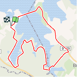
![](/images/other/stat-length.png)
![Randonnée V.T.T. Giffaumont-Champaubert - Espace VTT FFC Lac du Der en Champagne - Circuit n°01 - Entre Dame et Chevalier - Photo](https://media.geolcdn.com/t/1900/400/ext.pjpeg?maxdim=2&url=https%3A%2F%2Fservices.sitytrail.com%2FGeolivesWS%2FDownloadMedia.ashx%3FTrailID%3D102260%26Media%3D2721_1.jpg)
Espace VTT FFC Lac du Der en Champagne - Circuit n°01 - Entre Dame et Chevalier
tracegps
Utilisateur
![Longueur](/images/other/stat-length.png)
![Altitude max](https://static1.geolcdn.com/siteimages/upload/files/1508320355ic_sort_altitude_max_24dp.png)
![Dénivelé positif](https://static1.geolcdn.com/siteimages/upload/files/1508320355ic_sort_den_pos_24dp.png)
![Km-Effort](/images/other/stat-length.png)
![Altitude min](https://static1.geolcdn.com/siteimages/upload/files/1508320355ic_sort_altitude_min_24dp.png)
![Dénivelé négatif](https://static1.geolcdn.com/siteimages/upload/files/1508320355ic_sort_den_neg_24dp.png)
![Boucle](https://static1.geolcdn.com/siteimages/upload/files/16400158638029165_repeat_loop_refresh_sync_direction_icon.png)
![V.T.T.](https://static1.geolcdn.com/sitytour/trail-icons/202.png)
1h00
Difficulté : Moyen
![Scannez ce code QR pour ouvrir la randonnée dans l'application SityTrail](https://capi.geolives.com/qq0zvz2zws4bq2lad0pu/sitytour/trails/102260/qr.png?size=200)
Application GPS de randonnée GRATUITE
À propos
Randonnée V.T.T. de 11,2 km à découvrir à Grand Est, Marne, Giffaumont-Champaubert. Cette randonnée est proposée par tracegps.
Description
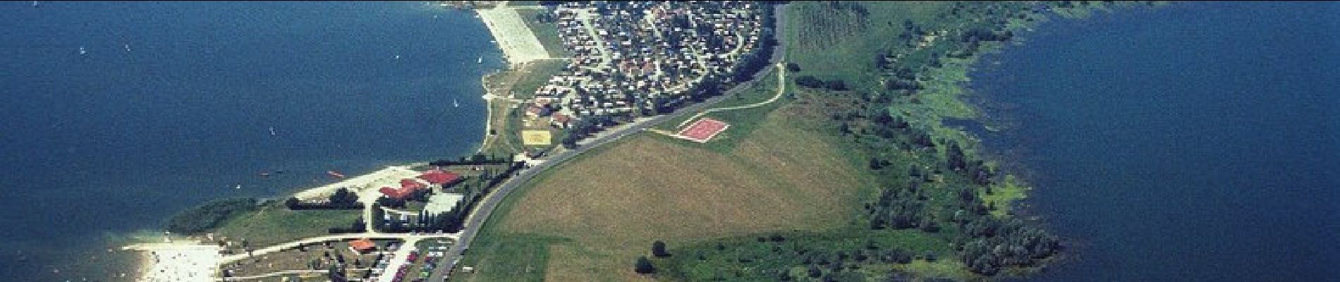
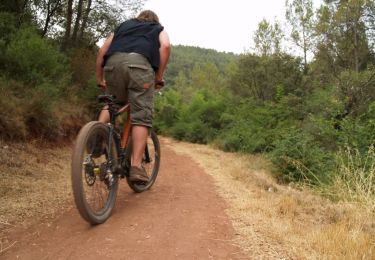
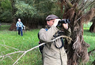
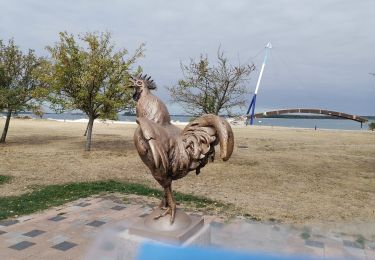
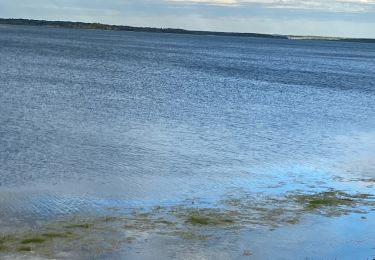
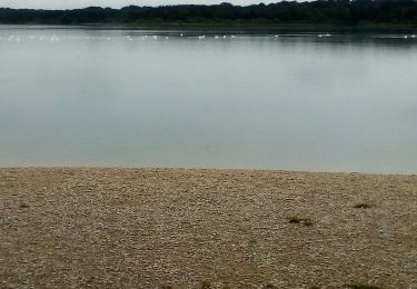
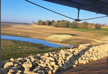
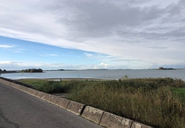
Espace VTT - FFC Lac du Der en Champagne Circuit officiel labellisé par la Fédération Française de Cyclisme. La balade à VTT au Pays du Lac du Der vous invite à un voyage insolite au bord de mer intérieure de 77 Km de rivages, posée dans un écrin de verdure. Prenez le temps de découvrir le charme des églises à pans de bois et d'observer la nature qui vous entoure, vous aurez alors l'occasion d'apercevoir chevreuils, faucons crécerelles, chats sauvages ou encore des milliers de grues cendrées. Cette balade vous emmène faire le tour d'un plan d'eau vaste de 230 hectares associant les trois composantes du lac de Der; la forêt, la terre et l'eau.
Localisation
Commentaires
Randonnées à proximité
![Randonnée V.T.T. Éclaron-Braucourt-Sainte-Livière - Espace VTT FFC Lac du Der en Champagne - Circuit n°08 - La Forêt du Der - Photo](https://media.geolcdn.com/t/375/260/ext.jpg?maxdim=2&url=https%3A%2F%2Fservices.sitytrail.com%2FGeolivesWS%2FDownloadMedia.ashx%3FTrailID%3D102269%26Media%3D2730_1.jpg)
![V.T.T. V.T.T.](https://static1.geolcdn.com/sitytour/trail-icons/202.png)
V.T.T.
![](/images/other/stat-length.png)
![](https://static1.geolcdn.com/siteimages/upload/files/16400158638029165_repeat_loop_refresh_sync_direction_icon.png)
![Randonnée V.T.T. Éclaron-Braucourt-Sainte-Livière - Tour du lac du Der - Photo](https://media.geolcdn.com/t/375/260/ext.jpg?maxdim=2&url=https%3A%2F%2Fstatic1.geolcdn.com%2Fsiteimages%2Fupload%2Ffiles%2F1524743154velo.jpg)
![V.T.T. V.T.T.](https://static1.geolcdn.com/sitytour/trail-icons/202.png)
V.T.T.
![](/images/other/stat-length.png)
![](https://static1.geolcdn.com/siteimages/upload/files/16400158638029165_repeat_loop_refresh_sync_direction_icon.png)
![Randonnée Marche Éclaron-Braucourt-Sainte-Livière - Tour cornet du Der - Photo](https://media.geolcdn.com/t/375/260/270e2be5-6240-41db-bc48-d6daf1cb00be.jpg&format=jpg&maxdim=2)
![Marche Marche](https://static1.geolcdn.com/sitytour/trail-icons/101.png)
Marche
![](/images/other/stat-length.png)
![](https://static1.geolcdn.com/siteimages/upload/files/16400158638029165_repeat_loop_refresh_sync_direction_icon.png)
![Randonnée Marche Giffaumont-Champaubert - LAC dur DER ... la forêt, la terre et l'eau. - Photo](https://media.geolcdn.com/t/375/260/16ddca7d-e5a5-4726-a093-703886190c99.jpg&format=jpg&maxdim=2)
![Marche Marche](https://static1.geolcdn.com/sitytour/trail-icons/101.png)
Marche
![](/images/other/stat-length.png)
![](https://static1.geolcdn.com/siteimages/upload/files/16400158638029165_repeat_loop_refresh_sync_direction_icon.png)
![Randonnée Vélo de route Éclaron-Braucourt-Sainte-Livière - 2020 08 25 lac de der - Photo](https://media.geolcdn.com/t/375/260/b17db6d0-c546-408a-8bf4-4dbb43655fff.jpg&format=jpg&maxdim=2)
![Vélo de route Vélo de route](https://static1.geolcdn.com/sitytour/trail-icons/201.png)
Vélo de route
![](/images/other/stat-length.png)
![](https://static1.geolcdn.com/siteimages/upload/files/16400158638029165_repeat_loop_refresh_sync_direction_icon.png)
![Randonnée Marche Giffaumont-Champaubert - ghifaumont - Photo](https://media.geolcdn.com/t/375/260/2d20b284-5919-43bc-beca-9c34719666bc.jpg&format=jpg&maxdim=2)
![Marche Marche](https://static1.geolcdn.com/sitytour/trail-icons/101.png)
Marche
![](/images/other/stat-length.png)
![](https://static1.geolcdn.com/siteimages/upload/files/16400158638029165_repeat_loop_refresh_sync_direction_icon.png)
![Randonnée Marche Giffaumont-Champaubert - Lac du Der 09-04-2014 - Photo](https://media.geolcdn.com/t/375/260/ext.jpg?maxdim=2&url=https%3A%2F%2Fstatic1.geolcdn.com%2Fsiteimages%2Fupload%2Ffiles%2F1553511878bg_sport_marche.png)
![Marche Marche](https://static1.geolcdn.com/sitytour/trail-icons/101.png)
Marche
![](/images/other/stat-length.png)
![](https://static1.geolcdn.com/siteimages/upload/files/16400158638029165_repeat_loop_refresh_sync_direction_icon.png)
![Randonnée Marche Giffaumont-Champaubert - lac du der - Photo](https://media.geolcdn.com/t/375/260/a2a32ad6-c50c-4066-848f-0c39f2554faa.jpg&format=jpg&maxdim=2)
![Marche Marche](https://static1.geolcdn.com/sitytour/trail-icons/101.png)
Marche
![](/images/other/stat-length.png)
![](https://static1.geolcdn.com/siteimages/upload/files/16400158638029165_repeat_loop_refresh_sync_direction_icon.png)
![Randonnée sport Giffaumont-Champaubert - Lac du Der Giffaumont. 17/10/2024 - Photo](https://media.geolcdn.com/t/375/260/1a9b1d86-ae35-4a73-a178-1b037d185480.jpg&format=jpg&maxdim=2)
sport
![](/images/other/stat-length.png)
![](https://static1.geolcdn.com/siteimages/upload/files/16400158638029165_repeat_loop_refresh_sync_direction_icon.png)