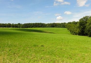
Randonnée Vélo Eppe-Sauvage - Valjoly via France - Photo
 jeanphi.hennebert
jeanphi.hennebert

Utilisateur

© OpenStreetMap contributors
Longueur
Longueur
78 km
Altitude max
Altitude max
256 m
Dénivelé positif
Dénivelé positif
919 m
Km-Effort
Km-Effort  
90 km
Altitude min
Altitude min
112 m
Dénivelé négatif
Dénivelé négatif
899 m
Boucle
Boucle
Oui
Date de création :
2019-01-15 14:41:36.676
Dernière modification :
2019-01-15 14:41:36.676

(0 Avis)

Vélo
Vélo
--
Difficulté : Moyen

Scannez ce code QR pour ouvrir la randonnée dans l'application SityTrail

Application GPS de randonnée GRATUITE

Logo SityTrail SityTrail

IGN / Instituts géographiques

Télécharger SityTrail sur l'App Store Télécharger SityTrail sur Google Play

Logo SityTrail SityTrail World

Le monde est à vous

Télécharger SityTrail sur l'App Store Télécharger SityTrail sur Google Play Télécharger SityTrail sur Huawei AppGallery

À propos

Randonnée Vélo de 78 km à découvrir à Hauts-de-France, Nord, Eppe-Sauvage. Cette randonnée est proposée par jeanphi.hennebert.

Profil altimétrique

Points d'intérêt

Point d'intérêt Sivry-Rance - 60 - Photo
jeanphi.hennebert
SIVRY-RANCE 
Point d'intérêt Beaumont - 56 - Photo
jeanphi.hennebert
BEAUMONT 
Point d'intérêt Beaumont - 53 - Photo
jeanphi.hennebert
BEAUMONT 
Point d'intérêt Beaumont - 51 - Photo
jeanphi.hennebert
BEAUMONT 
Point d'intérêt Beaumont - 31 - Photo
jeanphi.hennebert
BEAUMONT 
Point d'intérêt Thuin - 26 - Photo
jeanphi.hennebert
THUIN 
Point d'intérêt Solre-le-Château - Café-restaurant Chez Ninie - Photo
jeanphi.hennebert
SOLRE-LE-CHÂTEAU 
Point d'intérêt Hestrud - Café - Musée de la douane - Photo
jeanphi.hennebert
Point d'intérêt Cousolre - Café - Restaurant Au père Mathieu - Photo
jeanphi.hennebert
Point d'intérêt Sivry-Rance - Café - Le relais des gâtes - Photo
jeanphi.hennebert
Point d'intérêt Eppe-Sauvage - Café - Petite restauration - Photo
jeanphi.hennebert
Point d'intérêt Lobbes - Café boutique Le val Joly - Photo
jeanphi.hennebert
Point d'intérêt Merbes-le-Château - Cafe-Ecluse de La Buissiere - Photo
jeanphi.hennebert
MERBES-LE-CHÂTEAU 
Point d'intérêt Merbes-le-Château - Café - Restaurant Le Préambulles - Photo
jeanphi.hennebert
Point d'intérêt Thuin - TWI'LI snack et Petite gayole (resto) - Photo
jeanphi.hennebert

Localisation

Pays :
France
Région :
Hauts-de-France
Département/Province :
Nord
Commune :
Eppe-Sauvage
Localité :
Unknown
Départ:(Dec)
Départ:(UTM)
581136 ; 5552404 (31U) N.

Randonnées à proximité

Randonnée Marche Eppe-Sauvage - La Transylvestre - Photo
Marche
tracegps

Marche

Difficile
(1)
Eppe-Sauvage, Hauts-de-France, Nord, France
22 km | 27 km-effort
5h 30min
Oui
Randonnée Marche Trélon - entre 2 averses - Photo
Marche
brunomuffat

Marche

Facile
(1)
Trélon, Hauts-de-France, Nord, France
8,4 km | 10,1 km-effort
1h 45min
Oui
Randonnée Marche nordique Liessies - Liessies 7 km 10062024 - Photo
Marche nordique
alain.guillaume

Marche nordique

Très facile
(1)
Liessies, Hauts-de-France, Nord, France
7 km | 7,8 km-effort
Inconnu
Oui
Randonnée Marche Liessies - Liessies  - Photo
Marche
schuyteneer

Marche

Facile
Liessies, Hauts-de-France, Nord, France
67 km | 77 km-effort
3h 56min
Non
Randonnée V.T.C. Eppe-Sauvage - Eppe Sauvage - Boucle via Val Joly - Solre - Sivry - Sautin - Montbliard - Photo
V.T.C.
jeanphi.hennebert

V.T.C.

Facile
Eppe-Sauvage, Hauts-de-France, Nord, France
41 km | 48 km-effort
3h 0min
Oui
Randonnée Marche Willies - 20180525-Val_Joly-Tour_lac-18km - Photo
Marche
yamadix

Marche

Moyen
(4)
Willies, Hauts-de-France, Nord, France
18,2 km | 23 km-effort
5h 1min
Oui
Randonnée Marche Eppe-Sauvage - Randonnée ornithologique du Valjoly - Photo
Marche
tracegps

Marche

Moyen
Eppe-Sauvage, Hauts-de-France, Nord, France
4,1 km | 4,9 km-effort
3h 0min
Oui
Randonnée Marche Liessies - Week-end de randonnée autour du Val Joly - Liessies - Photo
Marche
tracegps

Marche

Difficile
Liessies, Hauts-de-France, Nord, France
44 km | 53 km-effort
11h 0min
Oui
Randonnée Marche Eppe-Sauvage - très agréable - Photo
Marche
brunomuffat

Marche

Très facile
Eppe-Sauvage, Hauts-de-France, Nord, France
9,4 km | 11,1 km-effort
1h 51min
Oui


Fermer
Mes abonnements