Randonnée Cheval Taxat-Senat - 2018 Allier 2 - Photo
 crumiere
crumiere

Utilisateur

© OpenStreetMap contributors
Longueur
Longueur
27 km
Altitude max
Altitude max
424 m
Dénivelé positif
Dénivelé positif
587 m
Km-Effort
Km-Effort  
35 km
Altitude min
Altitude min
285 m
Dénivelé négatif
Dénivelé négatif
574 m
Boucle
Boucle
Non
Date de création :
2019-01-15 14:13:19.264
Dernière modification :
2019-01-15 14:13:19.264

(0 Avis)

Cheval
Cheval
5h46
Difficulté : Moyen

Scannez ce code QR pour ouvrir la randonnée dans l'application SityTrail

Application GPS de randonnée GRATUITE

Logo SityTrail SityTrail

IGN / Instituts géographiques

Télécharger SityTrail sur l'App Store Télécharger SityTrail sur Google Play

Logo SityTrail SityTrail World

Le monde est à vous

Télécharger SityTrail sur l'App Store Télécharger SityTrail sur Google Play Télécharger SityTrail sur Huawei AppGallery

À propos

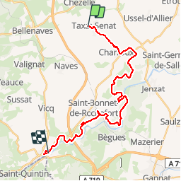
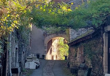
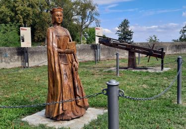
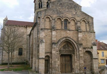
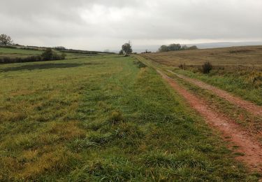
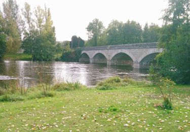
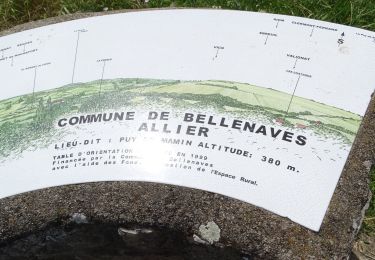
Randonnée Cheval de 27 km à découvrir à Auvergne-Rhône-Alpes, Allier, Taxat-Senat. Cette randonnée est proposée par crumiere.

Profil altimétrique

Localisation

Pays :
France
Région :
Auvergne-Rhône-Alpes
Département/Province :
Allier
Commune :
Taxat-Senat
Localité :
Unknown
Départ:(Dec)
Départ:(UTM)
510218 ; 5116470 (31T) N.

Randonnées à proximité

Randonnée Marche Deneuille-lès-Chantelle - Gorges de la Bouble - Abbaye de Chantelle - Photo
Marche
rigol05

Marche

Moyen
Deneuille-lès-Chantelle, Auvergne-Rhône-Alpes, Allier, France
7 km | 8,8 km-effort
2h 15min
Oui
Randonnée Marche Bellenaves - Bellenaves. Notre Dame de la Défense.  - Photo
Marche
Gegetop

Marche

Moyen
Bellenaves, Auvergne-Rhône-Alpes, Allier, France
16,8 km | 22 km-effort
4h 30min
Oui
Randonnée Marche Charroux - Moulin de Parrot - Photo
Marche
Vincent Bicard

Marche

Moyen
Charroux, Auvergne-Rhône-Alpes, Allier, France
14 km | 17,7 km-effort
3h 22min
Oui
Randonnée Marche Charroux - Le Moulin Parraud  - Photo
Marche
Gegetop

Marche

Facile
Charroux, Auvergne-Rhône-Alpes, Allier, France
13 km | 16,5 km-effort
3h 30min
Oui
Randonnée A pied Bellenaves - 2020-07-14 Bellenaves ( Fôret des collettes ) - Photo
A pied
guy63

A pied

Facile
Bellenaves, Auvergne-Rhône-Alpes, Allier, France
8,7 km | 11,1 km-effort
3h 30min
Oui
Randonnée Marche Charroux - Randonnée à Charroux, Vichy, 2023 - Photo
Marche
ezola

Marche

Difficile
Charroux, Auvergne-Rhône-Alpes, Allier, France
13,2 km | 16,7 km-effort
3h 22min
Non
Randonnée Marche Chantelle - Chantelle - Photo
Marche
jipelaire

Marche

Très facile
Chantelle, Auvergne-Rhône-Alpes, Allier, France
11,1 km | 13,2 km-effort
2h 17min
Oui
Randonnée Marche Charroux - GR de Pays Val de Sioule - Photo
Marche
loursblanc

Marche

Facile
Charroux, Auvergne-Rhône-Alpes, Allier, France
77 km | 100 km-effort
20h 0min
Oui
Randonnée Marche Charroux - GR de Pays Val de Sioule - Photo
Marche
loursblanc

Marche

Facile
Charroux, Auvergne-Rhône-Alpes, Allier, France
77 km | 100 km-effort
20h 0min
Oui


Fermer
Mes abonnements