

MÜLLERTHAL (Larochette -superbe parcours ds les formations rocheuses)

GerardBouche
Utilisateur

Longueur
12,5 km

Altitude max
424 m

Dénivelé positif
300 m

Km-Effort
16,5 km

Altitude min
273 m

Dénivelé négatif
299 m
Boucle
Oui
Date de création :
2018-08-19 07:26:59.721
Dernière modification :
2018-08-19 07:26:59.721
3h31
Difficulté : Facile

Application GPS de randonnée GRATUITE
À propos
Randonnée Marche de 12,5 km à découvrir à Inconnu, Canton Mersch, Larochette. Cette randonnée est proposée par GerardBouche.
Description
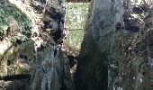
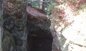
Au départ de l'église, un magnifique parcours (3 étoiles) dans ces formations rocheuses étranges et bien typiques du Müllerthal.
Localisation
Pays :
Luxembourg
Région :
Inconnu
Département/Province :
Canton Mersch
Commune :
Larochette
Localité :
Unknown
Départ:(Dec)
Départ:(UTM)
299774 ; 5518257 (32U) N.
Commentaires
Randonnées à proximité
Haller - Sentier_local_-_W4


Marche
Moyen
(1)
Waldbillig,
Inconnu,
Canton Echternach,
Luxembourg

6,2 km | 7,8 km-effort
1h 45min
Oui
Itinérant Luxembourg Jour 3: Graulinster- Echternach


Marche
Très difficile
Junglinster,
Inconnu,
Canton Grevenmacher,
Luxembourg

30 km | 37 km-effort
6h 51min
Non
Medernach M4 - Müllerthal


Marche
Moyen
(1)
Vallée de l'Ernz,
Inconnu,
Canton Diekirch,
Luxembourg

13,7 km | 19,5 km-effort
4h 25min
Oui
Rundwanderweg L4


A pied
Facile
Larochette,
Inconnu,
Canton Mersch,
Luxembourg

10,9 km | 14,7 km-effort
3h 19min
Oui
W1 Hiking Tour


A pied
Facile
(1)
Waldbillig,
Inconnu,
Canton Echternach,
Luxembourg

6,8 km | 8,4 km-effort
1h 54min
Oui
W5 Hiking Tour


A pied
Facile
(1)
Waldbillig,
Inconnu,
Canton Echternach,
Luxembourg

10,2 km | 13,7 km-effort
3h 6min
Oui

Rundwanderweg L2


A pied
Facile
(1)
Larochette,
Inconnu,
Canton Mersch,
Luxembourg

8,1 km | 10,3 km-effort
2h 21min
Non
Mullerthal Larochette L4 Hexenlee-Kauzelee-Drachenlee-Eylelee-Rammelee (PVDB)


Marche
Difficile
Larochette,
Inconnu,
Canton Mersch,
Luxembourg

12,6 km | 16,6 km-effort
3h 46min
Oui

M5 - Medernach


A pied
Facile
Vallée de l'Ernz,
Inconnu,
Canton Diekirch,
Luxembourg

8 km | 10,7 km-effort
2h 25min
Oui


 SityTrail




Très jolie balade, en majorité dans la forêt, suivre L4.