![](/images/other/stat-length.png)
![Randonnée Marche Montaigu-Vendée - La Maison de la Rivière - Photo](https://media.geolcdn.com/t/1900/400/ext.pjpeg?maxdim=2&url=https%3A%2F%2Fservices.sitytrail.com%2FGeolivesWS%2FDownloadMedia.ashx%3FTrailID%3D101640%26Media%3D1835_3.jpg)
La Maison de la Rivière
tracegps
Utilisateur
![Longueur](/images/other/stat-length.png)
Longueur
5,9 km
![Altitude max](https://static1.geolcdn.com/siteimages/upload/files/1508320355ic_sort_altitude_max_24dp.png)
Altitude max
61 m
![Dénivelé positif](https://static1.geolcdn.com/siteimages/upload/files/1508320355ic_sort_den_pos_24dp.png)
Dénivelé positif
90 m
![Km-Effort](/images/other/stat-length.png)
Km-Effort
7,1 km
![Altitude min](https://static1.geolcdn.com/siteimages/upload/files/1508320355ic_sort_altitude_min_24dp.png)
Altitude min
31 m
![Dénivelé négatif](https://static1.geolcdn.com/siteimages/upload/files/1508320355ic_sort_den_neg_24dp.png)
Dénivelé négatif
105 m
![Boucle](https://static1.geolcdn.com/siteimages/upload/files/16400158638029165_repeat_loop_refresh_sync_direction_icon.png)
Boucle
Oui
Date de création :
2014-12-10 00:00:00.0
Dernière modification :
2014-12-10 00:00:00.0
![Marche](https://static1.geolcdn.com/sitytour/trail-icons/101.png)
1h30
Difficulté : Moyen
![Scannez ce code QR pour ouvrir la randonnée dans l'application SityTrail](https://capi.geolives.com/qq0zvz2zws4bq2lad0pu/sitytour/trails/101640/qr.png?size=200)
Application GPS de randonnée GRATUITE
À propos
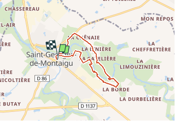
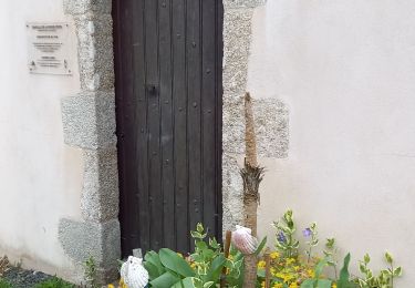
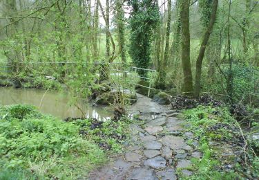
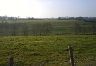
Randonnée Marche de 5,9 km à découvrir à Pays de la Loire, Vendée, Montaigu-Vendée. Cette randonnée est proposée par tracegps.
Description
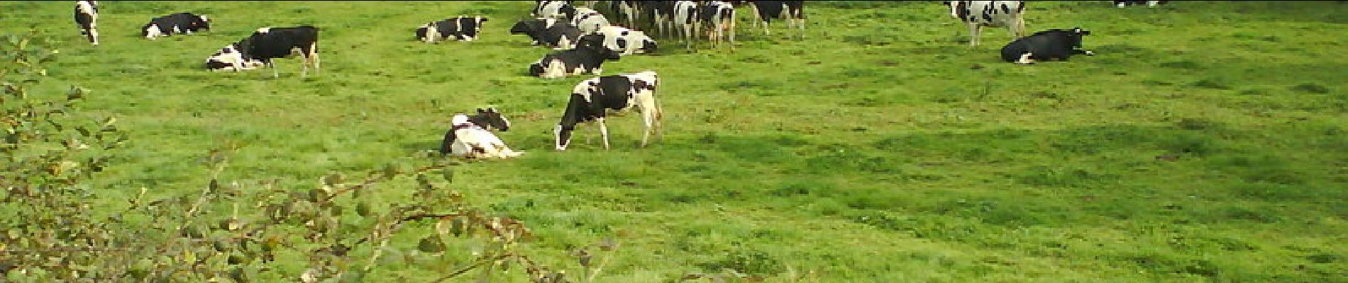
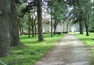
Parcours agréable, bord de l'eau, ombragé. Possibilité d'écourter le trajet (balisé). Air de pique nique possible en début ou fin de balade.
Localisation
Pays :
France
Région :
Pays de la Loire
Département/Province :
Vendée
Commune :
Montaigu-Vendée
Localité :
Saint-Georges-de-Montaigu
Départ:(Dec)
Départ:(UTM)
629808 ; 5200747 (30T) N.
Commentaires
Randonnées à proximité
![Randonnée V.T.T. Montaigu-Vendée - Le Bois Noir - Balade vers Montaigu - Photo](https://media.geolcdn.com/t/375/260/ext.jpg?maxdim=2&url=https%3A%2F%2Fservices.sitytrail.com%2FGeolivesWS%2FDownloadMedia.ashx%3FTrailID%3D102232%26Media%3D2690_4.jpg)
![V.T.T. V.T.T.](https://static1.geolcdn.com/sitytour/trail-icons/202.png)
Le Bois Noir - Balade vers Montaigu
V.T.T.
Moyen
Montaigu-Vendée,
Pays de la Loire,
Vendée,
France
![](/images/other/stat-length.png)
26 km | 28 km-effort
2h 30min
![](https://static1.geolcdn.com/siteimages/upload/files/16400158638029165_repeat_loop_refresh_sync_direction_icon.png)
Oui
![Randonnée V.T.T. Montaigu-Vendée - Les Pinserons - Photo](https://media.geolcdn.com/t/375/260/ext.jpg?maxdim=2&url=https%3A%2F%2Fservices.sitytrail.com%2FGeolivesWS%2FDownloadMedia.ashx%3FTrailID%3D102071%26Media%3D2430_3.jpg)
![V.T.T. V.T.T.](https://static1.geolcdn.com/sitytour/trail-icons/202.png)
Les Pinserons
V.T.T.
Moyen
Montaigu-Vendée,
Pays de la Loire,
Vendée,
France
![](/images/other/stat-length.png)
17,4 km | 19,1 km-effort
1h 30min
![](https://static1.geolcdn.com/siteimages/upload/files/16400158638029165_repeat_loop_refresh_sync_direction_icon.png)
Oui
![Randonnée Marche Montaigu-Vendée - Montaigu - Pont Lege - Photo](https://media.geolcdn.com/t/375/260/f11f8ab2-3856-4344-93da-6d5b8015299c.jpg&format=jpg&maxdim=2)
![Marche Marche](https://static1.geolcdn.com/sitytour/trail-icons/101.png)
Montaigu - Pont Lege
Marche
Difficile
Montaigu-Vendée,
Pays de la Loire,
Vendée,
France
![](/images/other/stat-length.png)
15,4 km | 18 km-effort
3h 54min
![](https://static1.geolcdn.com/siteimages/upload/files/16400158638029165_repeat_loop_refresh_sync_direction_icon.png)
Non
![Randonnée V.T.T. Montaigu-Vendée - Boufféré - La Caffinière - Photo](https://media.geolcdn.com/t/375/260/ext.jpg?maxdim=2&url=https%3A%2F%2Fservices.sitytrail.com%2FGeolivesWS%2FDownloadMedia.ashx%3FTrailID%3D102247%26Media%3D2706_2.jpg)
![V.T.T. V.T.T.](https://static1.geolcdn.com/sitytour/trail-icons/202.png)
Boufféré - La Caffinière
V.T.T.
Moyen
Montaigu-Vendée,
Pays de la Loire,
Vendée,
France
![](/images/other/stat-length.png)
28 km | 32 km-effort
2h 30min
![](https://static1.geolcdn.com/siteimages/upload/files/16400158638029165_repeat_loop_refresh_sync_direction_icon.png)
Oui
![Randonnée V.T.T. Montaigu-Vendée - La Cheffretière - Photo](https://media.geolcdn.com/t/375/260/ext.jpg?maxdim=2&url=https%3A%2F%2Fservices.sitytrail.com%2FGeolivesWS%2FDownloadMedia.ashx%3FTrailID%3D102206%26Media%3D2632_2.jpg)
![V.T.T. V.T.T.](https://static1.geolcdn.com/sitytour/trail-icons/202.png)
La Cheffretière
V.T.T.
Moyen
Montaigu-Vendée,
Pays de la Loire,
Vendée,
France
![](/images/other/stat-length.png)
18,5 km | 21 km-effort
1h 30min
![](https://static1.geolcdn.com/siteimages/upload/files/16400158638029165_repeat_loop_refresh_sync_direction_icon.png)
Oui
![Randonnée sport Montaigu-Vendée - Jbvv - Photo](https://media.geolcdn.com/t/375/260/ext.jpg?maxdim=2&url=https%3A%2F%2Fsecurestorage.geolives.com%2Fsitytour%2Ftrail-bg%2Fdefault.jpg)
Jbvv
sport
Très facile
Montaigu-Vendée,
Pays de la Loire,
Vendée,
France
![](/images/other/stat-length.png)
22 km | 24 km-effort
Inconnu
![](https://static1.geolcdn.com/siteimages/upload/files/16400158638029165_repeat_loop_refresh_sync_direction_icon.png)
Non
![Randonnée V.T.C. Montaigu-Vendée - 2023-03-05 - Photo](https://media.geolcdn.com/t/375/260/ext.jpg?maxdim=2&url=https%3A%2F%2Fstatic1.geolcdn.com%2Fsiteimages%2Fupload%2Ffiles%2F1524743154velo.jpg)
![V.T.C. V.T.C.](https://static1.geolcdn.com/sitytour/trail-icons/203.png)
2023-03-05
V.T.C.
Moyen
Montaigu-Vendée,
Pays de la Loire,
Vendée,
France
![](/images/other/stat-length.png)
22 km | 24 km-effort
1h 10min
![](https://static1.geolcdn.com/siteimages/upload/files/16400158638029165_repeat_loop_refresh_sync_direction_icon.png)
Oui
![Randonnée V.T.T. Montaigu-Vendée - Saint-Georges-de-Montaigu 2022 - Photo](https://media.geolcdn.com/t/375/260/ext.jpg?maxdim=2&url=https%3A%2F%2Fstatic1.geolcdn.com%2Fsiteimages%2Fupload%2Ffiles%2F1524743154velo.jpg)
![V.T.T. V.T.T.](https://static1.geolcdn.com/sitytour/trail-icons/202.png)
Saint-Georges-de-Montaigu 2022
V.T.T.
Difficile
Montaigu-Vendée,
Pays de la Loire,
Vendée,
France
![](/images/other/stat-length.png)
32 km | 37 km-effort
3h 5min
![](https://static1.geolcdn.com/siteimages/upload/files/16400158638029165_repeat_loop_refresh_sync_direction_icon.png)
Oui
![Randonnée Marche Montaigu-Vendée - st georges de montaigu st fulgent - Photo](https://media.geolcdn.com/t/375/260/ext.jpg?maxdim=2&url=https%3A%2F%2Fstatic1.geolcdn.com%2Fsiteimages%2Fupload%2Ffiles%2F1553511878bg_sport_marche.png)
![Marche Marche](https://static1.geolcdn.com/sitytour/trail-icons/101.png)
st georges de montaigu st fulgent
Marche
Moyen
Montaigu-Vendée,
Pays de la Loire,
Vendée,
France
![](/images/other/stat-length.png)
26 km | 30 km-effort
6h 21min
![](https://static1.geolcdn.com/siteimages/upload/files/16400158638029165_repeat_loop_refresh_sync_direction_icon.png)
Non