Randonnée Cheval Villandry - Villandry - Azay le Rideau - Photo
 tracegps
tracegps

Utilisateur

© OpenStreetMap contributors
Longueur
Longueur
25 km
Altitude max
Altitude max
99 m
Dénivelé positif
Dénivelé positif
330 m
Km-Effort
Km-Effort  
29 km
Altitude min
Altitude min
42 m
Dénivelé négatif
Dénivelé négatif
331 m
Boucle
Boucle
Oui
Date de création :
2014-12-10 00:00:00.0
Dernière modification :
2014-12-10 00:00:00.0

(0 Avis)

Cheval
Cheval
6h00
Difficulté : Moyen

Scannez ce code QR pour ouvrir la randonnée dans l'application SityTrail

Application GPS de randonnée GRATUITE

Logo SityTrail SityTrail

IGN / Instituts géographiques

Télécharger SityTrail sur l'App Store Télécharger SityTrail sur Google Play

Logo SityTrail SityTrail World

Le monde est à vous

Télécharger SityTrail sur l'App Store Télécharger SityTrail sur Google Play Télécharger SityTrail sur Huawei AppGallery

À propos

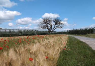
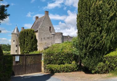
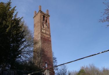
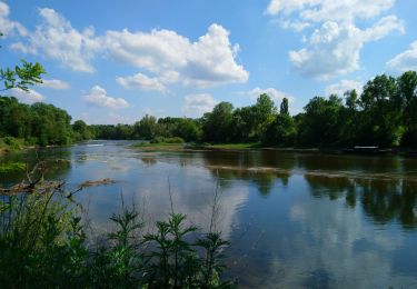
Randonnée Cheval de 25 km à découvrir à Centre-Val de Loire, Indre-et-Loire, Villandry. Cette randonnée est proposée par tracegps.

Description

Boucle à faire à cheval entre Villandry et Azay le Rideau. Départ / arrivée depuis le Centre Equestre l'Alezane. Plus d'informations sur le site Stars-Trec

Profil altimétrique

Localisation

Pays :
France
Région :
Centre-Val de Loire
Département/Province :
Indre-et-Loire
Commune :
Villandry
Localité :
Unknown
Départ:(Dec)
Départ:(UTM)
310133 ; 5244811 (31T) N.

Randonnées à proximité

Randonnée Marche Savonnières - Saveniére - Photo
Marche
jouhan

Marche

Moyen
Savonnières, Centre-Val de Loire, Indre-et-Loire, France
5,8 km | 6,9 km-effort
1h 38min
Non
Randonnée A pied Villandry - Villandry - Photo
A pied
fustier

A pied

Moyen
(1)
Villandry, Centre-Val de Loire, Indre-et-Loire, France
22 km | 24 km-effort
Inconnu
Oui
Randonnée Marche Villandry - villandry - Photo
Marche
dporcher

Marche

Très facile
Villandry, Centre-Val de Loire, Indre-et-Loire, France
11,3 km | 12,7 km-effort
2h 18min
Oui
Randonnée Marche Villandry - A L'Orée Du Chateau De Villandry - Photo
Marche
Patakk

Marche

Facile
Villandry, Centre-Val de Loire, Indre-et-Loire, France
11,6 km | 13 km-effort
2h 15min
Oui
Randonnée Cheval Villandry - Autour de Vallères - Photo
Cheval
tracegps

Cheval

Moyen
Villandry, Centre-Val de Loire, Indre-et-Loire, France
9,3 km | 10,8 km-effort
2h 30min
Oui
Randonnée Cheval Villandry - Château de Villandry - Photo
Cheval
tracegps

Cheval

Moyen
Villandry, Centre-Val de Loire, Indre-et-Loire, France
12,8 km | 14,6 km-effort
3h 0min
Oui
Randonnée Cheval Villandry - Boucle à Vallères - Photo
Cheval
tracegps

Cheval

Moyen
Villandry, Centre-Val de Loire, Indre-et-Loire, France
6,5 km | 7,6 km-effort
1h 30min
Oui
Randonnée Cheval Villandry - Les bords de Loire - Villandry - Photo
Cheval
tracegps

Cheval

Moyen
Villandry, Centre-Val de Loire, Indre-et-Loire, France
12,3 km | 14 km-effort
3h 0min
Oui
Randonnée V.T.T. Cinq-Mars-la-Pile - Cinq Mars la Pile, Maziéres de Touraine, Langeais - Photo
V.T.T.
tracegps

V.T.T.

Difficile
Cinq-Mars-la-Pile, Centre-Val de Loire, Indre-et-Loire, France
26 km | 31 km-effort
1h 45min
Oui


Fermer
Mes abonnements