![](/images/other/stat-length.png)
![Randonnée V.T.T. Chazelles - Pranzac - bois long de la Braconne - Photo](https://media.geolcdn.com/t/1900/400/ext.pjpeg?maxdim=2&url=https%3A%2F%2Fstatic1.geolcdn.com%2Fsiteimages%2Fupload%2Ffiles%2F1524743154velo.jpg)
Pranzac - bois long de la Braconne
tracegps
Utilisateur
![Longueur](/images/other/stat-length.png)
Longueur
27 km
![Altitude max](https://static1.geolcdn.com/siteimages/upload/files/1508320355ic_sort_altitude_max_24dp.png)
Altitude max
135 m
![Dénivelé positif](https://static1.geolcdn.com/siteimages/upload/files/1508320355ic_sort_den_pos_24dp.png)
Dénivelé positif
281 m
![Km-Effort](/images/other/stat-length.png)
Km-Effort
31 km
![Altitude min](https://static1.geolcdn.com/siteimages/upload/files/1508320355ic_sort_altitude_min_24dp.png)
Altitude min
81 m
![Dénivelé négatif](https://static1.geolcdn.com/siteimages/upload/files/1508320355ic_sort_den_neg_24dp.png)
Dénivelé négatif
281 m
![Boucle](https://static1.geolcdn.com/siteimages/upload/files/16400158638029165_repeat_loop_refresh_sync_direction_icon.png)
Boucle
Oui
Date de création :
2014-12-10 00:00:00.0
Dernière modification :
2014-12-10 00:00:00.0
![V.T.T.](https://static1.geolcdn.com/sitytour/trail-icons/202.png)
3h00
Difficulté : Moyen
![Scannez ce code QR pour ouvrir la randonnée dans l'application SityTrail](https://capi.geolives.com/qq0zvz2zws4bq2lad0pu/sitytour/trails/101339/qr.png?size=200)
Application GPS de randonnée GRATUITE
À propos
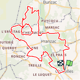
Randonnée V.T.T. de 27 km à découvrir à Nouvelle-Aquitaine, Charente, Chazelles. Cette randonnée est proposée par tracegps.
Description
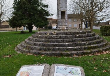
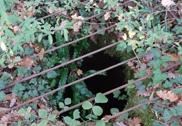
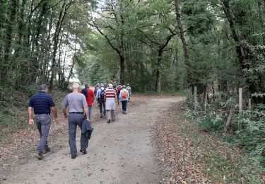
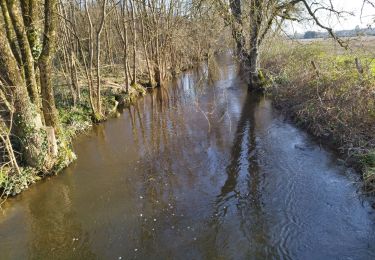
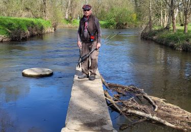
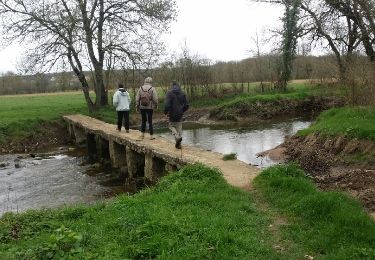
J'apprécie Le passage en forêt de la Braconne (bois long) Possibilité de visiter la Fosse Redon et la fosse de l'Ermitage ne pas oublier la grotte de "La Femme Morte". Le Gué de Gros terme est pittoresque,
Localisation
Pays :
France
Région :
Nouvelle-Aquitaine
Département/Province :
Charente
Commune :
Chazelles
Localité :
Unknown
Départ:(Dec)
Départ:(UTM)
294903 ; 5058350 (31T) N.
Commentaires
Randonnées à proximité
![Randonnée Marche Pranzac - Pranzac et ses petits villages. - Photo](https://media.geolcdn.com/t/375/260/ext.jpg?maxdim=2&url=https%3A%2F%2Fmedia.geolcdn.com%2Ff%2F3a77c9e3-0523-4318-8510-a2c1a4b859f3.jpg)
![Marche Marche](https://static1.geolcdn.com/sitytour/trail-icons/101.png)
Pranzac et ses petits villages.
Marche
Moyen
Pranzac,
Nouvelle-Aquitaine,
Charente,
France
![](/images/other/stat-length.png)
7,8 km | 9 km-effort
2h 26min
![](https://static1.geolcdn.com/siteimages/upload/files/16400158638029165_repeat_loop_refresh_sync_direction_icon.png)
Oui
![Randonnée Marche Chazelles - Les Grottes du Quéroy -gros terme et Combe - Photo](https://media.geolcdn.com/t/375/260/ext.jpg?maxdim=2&url=https%3A%2F%2Fmedia.geolcdn.com%2Ff%2Fa902d7b3-47f7-4cd6-b06e-56e13f719b7b.jpg)
![Marche Marche](https://static1.geolcdn.com/sitytour/trail-icons/101.png)
Les Grottes du Quéroy -gros terme et Combe
Marche
Moyen
(1)
Chazelles,
Nouvelle-Aquitaine,
Charente,
France
![](/images/other/stat-length.png)
8,2 km | 9,6 km-effort
2h 24min
![](https://static1.geolcdn.com/siteimages/upload/files/16400158638029165_repeat_loop_refresh_sync_direction_icon.png)
Oui
![Randonnée Marche Bunzac - BUNZAC 16110 ..départ de Puy cocu > combebrune > les Denis > le château des deffends - Photo](https://media.geolcdn.com/t/375/260/ext.jpg?maxdim=2&url=https%3A%2F%2Fmedia.geolcdn.com%2Ff%2F7d0ff8b1-963c-44bc-be90-151320ae11e3.jpg)
![Marche Marche](https://static1.geolcdn.com/sitytour/trail-icons/101.png)
BUNZAC 16110 ..départ de Puy cocu > combebrune > les Denis > le château des d...
Marche
Facile
Bunzac,
Nouvelle-Aquitaine,
Charente,
France
![](/images/other/stat-length.png)
9,3 km | 10,8 km-effort
3h 9min
![](https://static1.geolcdn.com/siteimages/upload/files/16400158638029165_repeat_loop_refresh_sync_direction_icon.png)
Oui
![Randonnée Marche Moulins-sur-Tardoire - La rando de Vilhoneur côté Nord - Photo](https://media.geolcdn.com/t/375/260/ext.jpg?maxdim=2&url=https%3A%2F%2Fmedia.geolcdn.com%2Ff%2Fc9220340-558b-478c-9a23-ab29d5a7cbe3.jpg)
![Marche Marche](https://static1.geolcdn.com/sitytour/trail-icons/101.png)
La rando de Vilhoneur côté Nord
Marche
Facile
Moulins-sur-Tardoire,
Nouvelle-Aquitaine,
Charente,
France
![](/images/other/stat-length.png)
7,1 km | 8,1 km-effort
2h 12min
![](https://static1.geolcdn.com/siteimages/upload/files/16400158638029165_repeat_loop_refresh_sync_direction_icon.png)
Oui
![Randonnée Marche Chazelles - La randonnée autour de Chazelles - Photo](https://media.geolcdn.com/t/375/260/ext.jpg?maxdim=2&url=https%3A%2F%2Fmedia.geolcdn.com%2Ff%2F6a56e3fd-00be-447e-b74c-a7c93873ee51.jpg)
![Marche Marche](https://static1.geolcdn.com/sitytour/trail-icons/101.png)
La randonnée autour de Chazelles
Marche
Facile
Chazelles,
Nouvelle-Aquitaine,
Charente,
France
![](/images/other/stat-length.png)
9,6 km | 11,1 km-effort
2h 32min
![](https://static1.geolcdn.com/siteimages/upload/files/16400158638029165_repeat_loop_refresh_sync_direction_icon.png)
Oui
![Randonnée V.T.T. Chazelles - Chazelles - Brégout - Photo](https://media.geolcdn.com/t/375/260/ext.jpg?maxdim=2&url=https%3A%2F%2Fstatic1.geolcdn.com%2Fsiteimages%2Fupload%2Ffiles%2F1524743154velo.jpg)
![V.T.T. V.T.T.](https://static1.geolcdn.com/sitytour/trail-icons/202.png)
Chazelles - Brégout
V.T.T.
Difficile
(1)
Chazelles,
Nouvelle-Aquitaine,
Charente,
France
![](/images/other/stat-length.png)
46 km | 57 km-effort
4h 0min
![](https://static1.geolcdn.com/siteimages/upload/files/16400158638029165_repeat_loop_refresh_sync_direction_icon.png)
Non
![Randonnée Marche Bunzac - Départ de puy cocu et les petits villages autour de Pranzac 16 110 - Photo](https://media.geolcdn.com/t/375/260/ext.jpg?maxdim=2&url=https%3A%2F%2Fmedia.geolcdn.com%2Ff%2F3a6a783b-5767-4811-845d-75faa28604c8.jpg)
![Marche Marche](https://static1.geolcdn.com/sitytour/trail-icons/101.png)
Départ de puy cocu et les petits villages autour de Pranzac 16 110
Marche
Moyen
Bunzac,
Nouvelle-Aquitaine,
Charente,
France
![](/images/other/stat-length.png)
8,9 km | 10,2 km-effort
2h 18min
![](https://static1.geolcdn.com/siteimages/upload/files/16400158638029165_repeat_loop_refresh_sync_direction_icon.png)
Oui
![Randonnée Marche Moulins-sur-Tardoire - Vilhonneur0504 - Photo](https://media.geolcdn.com/t/375/260/ext.jpg?maxdim=2&url=https%3A%2F%2Fmedia.geolcdn.com%2Ff%2F5373ed4e-d465-4437-8c4c-df16ce9bb694.jpg)
![Marche Marche](https://static1.geolcdn.com/sitytour/trail-icons/101.png)
Vilhonneur0504
Marche
Moyen
Moulins-sur-Tardoire,
Nouvelle-Aquitaine,
Charente,
France
![](/images/other/stat-length.png)
6 km | 6,8 km-effort
2h 31min
![](https://static1.geolcdn.com/siteimages/upload/files/16400158638029165_repeat_loop_refresh_sync_direction_icon.png)
Oui
![Randonnée Marche Chazelles - Les grottes du Queroy en passant par le pont Romain de Gros Terme - Photo](https://media.geolcdn.com/t/375/260/ext.jpg?maxdim=2&url=https%3A%2F%2Fservices.sitytrail.com%2FGeolivesWS%2FDownloadMedia.ashx%3FTrailID%3D716486%26Media%3Dfix__20170319104404.jpg)
![Marche Marche](https://static1.geolcdn.com/sitytour/trail-icons/101.png)
Les grottes du Queroy en passant par le pont Romain de Gros Terme
Marche
Facile
Chazelles,
Nouvelle-Aquitaine,
Charente,
France
![](/images/other/stat-length.png)
9,8 km | 11,2 km-effort
2h 47min
![](https://static1.geolcdn.com/siteimages/upload/files/16400158638029165_repeat_loop_refresh_sync_direction_icon.png)
Oui