![](/images/other/stat-length.png)
![Randonnée Marche Prads-Haute-Bléone - Tête de l'Estrop par la vallée de la Bléone - Photo](https://media.geolcdn.com/t/1900/400/ext.pjpeg?maxdim=2&url=https%3A%2F%2Fservices.sitytrail.com%2FGeolivesWS%2FDownloadMedia.ashx%3FTrailID%3D101205%26Media%3D692_1.jpg)
Tête de l'Estrop par la vallée de la Bléone
tracegps
Utilisateur
![Longueur](/images/other/stat-length.png)
![Altitude max](https://static1.geolcdn.com/siteimages/upload/files/1508320355ic_sort_altitude_max_24dp.png)
![Dénivelé positif](https://static1.geolcdn.com/siteimages/upload/files/1508320355ic_sort_den_pos_24dp.png)
![Km-Effort](/images/other/stat-length.png)
![Altitude min](https://static1.geolcdn.com/siteimages/upload/files/1508320355ic_sort_altitude_min_24dp.png)
![Dénivelé négatif](https://static1.geolcdn.com/siteimages/upload/files/1508320355ic_sort_den_neg_24dp.png)
![Boucle](https://static1.geolcdn.com/siteimages/upload/files/16400158638029165_repeat_loop_refresh_sync_direction_icon.png)
![Marche](https://static1.geolcdn.com/sitytour/trail-icons/101.png)
10h00
Difficulté : Très difficile
![Scannez ce code QR pour ouvrir la randonnée dans l'application SityTrail](https://capi.geolives.com/qq0zvz2zws4bq2lad0pu/sitytour/trails/101205/qr.png?size=200)
Application GPS de randonnée GRATUITE
À propos
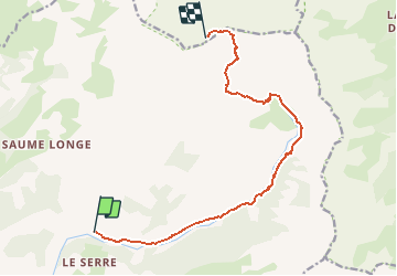
Randonnée Marche de 12,2 km à découvrir à Provence-Alpes-Côte d'Azur, Alpes-de-Haute-Provence, Prads-Haute-Bléone. Cette randonnée est proposée par tracegps.
Description
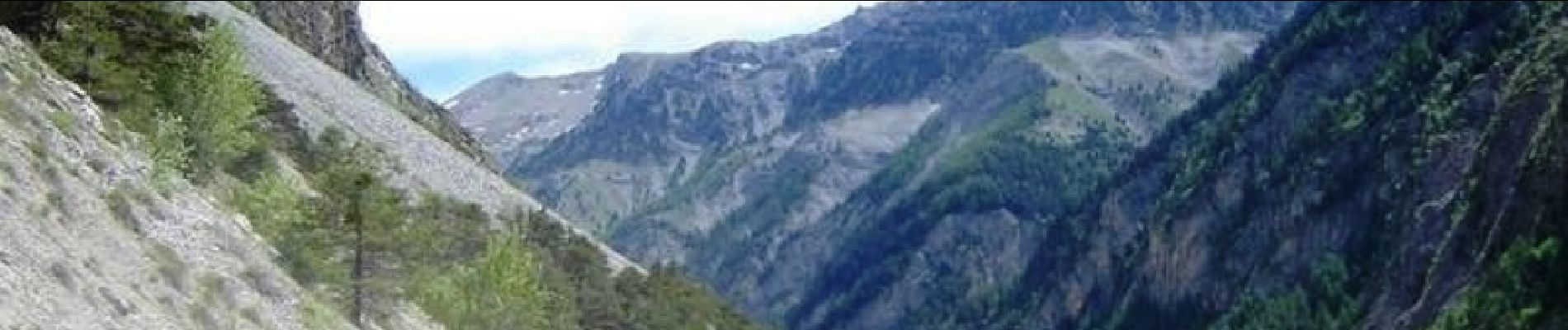
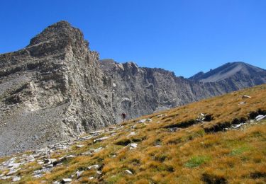
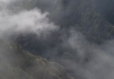
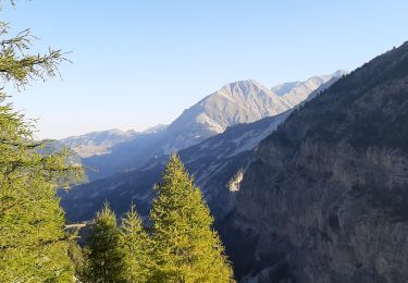
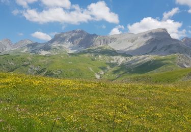
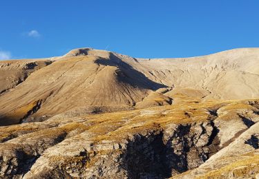
Une magnifique rando qui permet de découvrir le glacier le plus méridional des Alpes. La dernière partie est vraiment très belle, la cascade (qui s'appelle "cascade de la piche") peut se réveler impressionnante car on peut vraiment aller a coté du vide ! La dernière partie est assez "lunaire", le panorama somptueux si il ne fait pas encore nuit (et que le vent a soufflé un peu). Et pour couronner le tout, les gardiens du refuge sont des gens très sympa et accueillant ! Tout est dit, expliqué sur Montagne-Cool On en parle ICI
Localisation
Commentaires
Randonnées à proximité
![Randonnée Marche Le Vernet - VERNET . col de Mariaud. Les 3 cabanes o - Photo](https://media.geolcdn.com/t/375/260/ext.jpg?maxdim=2&url=https%3A%2F%2Fstatic1.geolcdn.com%2Fsiteimages%2Fupload%2Ffiles%2F1553511878bg_sport_marche.png)
![Marche Marche](https://static1.geolcdn.com/sitytour/trail-icons/101.png)
Marche
![](/images/other/stat-length.png)
![](https://static1.geolcdn.com/siteimages/upload/files/16400158638029165_repeat_loop_refresh_sync_direction_icon.png)
![Randonnée Marche Prads-Haute-Bléone - Estrop par Pic des Têtes - Photo](https://media.geolcdn.com/t/375/260/ext.jpg?maxdim=2&url=https%3A%2F%2Fservices.sitytrail.com%2FGeolivesWS%2FDownloadMedia.ashx%3FTrailID%3D452152%26Media%3D673d9b5f-8851-4b41-9daf-25b8a44f9005.jpg)
![Marche Marche](https://static1.geolcdn.com/sitytour/trail-icons/101.png)
Marche
![](/images/other/stat-length.png)
![](https://static1.geolcdn.com/siteimages/upload/files/16400158638029165_repeat_loop_refresh_sync_direction_icon.png)
![Randonnée Marche Prads-Haute-Bléone - Prads-Haute-Bléone 3 pâturages - Photo](https://media.geolcdn.com/t/375/260/43987642-b665-485c-a93a-08b9574c8ed6.jpg&format=jpg&maxdim=2)
![Marche Marche](https://static1.geolcdn.com/sitytour/trail-icons/101.png)
Marche
![](/images/other/stat-length.png)
![](https://static1.geolcdn.com/siteimages/upload/files/16400158638029165_repeat_loop_refresh_sync_direction_icon.png)
![Randonnée A pied Le Vernet - AR Roussimal- Vieille cabane- Cabane des Têtes- Val pousane - Photo](https://media.geolcdn.com/t/375/260/209ef688-5571-4538-b76d-15017869ac6f.gif&format=jpg&maxdim=2)
![A pied A pied](https://static1.geolcdn.com/sitytour/trail-icons/100.png)
A pied
![](/images/other/stat-length.png)
![](https://static1.geolcdn.com/siteimages/upload/files/16400158638029165_repeat_loop_refresh_sync_direction_icon.png)
![Randonnée Marche Le Vernet - VERNET . LES 3 CABANES O S M - Photo](https://media.geolcdn.com/t/375/260/41d47fbd-56eb-41e5-b00c-e62121b63a9e.jpg&format=jpg&maxdim=2)
![Marche Marche](https://static1.geolcdn.com/sitytour/trail-icons/101.png)
Marche
![](/images/other/stat-length.png)
![](https://static1.geolcdn.com/siteimages/upload/files/16400158638029165_repeat_loop_refresh_sync_direction_icon.png)
![Randonnée Marche Prads-Haute-Bléone - PRADS La Faviere. Cabane de Maureen n - Photo](https://media.geolcdn.com/t/375/260/3ced5f3e-568e-465e-a66b-891d3f94375a.jpg&format=jpg&maxdim=2)
![Marche Marche](https://static1.geolcdn.com/sitytour/trail-icons/101.png)
Marche
![](/images/other/stat-length.png)
![](https://static1.geolcdn.com/siteimages/upload/files/16400158638029165_repeat_loop_refresh_sync_direction_icon.png)
![Randonnée Marche Le Vernet - 04 - Le Vernet - Circuit des 3 cabanes - Photo](https://media.geolcdn.com/t/375/260/5f4f6b68-410e-4665-831f-4d845dee5ed7.jpg&format=jpg&maxdim=2)
![Marche Marche](https://static1.geolcdn.com/sitytour/trail-icons/101.png)
Marche
![](/images/other/stat-length.png)
![](https://static1.geolcdn.com/siteimages/upload/files/16400158638029165_repeat_loop_refresh_sync_direction_icon.png)
![Randonnée Marche Prads-Haute-Bléone - 04 l Estrop- du refuge à la Tête de l Estrop - Photo](https://media.geolcdn.com/t/375/260/876bf44f-3f32-4666-a5a6-76a6e2ed64fa.jpg&format=jpg&maxdim=2)
![Marche Marche](https://static1.geolcdn.com/sitytour/trail-icons/101.png)
Marche
![](/images/other/stat-length.png)
![](https://static1.geolcdn.com/siteimages/upload/files/16400158638029165_repeat_loop_refresh_sync_direction_icon.png)
![Randonnée Trail Prads-Haute-Bléone - Tour des 3 pâturages. - Photo](https://media.geolcdn.com/t/375/260/33ba0bdb-5c66-48fa-b9a8-98d2aa5aad6b.jpg&format=jpg&maxdim=2)
![Trail Trail](https://static1.geolcdn.com/sitytour/trail-icons/104.png)
Trail
![](/images/other/stat-length.png)
![](https://static1.geolcdn.com/siteimages/upload/files/16400158638029165_repeat_loop_refresh_sync_direction_icon.png)