![](/images/other/stat-length.png)
![Randonnée V.T.T. Sarrancolin - Le col d'Azet en VTT - Photo](https://media.geolcdn.com/t/1900/400/ext.pjpeg?maxdim=2&url=https%3A%2F%2Fservices.sitytrail.com%2FGeolivesWS%2FDownloadMedia.ashx%3FTrailID%3D101155%26Media%3D645_4.jpg)
Le col d'Azet en VTT
tracegps
Utilisateur
![Longueur](/images/other/stat-length.png)
![Altitude max](https://static1.geolcdn.com/siteimages/upload/files/1508320355ic_sort_altitude_max_24dp.png)
![Dénivelé positif](https://static1.geolcdn.com/siteimages/upload/files/1508320355ic_sort_den_pos_24dp.png)
![Km-Effort](/images/other/stat-length.png)
![Altitude min](https://static1.geolcdn.com/siteimages/upload/files/1508320355ic_sort_altitude_min_24dp.png)
![Dénivelé négatif](https://static1.geolcdn.com/siteimages/upload/files/1508320355ic_sort_den_neg_24dp.png)
![Boucle](https://static1.geolcdn.com/siteimages/upload/files/16400158638029165_repeat_loop_refresh_sync_direction_icon.png)
![V.T.T.](https://static1.geolcdn.com/sitytour/trail-icons/202.png)
2h30
Difficulté : Très difficile
![Scannez ce code QR pour ouvrir la randonnée dans l'application SityTrail](https://capi.geolives.com/qq0zvz2zws4bq2lad0pu/sitytour/trails/101155/qr.png?size=200)
Application GPS de randonnée GRATUITE
À propos
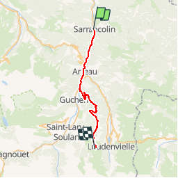
Randonnée V.T.T. de 28 km à découvrir à Occitanie, Hautes-Pyrénées, Sarrancolin. Cette randonnée est proposée par tracegps.
Description
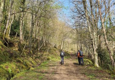
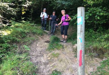
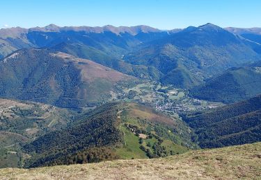
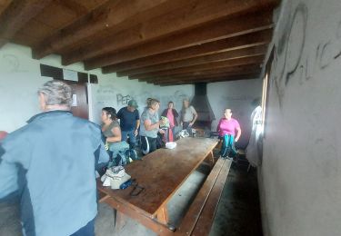
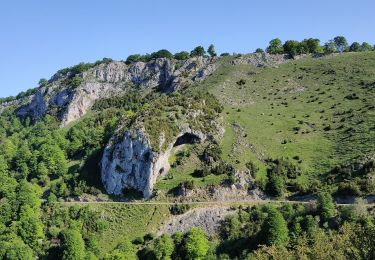
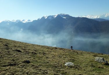
Ascension du Col d'Azet (Val Louron) à VTT C'était le jour où le tour de France passait à Arreau et au col de Peyresourde. Temps magnifique. On part de Sarrancolin, route jusqu'à Arreau puis Gouaux. On emprunte alors (Km 13) une piste forestière en bon état et d'inclinaison raisonnable mais soutenue sur 9 Km. On est dans les bois, pas beaucoup de vues mais ballade sympa. On débouche de la forêt au Cap de Boupillac (Km 22). C'est alors une succession de croupes herbeuses bien arrondies avec des montées très pentues et des descentes de même pente. C'est amusant, casse patte, on est parfois obligés de mettre pied à terre. On est sur la crête qui domine la vallée d'Aure d'un côté et la vallée du Louron de l'autre. C'est magnifique, la vue est superbe de tous les côtés. On poursuit cette crête jusqu'au point culminant, le Tuc de Labatiadère, 1737m, pour redescendre légèrement vers le col d'Azet. Pause pique-nique, sieste, on a vu le tour de France escalader les pentes du Peyresourde en face de nous. On redescend par la route vers le village d'Azet, puis St Lary.
Localisation
Commentaires
Randonnées à proximité
![Randonnée Marche Hèches - Rebouc G4 - Photo](https://media.geolcdn.com/t/375/260/6afd6a38-38b1-4921-be66-02c17ac9ac6f.jpg&format=jpg&maxdim=2)
![Marche Marche](https://static1.geolcdn.com/sitytour/trail-icons/101.png)
Marche
![](/images/other/stat-length.png)
![](https://static1.geolcdn.com/siteimages/upload/files/16400158638029165_repeat_loop_refresh_sync_direction_icon.png)
![Randonnée Marche Esparros - Pacte des loups - Photo](https://media.geolcdn.com/t/375/260/ext.jpg?maxdim=2&url=https%3A%2F%2Fstatic1.geolcdn.com%2Fsiteimages%2Fupload%2Ffiles%2F1553511878bg_sport_marche.png)
![Marche Marche](https://static1.geolcdn.com/sitytour/trail-icons/101.png)
Marche
![](/images/other/stat-length.png)
![](https://static1.geolcdn.com/siteimages/upload/files/16400158638029165_repeat_loop_refresh_sync_direction_icon.png)
![Randonnée Marche Hèches - REBOUC sortie commune LPC trace revue et corrigée](https://media.geolcdn.com/t/375/260/8e9dfb66-dcd3-4aee-b1eb-ee2219a413be.jpg&format=jpg&maxdim=2)
![Marche Marche](https://static1.geolcdn.com/sitytour/trail-icons/101.png)
Marche
![](/images/other/stat-length.png)
![](https://static1.geolcdn.com/siteimages/upload/files/16400158638029165_repeat_loop_refresh_sync_direction_icon.png)
![Randonnée Marche Sarrancolin - plo de Berdaoulou - Photo](https://media.geolcdn.com/t/375/260/2313cc1f-dd1d-4b74-9e32-b9528b3e7a68.jpg&format=jpg&maxdim=2)
![Marche Marche](https://static1.geolcdn.com/sitytour/trail-icons/101.png)
Marche
![](/images/other/stat-length.png)
![](https://static1.geolcdn.com/siteimages/upload/files/16400158638029165_repeat_loop_refresh_sync_direction_icon.png)
![Randonnée Marche Esparros - Pacte des loups - Photo](https://media.geolcdn.com/t/375/260/c60a69e3-27b6-4618-8750-9159e2522e05.jpg&format=jpg&maxdim=2)
![Marche Marche](https://static1.geolcdn.com/sitytour/trail-icons/101.png)
Marche
![](/images/other/stat-length.png)
![](https://static1.geolcdn.com/siteimages/upload/files/16400158638029165_repeat_loop_refresh_sync_direction_icon.png)
![Randonnée Marche Aspin-Aure - plot del naou col d'Aspin - Photo](https://media.geolcdn.com/t/375/260/b10757ed-27c5-4ca9-841f-5f0674691f7c.jpg&format=jpg&maxdim=2)
![Marche Marche](https://static1.geolcdn.com/sitytour/trail-icons/101.png)
Marche
![](/images/other/stat-length.png)
![](https://static1.geolcdn.com/siteimages/upload/files/16400158638029165_repeat_loop_refresh_sync_direction_icon.png)
![Randonnée Marche Esparros - esparros pacte des l 2023 - Photo](https://media.geolcdn.com/t/375/260/8022eec4-ae4c-47cd-a2c1-3993c3591939.jpg&format=jpg&maxdim=2)
![Marche Marche](https://static1.geolcdn.com/sitytour/trail-icons/101.png)
Marche
![](/images/other/stat-length.png)
![](https://static1.geolcdn.com/siteimages/upload/files/16400158638029165_repeat_loop_refresh_sync_direction_icon.png)
![Randonnée Marche Esparros - Signal de Nassia depuis le Pla de Moula après Esparros - Photo](https://media.geolcdn.com/t/375/260/f15ee077-25a8-4a44-be24-60ad7232147d.jpg&format=jpg&maxdim=2)
![Marche Marche](https://static1.geolcdn.com/sitytour/trail-icons/101.png)
Marche
![](/images/other/stat-length.png)
![](https://static1.geolcdn.com/siteimages/upload/files/16400158638029165_repeat_loop_refresh_sync_direction_icon.png)
![Randonnée Marche Ilhet - Pic Montaut - Photo](https://media.geolcdn.com/t/375/260/84e85eb5-8bf9-4949-9482-40db03b24211.jpg&format=jpg&maxdim=2)
![Marche Marche](https://static1.geolcdn.com/sitytour/trail-icons/101.png)
Marche
![](/images/other/stat-length.png)
![](https://static1.geolcdn.com/siteimages/upload/files/16400158638029165_repeat_loop_refresh_sync_direction_icon.png)