![](/images/other/stat-length.png)
![Randonnée Marche Névache - la roche du Chardonnet - Photo](https://media.geolcdn.com/t/1900/400/ext.pjpeg?maxdim=2&url=https%3A%2F%2Fservices.sitytrail.com%2FGeolivesWS%2FDownloadMedia.ashx%3FTrailID%3D1011228%26Media%3Dfix__20180726084936.jpg)
la roche du Chardonnet
amiral13
Utilisateur GUIDE
![Longueur](/images/other/stat-length.png)
![Altitude max](https://static1.geolcdn.com/siteimages/upload/files/1508320355ic_sort_altitude_max_24dp.png)
![Dénivelé positif](https://static1.geolcdn.com/siteimages/upload/files/1508320355ic_sort_den_pos_24dp.png)
![Km-Effort](/images/other/stat-length.png)
![Altitude min](https://static1.geolcdn.com/siteimages/upload/files/1508320355ic_sort_altitude_min_24dp.png)
![Dénivelé négatif](https://static1.geolcdn.com/siteimages/upload/files/1508320355ic_sort_den_neg_24dp.png)
![Boucle](https://static1.geolcdn.com/siteimages/upload/files/16400158638029165_repeat_loop_refresh_sync_direction_icon.png)
![Marche](https://static1.geolcdn.com/sitytour/trail-icons/101.png)
7h26
Difficulté : Moyen
![Scannez ce code QR pour ouvrir la randonnée dans l'application SityTrail](https://capi.geolives.com/qq0zvz2zws4bq2lad0pu/sitytour/trails/1011228/qr.png?size=200)
Application GPS de randonnée GRATUITE
À propos
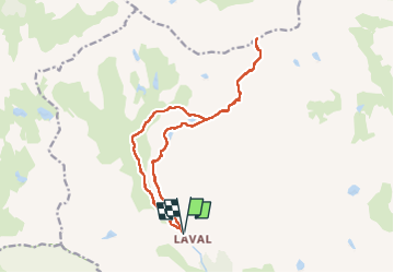
Randonnée Marche de 16,6 km à découvrir à Provence-Alpes-Côte d'Azur, Hautes-Alpes, Névache. Cette randonnée est proposée par amiral13.
Description
une belle randonnée avec 3 lacs un col et un sommet.
Magnifique vue sur le massif des Ecrins si le temps le permet.
pas de difficulté si ce n'est une dénivelée et une longueur qui commence à être importante.
rando effectuée le 26 juillet 2018 la difficulté peut être plus importante en début de saison avec la présence de neige.
Localisation
Commentaires
Randonnées à proximité
![Randonnée Marche Névache - Névache - l'Argentière Lac Laramon Lac du Serpent - 10km 600m 3h10 (30mn) - 2014 06 01 - Photo](https://media.geolcdn.com/t/375/260/ext.jpg?maxdim=2&url=https%3A%2F%2Fservices.sitytrail.com%2FGeolivesWS%2FDownloadMedia.ashx%3FTrailID%3D308075%26Media%3Dfix__20140601111157.jpg)
![Marche Marche](https://static1.geolcdn.com/sitytour/trail-icons/101.png)
Marche
![](/images/other/stat-length.png)
![](https://static1.geolcdn.com/siteimages/upload/files/16400158638029165_repeat_loop_refresh_sync_direction_icon.png)
![Randonnée Marche Névache - Col du Chardonnet - Névache - Photo](https://media.geolcdn.com/t/375/260/ext.jpg?maxdim=2&url=https%3A%2F%2Fservices.sitytrail.com%2FGeolivesWS%2FDownloadMedia.ashx%3FTrailID%3D172510%26Media%3D13871_4.jpg)
![Marche Marche](https://static1.geolcdn.com/sitytour/trail-icons/101.png)
Marche
![](/images/other/stat-length.png)
![](https://static1.geolcdn.com/siteimages/upload/files/16400158638029165_repeat_loop_refresh_sync_direction_icon.png)
![Randonnée Marche Le Monêtier-les-Bains - Le Grand Lac - Photo](https://media.geolcdn.com/t/375/260/ext.jpg?maxdim=2&url=https%3A%2F%2Fservices.sitytrail.com%2FGeolivesWS%2FDownloadMedia.ashx%3FTrailID%3D101251%26Media%3D741_2.jpg)
![Marche Marche](https://static1.geolcdn.com/sitytour/trail-icons/101.png)
Marche
![](/images/other/stat-length.png)
![](https://static1.geolcdn.com/siteimages/upload/files/16400158638029165_repeat_loop_refresh_sync_direction_icon.png)
![Randonnée Marche Le Monêtier-les-Bains - 05 col ponsonniere - Photo](https://media.geolcdn.com/t/375/260/732cfff8-bdda-413d-a875-cbedcd33e096.jpg&format=jpg&maxdim=2)
![Marche Marche](https://static1.geolcdn.com/sitytour/trail-icons/101.png)
Marche
![](/images/other/stat-length.png)
![](https://static1.geolcdn.com/siteimages/upload/files/16400158638029165_repeat_loop_refresh_sync_direction_icon.png)
![Randonnée Marche Névache - Beraudes - Photo](https://media.geolcdn.com/t/375/260/0b2aacf4-b966-4747-8342-45afac1d45d3.jpg&format=jpg&maxdim=2)
![Marche Marche](https://static1.geolcdn.com/sitytour/trail-icons/101.png)
Marche
![](/images/other/stat-length.png)
![](https://static1.geolcdn.com/siteimages/upload/files/16400158638029165_repeat_loop_refresh_sync_direction_icon.png)
![Randonnée Marche Névache - Col de Buffère - Photo](https://media.geolcdn.com/t/375/260/29173095-8bad-4703-9f92-e4d79283feeb.jpg&format=jpg&maxdim=2)
![Marche Marche](https://static1.geolcdn.com/sitytour/trail-icons/101.png)
Marche
![](/images/other/stat-length.png)
![](https://static1.geolcdn.com/siteimages/upload/files/16400158638029165_repeat_loop_refresh_sync_direction_icon.png)
![Randonnée Marche Névache - Col roche noire - Photo](https://media.geolcdn.com/t/375/260/677a67a8-134f-4e40-9c36-524ac13be98e.jpg&format=jpg&maxdim=2)
![Marche Marche](https://static1.geolcdn.com/sitytour/trail-icons/101.png)
Marche
![](/images/other/stat-length.png)
![](https://static1.geolcdn.com/siteimages/upload/files/16400158638029165_repeat_loop_refresh_sync_direction_icon.png)
![Randonnée Marche Le Monêtier-les-Bains - l'aiguillette du Lauzet par le grand lac - Photo](https://media.geolcdn.com/t/375/260/047d899e-dac4-4227-82df-970b78e389f9.jpg&format=jpg&maxdim=2)
![Marche Marche](https://static1.geolcdn.com/sitytour/trail-icons/101.png)
Marche
![](/images/other/stat-length.png)
![](https://static1.geolcdn.com/siteimages/upload/files/16400158638029165_repeat_loop_refresh_sync_direction_icon.png)
![Randonnée Via ferrata Le Monêtier-les-Bains - Via ferrata Aiguillette du Lauzet - Photo](https://media.geolcdn.com/t/375/260/f94c7ee2-184f-466f-9471-9131d6d51143.jpg&format=jpg&maxdim=2)
![Via ferrata Via ferrata](https://static1.geolcdn.com/sitytour/trail-icons/902.png)
Via ferrata
![](/images/other/stat-length.png)
![](https://static1.geolcdn.com/siteimages/upload/files/16400158638029165_repeat_loop_refresh_sync_direction_icon.png)