![](/images/other/stat-length.png)
![Randonnée V.T.T. Quillan - Tour des châteaux du Pays Cathare - Quillan - Carcasses - Photo](https://media.geolcdn.com/t/1900/400/ext.pjpeg?maxdim=2&url=https%3A%2F%2Fservices.sitytrail.com%2FGeolivesWS%2FDownloadMedia.ashx%3FTrailID%3D101107%26Media%3D594_3.jpg)
Tour des châteaux du Pays Cathare - Quillan - Carcasses
tracegps
Utilisateur
![Longueur](/images/other/stat-length.png)
![Altitude max](https://static1.geolcdn.com/siteimages/upload/files/1508320355ic_sort_altitude_max_24dp.png)
![Dénivelé positif](https://static1.geolcdn.com/siteimages/upload/files/1508320355ic_sort_den_pos_24dp.png)
![Km-Effort](/images/other/stat-length.png)
![Altitude min](https://static1.geolcdn.com/siteimages/upload/files/1508320355ic_sort_altitude_min_24dp.png)
![Dénivelé négatif](https://static1.geolcdn.com/siteimages/upload/files/1508320355ic_sort_den_neg_24dp.png)
![Boucle](https://static1.geolcdn.com/siteimages/upload/files/16400158638029165_repeat_loop_refresh_sync_direction_icon.png)
![V.T.T.](https://static1.geolcdn.com/sitytour/trail-icons/202.png)
5h00
Difficulté : Très difficile
![Scannez ce code QR pour ouvrir la randonnée dans l'application SityTrail](https://capi.geolives.com/qq0zvz2zws4bq2lad0pu/sitytour/trails/101107/qr.png?size=200)
Application GPS de randonnée GRATUITE
À propos
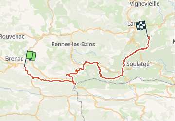
Randonnée V.T.T. de 63 km à découvrir à Occitanie, Aude, Quillan. Cette randonnée est proposée par tracegps.
Description
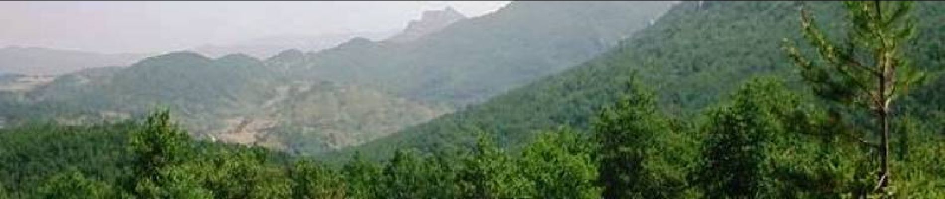
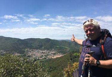
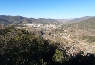
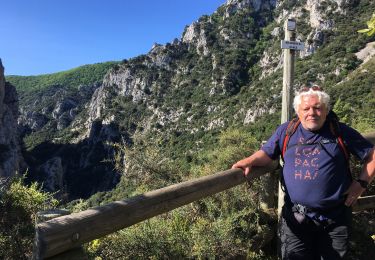
1 Aout 2004 On s’attaque d’entrée de jeu par la montée au col de St Louis, où l’on va prendre 500 m de dénivelée. Une grande piste roulante nous y mène. Le tracé du sentier cathare ne correspond pas toujours sur le terrain avec la carte IGN, donc on se retrouve un moment à galérer dans un chemin matraqué par les chevaux, qui finit dans une propriété privée….. La chaleur commence à se faire sentir sérieusement. Après Bugarach, il y a une belle remontée à 900 m d’altitude, vue magnifique, mais le portage en plein cagnard va faire mal. La suite est ICI
Localisation
Commentaires
Randonnées à proximité
![Randonnée Vélo Quillan - CCS FFC Aude en Pyrénées - Circuit n°13 - Quillan - Photo](https://media.geolcdn.com/t/375/260/ext.jpg?maxdim=2&url=https%3A%2F%2Fservices.sitytrail.com%2FGeolivesWS%2FDownloadMedia.ashx%3FTrailID%3D111472%26Media%3D7355_2.jpg)
![Vélo Vélo](https://static1.geolcdn.com/sitytour/trail-icons/200.png)
Vélo
![](/images/other/stat-length.png)
![](https://static1.geolcdn.com/siteimages/upload/files/16400158638029165_repeat_loop_refresh_sync_direction_icon.png)
![Randonnée V.T.T. Quillan - Espace VTT FFC Aude en Pyrénées - Circuit n° 02 - Quillan / Belviane et Cavirac - Photo](https://media.geolcdn.com/t/375/260/ext.jpg?maxdim=2&url=https%3A%2F%2Fservices.sitytrail.com%2FGeolivesWS%2FDownloadMedia.ashx%3FTrailID%3D103952%26Media%3D6835_1.jpg)
![V.T.T. V.T.T.](https://static1.geolcdn.com/sitytour/trail-icons/202.png)
V.T.T.
![](/images/other/stat-length.png)
![](https://static1.geolcdn.com/siteimages/upload/files/16400158638029165_repeat_loop_refresh_sync_direction_icon.png)
![Randonnée Marche Quillan - Quillan Bezu - Photo](https://media.geolcdn.com/t/375/260/ext.jpg?maxdim=2&url=https%3A%2F%2Fstatic1.geolcdn.com%2Fsiteimages%2Fupload%2Ffiles%2F1553511878bg_sport_marche.png)
![Marche Marche](https://static1.geolcdn.com/sitytour/trail-icons/101.png)
![Randonnée Marche Quillan - Rando du château de Quillian - Photo](https://media.geolcdn.com/t/375/260/022bcdca-9cbb-47e3-80f9-9a60d082eb33.jpg&format=jpg&maxdim=2)
![Marche Marche](https://static1.geolcdn.com/sitytour/trail-icons/101.png)
Marche
![](/images/other/stat-length.png)
![](https://static1.geolcdn.com/siteimages/upload/files/16400158638029165_repeat_loop_refresh_sync_direction_icon.png)
![Randonnée Luge Quillan - Cathare 5.Quillan.Quirbajou - Photo](https://media.geolcdn.com/t/375/260/ae1b2057-d62e-45d4-8804-29f6338a71b9.jpg&format=jpg&maxdim=2)
![Luge Luge](https://static1.geolcdn.com/sitytour/trail-icons/506.png)
Luge
![](/images/other/stat-length.png)
![](https://static1.geolcdn.com/siteimages/upload/files/16400158638029165_repeat_loop_refresh_sync_direction_icon.png)
![Randonnée Marche Quillan - Sentier Cathare - de Quillan à Bugarach - Photo](https://media.geolcdn.com/t/375/260/ext.jpg?maxdim=2&url=https%3A%2F%2Fservices.sitytrail.com%2FGeolivesWS%2FDownloadMedia.ashx%3FTrailID%3D106636%26Media%3D11246_5.jpg)
![Marche Marche](https://static1.geolcdn.com/sitytour/trail-icons/101.png)
Marche
![](/images/other/stat-length.png)
![](https://static1.geolcdn.com/siteimages/upload/files/16400158638029165_repeat_loop_refresh_sync_direction_icon.png)
![Randonnée Marche Quillan - sentier de l'amour vert - Photo](https://media.geolcdn.com/t/375/260/7ccb3e70-466c-4797-9980-6adf4594a412.jpg&format=jpg&maxdim=2)
![Marche Marche](https://static1.geolcdn.com/sitytour/trail-icons/101.png)
Marche
![](/images/other/stat-length.png)
![](https://static1.geolcdn.com/siteimages/upload/files/16400158638029165_repeat_loop_refresh_sync_direction_icon.png)
![Randonnée Marche Quillan - 20211010 Quillan-Puivert - Photo](https://media.geolcdn.com/t/375/260/1e66e058-3a89-44af-a57d-5d348ccbd6d6.jpg&format=jpg&maxdim=2)
![Marche Marche](https://static1.geolcdn.com/sitytour/trail-icons/101.png)
Marche
![](/images/other/stat-length.png)
![](https://static1.geolcdn.com/siteimages/upload/files/16400158638029165_repeat_loop_refresh_sync_direction_icon.png)
![Randonnée Marche Belvianes-et-Cavirac - Belvédère du diable - Photo](https://media.geolcdn.com/t/375/260/3844e9f4-7b9d-4c27-859a-f4e9f25667b5.jpg&format=jpg&maxdim=2)
![Marche Marche](https://static1.geolcdn.com/sitytour/trail-icons/101.png)
Marche
![](/images/other/stat-length.png)
![](https://static1.geolcdn.com/siteimages/upload/files/16400158638029165_repeat_loop_refresh_sync_direction_icon.png)