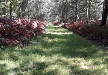
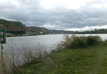
Randonnée V.T.T. Saint-Étienne-du-Rouvray - L'OxyBike 2006 - Photo
 tracegps
tracegps

Utilisateur

© OpenStreetMap contributors
Longueur
Longueur
78 km
Altitude max
Altitude max
151 m
Dénivelé positif
Dénivelé positif
1437 m
Km-Effort
Km-Effort  
97 km
Altitude min
Altitude min
2 m
Dénivelé négatif
Dénivelé négatif
1436 m
Boucle
Boucle
Oui
Date de création :
2014-12-10 00:00:00.0
Dernière modification :
2014-12-10 00:00:00.0

(0 Avis)

V.T.T.
V.T.T.
6h30
Difficulté : Très difficile

Scannez ce code QR pour ouvrir la randonnée dans l'application SityTrail

Application GPS de randonnée GRATUITE

Logo SityTrail SityTrail

IGN / Instituts géographiques

Télécharger SityTrail sur l'App Store Télécharger SityTrail sur Google Play

Logo SityTrail SityTrail World

Le monde est à vous

Télécharger SityTrail sur l'App Store Télécharger SityTrail sur Google Play Télécharger SityTrail sur Huawei AppGallery

À propos

Randonnée V.T.T. de 78 km à découvrir à Normandie, Seine-Maritime, Saint-Étienne-du-Rouvray. Cette randonnée est proposée par tracegps.

Description

02 Avril 2006 Le ciel est encore chargé mais s'éclaircit de plus en plus, laissant même apparaître des trous de ciel bleu et des rayons de soleil. Cool. Un peu de vent de face sur les 1,7 kilomètres de bitume nous séparant de la première zone boisée, un morceau de forêt proche de Petit-Couronne où les sentiers en légère descente sont à mon grand étonnement presque sec malgré le pluies récentes.... La suite du récit est ICI

Profil altimétrique

Photos

Localisation

Pays :
France
Région :
Normandie
Département/Province :
Seine-Maritime
Commune :
Saint-Étienne-du-Rouvray
Localité :
Unknown
Départ:(Dec)
Départ:(UTM)
359417 ; 5472407 (31U) N.

Randonnées à proximité

Randonnée Marche Petit-Couronne - Petit-couronne. Vers le puis Hébert 10 Km - Photo
Marche
MichelRando7656

Marche

Difficile
(1)
Petit-Couronne, Normandie, Seine-Maritime, France
9,7 km | 12,3 km-effort
2h 18min
Oui
Randonnée Marche Oissel - Oissel 13 km - Variante 5 - Photo
Marche
MichelRando7656

Marche

Très facile
(1)
Oissel, Normandie, Seine-Maritime, France
13,3 km | 15,2 km-effort
2h 35min
Oui
Randonnée Marche Oissel - Oissel 15 km - Variante N1 - Photo
Marche
MichelRando7656

Marche

Très facile
(1)
Oissel, Normandie, Seine-Maritime, France
14,9 km | 16,9 km-effort
2h 35min
Oui
Randonnée Marche Petit-Couronne - Petit-Couronne  Rando 9km200 - Photo
Marche
MichelRando7656

Marche

Moyen
(1)
Petit-Couronne, Normandie, Seine-Maritime, France
9,2 km | 11 km-effort
2h 48min
Oui
Randonnée Marche Oissel - Oissel 13 km  - Photo
Marche
MichelRando7656

Marche

Très facile
(1)
Oissel, Normandie, Seine-Maritime, France
13,6 km | 15,4 km-effort
2h 35min
Oui
Randonnée Marche Saint-Étienne-du-Rouvray - Forêt St. EtienneDu Rouvray P2 (86) - Photo
Marche
randovivi

Marche

Très facile
(1)
Saint-Étienne-du-Rouvray, Normandie, Seine-Maritime, France
9,7 km | 10,7 km-effort
2h 23min
Oui
Randonnée Marche Le Grand-Quevilly - 20231219-la su 3 cool - Photo
Marche
doudet

Marche

Facile
Le Grand-Quevilly, Normandie, Seine-Maritime, France
7,8 km | 9 km-effort
2h 8min
Oui
Randonnée Marche Rouen - 20231109-Rouen  - Photo
Marche
doudet

Marche

Facile
Rouen, Normandie, Seine-Maritime, France
3,2 km | 3,6 km-effort
57min
Oui
Randonnée Marche Le Grand-Quevilly - 20230523-Quevilly Cool - Photo
Marche
doudet

Marche

Facile
Le Grand-Quevilly, Normandie, Seine-Maritime, France
7,8 km | 9 km-effort
2h 17min
Oui


Fermer
Mes abonnements