![](/images/other/stat-length.png)
![Randonnée Marche Étaples - LP62_ETAPLES_Bois-de-ROMBLY_14km - Photo](https://media.geolcdn.com/t/1900/400/978f8678-ef4e-482b-bfe1-c5d093202f23.jpg&format=pjpeg&maxdim=2)
LP62_ETAPLES_Bois-de-ROMBLY_14km
BAIE de SOMME & alentours
Autour de la Baie à pieds
![Longueur](/images/other/stat-length.png)
![Altitude max](https://static1.geolcdn.com/siteimages/upload/files/1508320355ic_sort_altitude_max_24dp.png)
![Dénivelé positif](https://static1.geolcdn.com/siteimages/upload/files/1508320355ic_sort_den_pos_24dp.png)
![Km-Effort](/images/other/stat-length.png)
![Altitude min](https://static1.geolcdn.com/siteimages/upload/files/1508320355ic_sort_altitude_min_24dp.png)
![Dénivelé négatif](https://static1.geolcdn.com/siteimages/upload/files/1508320355ic_sort_den_neg_24dp.png)
![Boucle](https://static1.geolcdn.com/siteimages/upload/files/16400158638029165_repeat_loop_refresh_sync_direction_icon.png)
![Marche](https://static1.geolcdn.com/sitytour/trail-icons/101.png)
3h40
Difficulté : Moyen
![Scannez ce code QR pour ouvrir la randonnée dans l'application SityTrail](https://capi.geolives.com/qq0zvz2zws4bq2lad0pu/sitytour/trails/1006259/qr.png?size=200)
Application GPS de randonnée GRATUITE
À propos
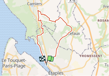
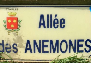
Randonnée Marche de 13,7 km à découvrir à Hauts-de-France, Pas-de-Calais, Étaples. Cette randonnée est proposée par BAIE de SOMME & alentours.
Description
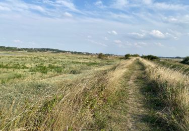
Circuit hors du commun, le sentier de Rombly expose implicitement la lutte historique et permanente de la mouvance des terres et des eaux. Vous serpenterez dans la Réserve Naturelle de la Circuit proposé par la Communauté de Communes Mer & Terres d’Opale et l’Office de Tourisme d’Etaples sur Mer.
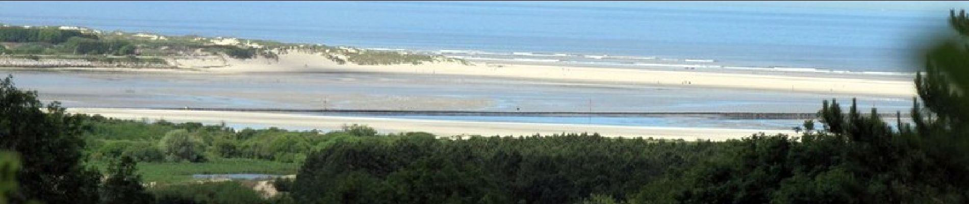
Baie de Canche, jusqu’au bois de Rombly, nom en souvenir de cet ancien village qui fût enseveli par les sables au Moyen Age et disparu en 1646.
GRANDE PRUDENCE LORS DE LA TRAVERSÉE DE LA "D940" (Pas de passage pietons protégé)
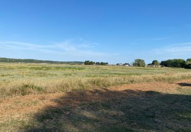
Une prairie est à traversée, pendre soins de bien REFERMER les barrières à chaque extrémité
Localisation
Commentaires
Randonnées à proximité
![Randonnée Vélo Étaples - Les Garnoulles - Etaples - Photo](https://media.geolcdn.com/t/375/260/ext.jpg?maxdim=2&url=https%3A%2F%2Fservices.sitytrail.com%2FGeolivesWS%2FDownloadMedia.ashx%3FTrailID%3D110038%26Media%3D5140_6.jpg)
![Vélo Vélo](https://static1.geolcdn.com/sitytour/trail-icons/200.png)
Vélo
![](/images/other/stat-length.png)
![](https://static1.geolcdn.com/siteimages/upload/files/16400158638029165_repeat_loop_refresh_sync_direction_icon.png)
![Randonnée Marche Étaples - Le sentier du Rombly - Etaples - Photo](https://media.geolcdn.com/t/375/260/ext.jpg?maxdim=2&url=https%3A%2F%2Fservices.sitytrail.com%2FGeolivesWS%2FDownloadMedia.ashx%3FTrailID%3D110030%26Media%3D5135_5.jpg)
![Marche Marche](https://static1.geolcdn.com/sitytour/trail-icons/101.png)
Marche
![](/images/other/stat-length.png)
![](https://static1.geolcdn.com/siteimages/upload/files/16400158638029165_repeat_loop_refresh_sync_direction_icon.png)
![Randonnée A pied Étaples - Sentier de Rombly - Photo](https://media.geolcdn.com/t/375/260/91fe37b4-244e-4fc8-8ef4-3e25b2d6c241.jpeg&format=jpg&maxdim=2)
![A pied A pied](https://static1.geolcdn.com/sitytour/trail-icons/100.png)
A pied
![](/images/other/stat-length.png)
![](https://static1.geolcdn.com/siteimages/upload/files/16400158638029165_repeat_loop_refresh_sync_direction_icon.png)
![Randonnée Marche nordique Le Touquet-Paris-Plage - Marche nordique : Boucle 12 km Le Touquet - Merlimont - Photo](https://media.geolcdn.com/t/375/260/3f68287f-5493-43e5-98e0-b8e122cf61f9.jpg&format=jpg&maxdim=2)
![Marche nordique Marche nordique](https://static1.geolcdn.com/sitytour/trail-icons/102.png)
Marche nordique
![](/images/other/stat-length.png)
![](https://static1.geolcdn.com/siteimages/upload/files/16400158638029165_repeat_loop_refresh_sync_direction_icon.png)
![Randonnée Marche Le Touquet-Paris-Plage - Sur la route du musée - Photo](https://media.geolcdn.com/t/375/260/62c5aadb-0410-4785-8e61-ddcf957a5ea7.jpg&format=jpg&maxdim=2)
![Marche Marche](https://static1.geolcdn.com/sitytour/trail-icons/101.png)
Marche
![](/images/other/stat-length.png)
![](https://static1.geolcdn.com/siteimages/upload/files/16400158638029165_repeat_loop_refresh_sync_direction_icon.png)
![Randonnée Marche Le Touquet-Paris-Plage - Balade dans la baie de Canche - Photo](https://media.geolcdn.com/t/375/260/3dc28a84-57d0-46cf-b02e-bd5974f0e2ec.jpg&format=jpg&maxdim=2)
![Marche Marche](https://static1.geolcdn.com/sitytour/trail-icons/101.png)
Marche
![](/images/other/stat-length.png)
![](https://static1.geolcdn.com/siteimages/upload/files/16400158638029165_repeat_loop_refresh_sync_direction_icon.png)
![Randonnée Marche Étaples - Étaples - La forestière - Photo](https://media.geolcdn.com/t/375/260/ea83baf0-4684-4df5-9be2-2a2c1d93a866.jpg&format=jpg&maxdim=2)
![Marche Marche](https://static1.geolcdn.com/sitytour/trail-icons/101.png)
Marche
![](/images/other/stat-length.png)
![](https://static1.geolcdn.com/siteimages/upload/files/16400158638029165_repeat_loop_refresh_sync_direction_icon.png)
![Randonnée Vélo de route Le Touquet-Paris-Plage - Le Touquet Vélo - Photo](https://media.geolcdn.com/t/375/260/d0d444ac-fb80-4612-9631-6d43cd426718.jpg&format=jpg&maxdim=2)
![Vélo de route Vélo de route](https://static1.geolcdn.com/sitytour/trail-icons/201.png)
Vélo de route
![](/images/other/stat-length.png)
![](https://static1.geolcdn.com/siteimages/upload/files/16400158638029165_repeat_loop_refresh_sync_direction_icon.png)
![Randonnée Marche Le Touquet-Paris-Plage - Le Touquet Paris Plage - Photo](https://media.geolcdn.com/t/375/260/58cf07f6-f257-4be4-a8f7-0f5714037a5d.jpg&format=jpg&maxdim=2)
![Marche Marche](https://static1.geolcdn.com/sitytour/trail-icons/101.png)
Marche
![](/images/other/stat-length.png)
![](https://static1.geolcdn.com/siteimages/upload/files/16400158638029165_repeat_loop_refresh_sync_direction_icon.png)