![](/images/other/stat-length.png)
![Randonnée Course à pied Gardouch - A Gardouch sans les moufles ! - Photo](https://media.geolcdn.com/t/1900/400/ext.pjpeg?maxdim=2&url=https%3A%2F%2Fstatic1.geolcdn.com%2Fsiteimages%2Fupload%2Ffiles%2F1524743154running.jpg)
A Gardouch sans les moufles !
tracegps
Utilisateur
![Longueur](/images/other/stat-length.png)
Longueur
18,3 km
![Altitude max](https://static1.geolcdn.com/siteimages/upload/files/1508320355ic_sort_altitude_max_24dp.png)
Altitude max
254 m
![Dénivelé positif](https://static1.geolcdn.com/siteimages/upload/files/1508320355ic_sort_den_pos_24dp.png)
Dénivelé positif
231 m
![Km-Effort](/images/other/stat-length.png)
Km-Effort
21 km
![Altitude min](https://static1.geolcdn.com/siteimages/upload/files/1508320355ic_sort_altitude_min_24dp.png)
Altitude min
162 m
![Dénivelé négatif](https://static1.geolcdn.com/siteimages/upload/files/1508320355ic_sort_den_neg_24dp.png)
Dénivelé négatif
231 m
![Boucle](https://static1.geolcdn.com/siteimages/upload/files/16400158638029165_repeat_loop_refresh_sync_direction_icon.png)
Boucle
Oui
Date de création :
2014-12-10 00:00:00.0
Dernière modification :
2014-12-10 00:00:00.0
![Course à pied](https://static1.geolcdn.com/sitytour/trail-icons/103.png)
1h40
Difficulté : Difficile
![Scannez ce code QR pour ouvrir la randonnée dans l'application SityTrail](https://capi.geolives.com/qq0zvz2zws4bq2lad0pu/sitytour/trails/100611/qr.png?size=200)
Application GPS de randonnée GRATUITE
À propos
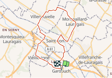
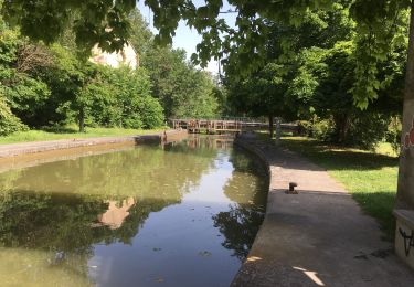
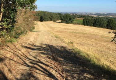
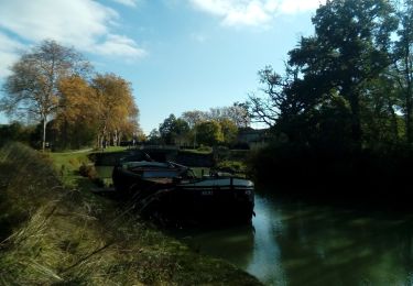
Randonnée Course à pied de 18,3 km à découvrir à Occitanie, Haute-Garonne, Gardouch. Cette randonnée est proposée par tracegps.
Description
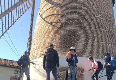
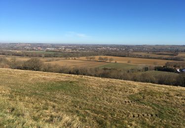
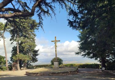
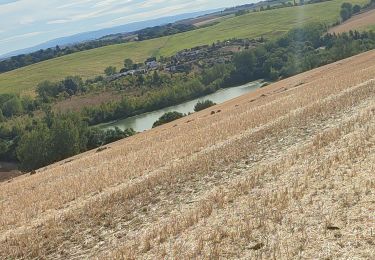
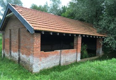
Gardouch, drôle d'architecture à St Rome, Belle cote entre Vieillevigne et Gardouch avec un double point de vue de part et d'autre du coteau. Encore une découverte de Jean Pierre Esquirol !
Localisation
Pays :
France
Région :
Occitanie
Département/Province :
Haute-Garonne
Commune :
Gardouch
Localité :
Unknown
Départ:(Dec)
Départ:(UTM)
393356 ; 4805182 (31T) N.
Commentaires
Randonnées à proximité
![Randonnée Marche Nailloux - Les deux bastides Royales - Photo](https://media.geolcdn.com/t/375/260/1cae95bd-c33e-4011-91c6-191434188286.jpg&format=jpg&maxdim=2)
![Marche Marche](https://static1.geolcdn.com/sitytour/trail-icons/101.png)
Les deux bastides Royales
Marche
Difficile
Nailloux,
Occitanie,
Haute-Garonne,
France
![](/images/other/stat-length.png)
12,1 km | 15,7 km-effort
3h 12min
![](https://static1.geolcdn.com/siteimages/upload/files/16400158638029165_repeat_loop_refresh_sync_direction_icon.png)
Oui
![Randonnée Marche Gardouch - Canal du Midi - Photo](https://media.geolcdn.com/t/375/260/d8458df4-0ea1-46aa-a903-e9cd0d9f4c56.jpg&format=jpg&maxdim=2)
![Marche Marche](https://static1.geolcdn.com/sitytour/trail-icons/101.png)
Canal du Midi
Marche
Difficile
Gardouch,
Occitanie,
Haute-Garonne,
France
![](/images/other/stat-length.png)
10,5 km | 12,7 km-effort
2h 32min
![](https://static1.geolcdn.com/siteimages/upload/files/16400158638029165_repeat_loop_refresh_sync_direction_icon.png)
Oui
![Randonnée Marche Montesquieu-Lauragais - mardi 20 octobre - Photo](https://media.geolcdn.com/t/375/260/e11f6810-5cf9-4890-a395-41d87f66a996.jpg&format=jpg&maxdim=2)
![Marche Marche](https://static1.geolcdn.com/sitytour/trail-icons/101.png)
mardi 20 octobre
Marche
Très facile
Montesquieu-Lauragais,
Occitanie,
Haute-Garonne,
France
![](/images/other/stat-length.png)
12 km | 13,7 km-effort
2h 40min
![](https://static1.geolcdn.com/siteimages/upload/files/16400158638029165_repeat_loop_refresh_sync_direction_icon.png)
Oui
![Randonnée Marche Montgeard - Boucle autour de Montréal - Photo](https://media.geolcdn.com/t/375/260/af9ca54b-89ef-4214-b661-519f1fa6a78d.jpg&format=jpg&maxdim=2)
![Marche Marche](https://static1.geolcdn.com/sitytour/trail-icons/101.png)
Boucle autour de Montréal
Marche
Moyen
Montgeard,
Occitanie,
Haute-Garonne,
France
![](/images/other/stat-length.png)
56 km | 73 km-effort
2h 44min
![](https://static1.geolcdn.com/siteimages/upload/files/16400158638029165_repeat_loop_refresh_sync_direction_icon.png)
Non
![Randonnée Marche Montgeard - lac - Photo](https://media.geolcdn.com/t/375/260/3e9e31c4-aa7d-40c3-95d5-e6b62431a5f2.jpg&format=jpg&maxdim=2)
![Marche Marche](https://static1.geolcdn.com/sitytour/trail-icons/101.png)
![Randonnée Marche Gardouch - Le canal du Midi - Photo](https://media.geolcdn.com/t/375/260/af9bcfd4-c626-4ab8-94b1-1fbe54078c4c.jpg&format=jpg&maxdim=2)
![Marche Marche](https://static1.geolcdn.com/sitytour/trail-icons/101.png)
Le canal du Midi
Marche
Difficile
Gardouch,
Occitanie,
Haute-Garonne,
France
![](/images/other/stat-length.png)
11,2 km | 12,1 km-effort
2h 34min
![](https://static1.geolcdn.com/siteimages/upload/files/16400158638029165_repeat_loop_refresh_sync_direction_icon.png)
Non
![Randonnée Marche Nailloux - Nailloux - Photo](https://media.geolcdn.com/t/375/260/50801882-1002-4524-a1b4-9b797a455e95.jpg&format=jpg&maxdim=2)
![Marche Marche](https://static1.geolcdn.com/sitytour/trail-icons/101.png)
Nailloux
Marche
Moyen
Nailloux,
Occitanie,
Haute-Garonne,
France
![](/images/other/stat-length.png)
7,1 km | 8,8 km-effort
1h 47min
![](https://static1.geolcdn.com/siteimages/upload/files/16400158638029165_repeat_loop_refresh_sync_direction_icon.png)
Oui
![Randonnée Marche Gardouch - Les Collines du Lauragais - Photo](https://media.geolcdn.com/t/375/260/0a95eafd-6ea3-4caa-86c2-d396d6c9c7af.jpg&format=jpg&maxdim=2)
![Marche Marche](https://static1.geolcdn.com/sitytour/trail-icons/101.png)
Les Collines du Lauragais
Marche
Gardouch,
Occitanie,
Haute-Garonne,
France
![](/images/other/stat-length.png)
8,3 km | 10,1 km-effort
2h 21min
![](https://static1.geolcdn.com/siteimages/upload/files/16400158638029165_repeat_loop_refresh_sync_direction_icon.png)
Oui
![Randonnée Marche Vieillevigne - lamarasse2h15 - Photo](https://media.geolcdn.com/t/375/260/eb4e540c-b81a-47ad-a382-5a62ea4fd489.jpg&format=jpg&maxdim=2)
![Marche Marche](https://static1.geolcdn.com/sitytour/trail-icons/101.png)
lamarasse2h15
Marche
Très facile
Vieillevigne,
Occitanie,
Haute-Garonne,
France
![](/images/other/stat-length.png)
10,1 km | 10,9 km-effort
2h 9min
![](https://static1.geolcdn.com/siteimages/upload/files/16400158638029165_repeat_loop_refresh_sync_direction_icon.png)
Non