Accueil
World
NEW
Premium
Shop
Randonnées
Articles
Aide - support
Français
English
Nederlands
Español
Italiano
Deutsch
Connexion
Accueil
World
Premium
Shop
Randonnées
Articles
Aide - support
SityTrail
>
Points d'intérêt
>
IMG_00071
SityTrail
>
Points d'intérêt
>
IMG_00071
IMG_00071
Description
Photos
IMG_00071 est à découvrir dans les randonnées suivantes...
azerty.69696
Le chemin des Chars
V.T.T.
Moyen
(1)
Wacquemoulin, Hauts-de-France, Oise, France
79 km | 91 km-effort
7h 0min
Non
azerty.69696
Utilisateur
©
OpenStreetMap
contributors
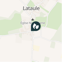
Localisation
Pays :
France
Région :
Hauts-de-France
Département/Province :
Oise
Commune :
Lataule
Localité :
Unknown
Localisation
49.5366040058434 / 2.6782970130443573
Date de création :
2018-04-10 16:47:11.1
Dernière modification
2018-04-10 16:47:11.1
(0 Avis)
Commentaires
Veuillez vous connecter pour laisser un commentaire ou une note
Points d'intérêt à proximité
azerty.69696
IMG_00091
GOURNAY-SUR-ARONDE
azerty.69696
IMG_00081
GOURNAY-SUR-ARONDE
azerty.69696
IMG_00101
MÉRY-LA-BATAILLE
azerty.69696
[EVT60] Courcelles Epayelle...
COURCELLES-EPAYELLES
azerty.69696
IMG_00011
MÉNÉVILLERS
azerty.69696
[EVT60] Menevillers - la Pl...
MÉNÉVILLERS
azerty.69696
IMG_00061
COURCELLES-EPAYELLES
azerty.69696
IMG_00021
MÉNÉVILLERS
Fermer
Mes abonnements