![](/images/other/stat-length.png)
- Randonnées
- Vélo
- France
- Nouvelle-Aquitaine
- Haute-Vienne
Haute-Vienne, Nouvelle-Aquitaine, Vélo : Les meilleures randonnées, itinéraires, parcours, balades et promenades
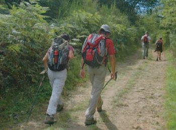
Haute-Vienne : découvrez les meilleures randonnées : 6 vélo, 10 vélo de route, 218 v.t.t., 4 v.t.c., 4 cyclotourisme et 15 vélo électrique. Tous ces circuits, parcours, itinéraires et activités en plein air sont disponibles dans nos applications SityTrail pour smartphones et tablettes.
Les meilleurs parcours (257)
![Randonnée V.T.T. Chaptelat - Circuit St Eloi - Chaptelat - Photo](https://media.geolcdn.com/t/350/260/ext.jpg?maxdim=2&url=https%3A%2F%2Fservices.sitytrail.com%2FGeolivesWS%2FDownloadMedia.ashx%3FTrailID%3D105844%26Media%3D9813_5.jpg)
![V.T.T. V.T.T.](https://static1.geolcdn.com/sitytour/trail-icons/202.png)
Km
V.T.T.
![](/images/other/stat-length.png)
![](https://static1.geolcdn.com/siteimages/upload/files/1508320355ic_sort_den_pos_24dp.png)
![](https://static1.geolcdn.com/siteimages/upload/files/1508320355ic_sort_den_neg_24dp.png)
![](https://static1.geolcdn.com/siteimages/upload/files/16400158638029165_repeat_loop_refresh_sync_direction_icon.png)
• Circuit très sympathique à faire. 423 m de D+. Paysage magnifique en cette entrée de l'automne. Circuit très facile e...
![Randonnée V.T.T. Vayres - Circuit de la Serpentine Variante - Vayres - Photo](https://media.geolcdn.com/t/350/260/ext.jpg?maxdim=2&url=https%3A%2F%2Fservices.sitytrail.com%2FGeolivesWS%2FDownloadMedia.ashx%3FTrailID%3D111350%26Media%3D7083_1.jpg)
![V.T.T. V.T.T.](https://static1.geolcdn.com/sitytour/trail-icons/202.png)
Km
V.T.T.
![](/images/other/stat-length.png)
![](https://static1.geolcdn.com/siteimages/upload/files/1508320355ic_sort_den_pos_24dp.png)
![](https://static1.geolcdn.com/siteimages/upload/files/1508320355ic_sort_den_neg_24dp.png)
![](https://static1.geolcdn.com/siteimages/upload/files/16400158638029165_repeat_loop_refresh_sync_direction_icon.png)
• Circuit proposé par le Comité Départemental du Tourisme de la Haute-Vienne sur le site www.randonnee-hautevienne.com ...
![Randonnée V.T.T. Feytiat - De Feytiat à Aureil puis Eyjeaux et retour - Photo](https://media.geolcdn.com/t/350/260/23a20227-c572-4d40-99ee-ec6496521832.jpg&format=jpg&maxdim=2)
![V.T.T. V.T.T.](https://static1.geolcdn.com/sitytour/trail-icons/202.png)
Km
V.T.T.
![](/images/other/stat-length.png)
![](https://static1.geolcdn.com/siteimages/upload/files/1508320355ic_sort_den_pos_24dp.png)
![](https://static1.geolcdn.com/siteimages/upload/files/1508320355ic_sort_den_neg_24dp.png)
![](https://static1.geolcdn.com/siteimages/upload/files/16400158638029165_repeat_loop_refresh_sync_direction_icon.png)
• Superbe boucle, très beaux chemins et paysages splendides
![Randonnée V.T.T. Feytiat - De Feytiat à StLéonard de Noblat V3 - Photo](https://media.geolcdn.com/t/350/260/7a3c2a69-1b67-45c2-93b8-99d0b2dd4edc.jpeg&format=jpg&maxdim=2)
![V.T.T. V.T.T.](https://static1.geolcdn.com/sitytour/trail-icons/202.png)
Km
V.T.T.
![](/images/other/stat-length.png)
![](https://static1.geolcdn.com/siteimages/upload/files/1508320355ic_sort_den_pos_24dp.png)
![](https://static1.geolcdn.com/siteimages/upload/files/1508320355ic_sort_den_neg_24dp.png)
![](https://static1.geolcdn.com/siteimages/upload/files/16400158638029165_repeat_loop_refresh_sync_direction_icon.png)
• Superbes randonnée VTT paysages splendides chemins variant du très roulant au très technique avec quelques belles côtes
![Randonnée V.T.T. Condat-sur-Vienne - Départ de Condat tour de Pradellas et bord de Briance - Photo](https://media.geolcdn.com/t/350/260/ext.jpg?maxdim=2&url=https%3A%2F%2Fstatic1.geolcdn.com%2Fsiteimages%2Fupload%2Ffiles%2F1524743154velo.jpg)
![V.T.T. V.T.T.](https://static1.geolcdn.com/sitytour/trail-icons/202.png)
Km
V.T.T.
![](/images/other/stat-length.png)
![](https://static1.geolcdn.com/siteimages/upload/files/1508320355ic_sort_den_pos_24dp.png)
![](https://static1.geolcdn.com/siteimages/upload/files/1508320355ic_sort_den_neg_24dp.png)
![](https://static1.geolcdn.com/siteimages/upload/files/16400158638029165_repeat_loop_refresh_sync_direction_icon.png)
![Randonnée Vélo Cieux - Monts de Blond 87 - Photo](https://media.geolcdn.com/t/350/260/ext.jpg?maxdim=2&url=https%3A%2F%2Fservices.sitytrail.com%2FGeolivesWS%2FDownloadMedia.ashx%3FTrailID%3D872508%26Media%3D20171206163901.jpg)
![Vélo Vélo](https://static1.geolcdn.com/sitytour/trail-icons/200.png)
Km
Vélo
![](/images/other/stat-length.png)
![](https://static1.geolcdn.com/siteimages/upload/files/1508320355ic_sort_den_pos_24dp.png)
![](https://static1.geolcdn.com/siteimages/upload/files/1508320355ic_sort_den_neg_24dp.png)
![](https://static1.geolcdn.com/siteimages/upload/files/16400158638029165_repeat_loop_refresh_sync_direction_icon.png)
• Boucle pour aller voir le Champignon
![Randonnée V.T.T. Bujaleuf - Au nord de Bujaleuf - Photo](https://media.geolcdn.com/t/350/260/ext.jpg?maxdim=2&url=https%3A%2F%2Fservices.sitytrail.com%2FGeolivesWS%2FDownloadMedia.ashx%3FTrailID%3D317594%26Media%3D16860_6.jpg)
![V.T.T. V.T.T.](https://static1.geolcdn.com/sitytour/trail-icons/202.png)
Km
V.T.T.
![](/images/other/stat-length.png)
![](https://static1.geolcdn.com/siteimages/upload/files/1508320355ic_sort_den_pos_24dp.png)
![](https://static1.geolcdn.com/siteimages/upload/files/1508320355ic_sort_den_neg_24dp.png)
![](https://static1.geolcdn.com/siteimages/upload/files/16400158638029165_repeat_loop_refresh_sync_direction_icon.png)
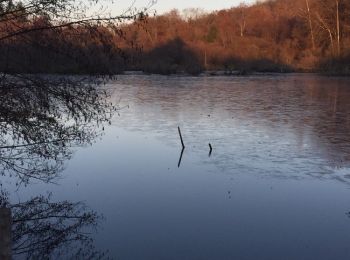
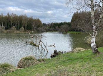
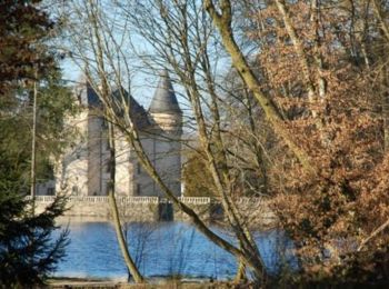
• Petite balade autour de Bujaleuf. Départ du parking au bord du lac, prés du lotissement du lac.
![Randonnée V.T.T. Bellac - blanzac rudy guillaume - Photo](https://media.geolcdn.com/t/350/260/ext.jpg?maxdim=2&url=https%3A%2F%2Fstatic1.geolcdn.com%2Fsiteimages%2Fupload%2Ffiles%2F1524743154velo.jpg)
![V.T.T. V.T.T.](https://static1.geolcdn.com/sitytour/trail-icons/202.png)
Km
V.T.T.
![](/images/other/stat-length.png)
![](https://static1.geolcdn.com/siteimages/upload/files/1508320355ic_sort_den_pos_24dp.png)
![](https://static1.geolcdn.com/siteimages/upload/files/1508320355ic_sort_den_neg_24dp.png)
![](https://static1.geolcdn.com/siteimages/upload/files/16400158638029165_repeat_loop_refresh_sync_direction_icon.png)
![Randonnée V.T.T. Saint-Priest-sous-Aixe - STPRIESTSOUSAIXE - Photo](https://media.geolcdn.com/t/350/260/ext.jpg?maxdim=2&url=https%3A%2F%2Fstatic1.geolcdn.com%2Fsiteimages%2Fupload%2Ffiles%2F1524743154velo.jpg)
![V.T.T. V.T.T.](https://static1.geolcdn.com/sitytour/trail-icons/202.png)
Km
V.T.T.
![](/images/other/stat-length.png)
![](https://static1.geolcdn.com/siteimages/upload/files/1508320355ic_sort_den_pos_24dp.png)
![](https://static1.geolcdn.com/siteimages/upload/files/1508320355ic_sort_den_neg_24dp.png)
![](https://static1.geolcdn.com/siteimages/upload/files/16400158638029165_repeat_loop_refresh_sync_direction_icon.png)
![Randonnée V.T.T. Saint-Priest-sous-Aixe - Circuit Balade en forêt des Loges - Saint-Priest-sous-Aixe - Photo](https://media.geolcdn.com/t/350/260/ext.jpg?maxdim=2&url=https%3A%2F%2Fservices.sitytrail.com%2FGeolivesWS%2FDownloadMedia.ashx%3FTrailID%3D112121%26Media%3D9917_3.jpg)
![V.T.T. V.T.T.](https://static1.geolcdn.com/sitytour/trail-icons/202.png)
Km
V.T.T.
![](/images/other/stat-length.png)
![](https://static1.geolcdn.com/siteimages/upload/files/1508320355ic_sort_den_pos_24dp.png)
![](https://static1.geolcdn.com/siteimages/upload/files/1508320355ic_sort_den_neg_24dp.png)
![](https://static1.geolcdn.com/siteimages/upload/files/16400158638029165_repeat_loop_refresh_sync_direction_icon.png)
• Circuit proposé par le Comité Départemental du Tourisme de la Haute-Vienne sur le site www.randonnee-hautevienne.com ...
![Randonnée V.T.T. Les Cars - Circuit du dolmen de la Goupillère - Les Cars - Photo](https://media.geolcdn.com/t/350/260/ext.jpg?maxdim=2&url=https%3A%2F%2Fservices.sitytrail.com%2FGeolivesWS%2FDownloadMedia.ashx%3FTrailID%3D112118%26Media%3D9916_6.jpg)
![V.T.T. V.T.T.](https://static1.geolcdn.com/sitytour/trail-icons/202.png)
Km
V.T.T.
![](/images/other/stat-length.png)
![](https://static1.geolcdn.com/siteimages/upload/files/1508320355ic_sort_den_pos_24dp.png)
![](https://static1.geolcdn.com/siteimages/upload/files/1508320355ic_sort_den_neg_24dp.png)
![](https://static1.geolcdn.com/siteimages/upload/files/16400158638029165_repeat_loop_refresh_sync_direction_icon.png)
• Circuit proposé par le Comité Départemental du Tourisme de la Haute-Vienne sur le site www.randonnee-hautevienne.com ...
![Randonnée V.T.T. La Geneytouse - Chemin de l'âme de l'âne au Rio Negro - La Geneytouse - Photo](https://media.geolcdn.com/t/350/260/ext.jpg?maxdim=2&url=https%3A%2F%2Fservices.sitytrail.com%2FGeolivesWS%2FDownloadMedia.ashx%3FTrailID%3D112116%26Media%3D9915_3.jpg)
![V.T.T. V.T.T.](https://static1.geolcdn.com/sitytour/trail-icons/202.png)
Km
V.T.T.
![](/images/other/stat-length.png)
![](https://static1.geolcdn.com/siteimages/upload/files/1508320355ic_sort_den_pos_24dp.png)
![](https://static1.geolcdn.com/siteimages/upload/files/1508320355ic_sort_den_neg_24dp.png)
![](https://static1.geolcdn.com/siteimages/upload/files/16400158638029165_repeat_loop_refresh_sync_direction_icon.png)
• Circuit proposé par le Comité Départemental du Tourisme de la Haute-Vienne sur le site www.randonnee-hautevienne.com ...
![Randonnée V.T.T. Rilhac-Rancon - De Rilhac à Payaud et Bramaud - Photo](https://media.geolcdn.com/t/350/260/3e4d29ef-d190-4d96-9eab-7092d1dfb9b0.jpeg&format=jpg&maxdim=2)
![V.T.T. V.T.T.](https://static1.geolcdn.com/sitytour/trail-icons/202.png)
Km
V.T.T.
![](/images/other/stat-length.png)
![](https://static1.geolcdn.com/siteimages/upload/files/1508320355ic_sort_den_pos_24dp.png)
![](https://static1.geolcdn.com/siteimages/upload/files/1508320355ic_sort_den_neg_24dp.png)
![](https://static1.geolcdn.com/siteimages/upload/files/16400158638029165_repeat_loop_refresh_sync_direction_icon.png)
• Petite randonnée variée et un peu vallonnée
![Randonnée V.T.T. Feytiat - De Puy Marot à Gd Quartier et retour par les Biards - Photo](https://media.geolcdn.com/t/350/260/7cb1b01a-2a76-466e-a1cf-ab8b06faa770.jpg&format=jpg&maxdim=2)
![V.T.T. V.T.T.](https://static1.geolcdn.com/sitytour/trail-icons/202.png)
Km
V.T.T.
![](/images/other/stat-length.png)
![](https://static1.geolcdn.com/siteimages/upload/files/1508320355ic_sort_den_pos_24dp.png)
![](https://static1.geolcdn.com/siteimages/upload/files/1508320355ic_sort_den_neg_24dp.png)
![](https://static1.geolcdn.com/siteimages/upload/files/16400158638029165_repeat_loop_refresh_sync_direction_icon.png)
• Super circuit, jolis paysages, beaux chemins sans grosse difficulté si ce n’est certaines portions bien boueuses selo...
![Randonnée V.T.T. Compreignac - Tour du lac de St Pardoux - Photo](https://media.geolcdn.com/t/350/260/ext.jpg?maxdim=2&url=https%3A%2F%2Fservices.sitytrail.com%2FGeolivesWS%2FDownloadMedia.ashx%3FTrailID%3D334246%26Media%3Dfix__20140805165019.jpg)
![V.T.T. V.T.T.](https://static1.geolcdn.com/sitytour/trail-icons/202.png)
Km
V.T.T.
![](/images/other/stat-length.png)
![](https://static1.geolcdn.com/siteimages/upload/files/1508320355ic_sort_den_pos_24dp.png)
![](https://static1.geolcdn.com/siteimages/upload/files/1508320355ic_sort_den_neg_24dp.png)
![](https://static1.geolcdn.com/siteimages/upload/files/16400158638029165_repeat_loop_refresh_sync_direction_icon.png)
• Des Racines et des Cailloux mais aussi des plages
![Randonnée V.T.T. Châteauneuf-la-Forêt - La forêt de Châteauneuf la Forêt - Photo](https://media.geolcdn.com/t/350/260/ext.jpg?maxdim=2&url=https%3A%2F%2Fservices.sitytrail.com%2FGeolivesWS%2FDownloadMedia.ashx%3FTrailID%3D317425%26Media%3D16655_2.jpg)
![V.T.T. V.T.T.](https://static1.geolcdn.com/sitytour/trail-icons/202.png)
Km
V.T.T.
![](/images/other/stat-length.png)
![](https://static1.geolcdn.com/siteimages/upload/files/1508320355ic_sort_den_pos_24dp.png)
![](https://static1.geolcdn.com/siteimages/upload/files/1508320355ic_sort_den_neg_24dp.png)
![](https://static1.geolcdn.com/siteimages/upload/files/16400158638029165_repeat_loop_refresh_sync_direction_icon.png)
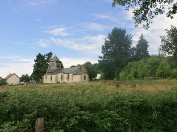
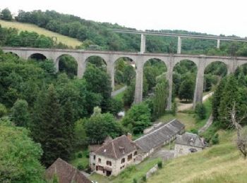
• Magnifique randonnée dans les bois de Châteauneuf la Forêt qui vous conduira à la Chapelle du Mont Gargan, le point c...
![Randonnée V.T.T. Meuzac - De landes en forêts - Meuzac - Photo](https://media.geolcdn.com/t/350/260/ext.jpg?maxdim=2&url=https%3A%2F%2Fservices.sitytrail.com%2FGeolivesWS%2FDownloadMedia.ashx%3FTrailID%3D316798%26Media%3D5981_2.jpg)
![V.T.T. V.T.T.](https://static1.geolcdn.com/sitytour/trail-icons/202.png)
Km
V.T.T.
![](/images/other/stat-length.png)
![](https://static1.geolcdn.com/siteimages/upload/files/1508320355ic_sort_den_pos_24dp.png)
![](https://static1.geolcdn.com/siteimages/upload/files/1508320355ic_sort_den_neg_24dp.png)
![](https://static1.geolcdn.com/siteimages/upload/files/16400158638029165_repeat_loop_refresh_sync_direction_icon.png)
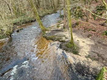
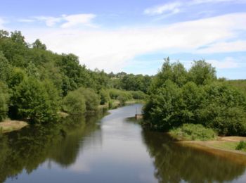
• Meuzac vous accueille pour une longue randonnée à la découverte du patrimoine naturel (plans d'eau, lacs, bocage limo...
![Randonnée V.T.T. Rilhac-Rancon - De Cassepierre à Nieul - Rilhac Rancon - Photo](https://media.geolcdn.com/t/350/260/ext.jpg?maxdim=2&url=https%3A%2F%2Fservices.sitytrail.com%2FGeolivesWS%2FDownloadMedia.ashx%3FTrailID%3D215191%26Media%3D15796_1.jpg)
![V.T.T. V.T.T.](https://static1.geolcdn.com/sitytour/trail-icons/202.png)
Km
V.T.T.
![](/images/other/stat-length.png)
![](https://static1.geolcdn.com/siteimages/upload/files/1508320355ic_sort_den_pos_24dp.png)
![](https://static1.geolcdn.com/siteimages/upload/files/1508320355ic_sort_den_neg_24dp.png)
![](https://static1.geolcdn.com/siteimages/upload/files/16400158638029165_repeat_loop_refresh_sync_direction_icon.png)
• Au départ du parking du restaurant "La Chanterelle", à Cassepierre. Boucle de 60km en allant à Nieul. Le parcours est...
![Randonnée V.T.T. Saint-Ouen-sur-Gartempe - Circuit le bredet do cro do loup - Saint Ouen sur Gartempe - Photo](https://media.geolcdn.com/t/350/260/ext.jpg?maxdim=2&url=https%3A%2F%2Fservices.sitytrail.com%2FGeolivesWS%2FDownloadMedia.ashx%3FTrailID%3D112461%26Media%3D10592_2.jpg)
![V.T.T. V.T.T.](https://static1.geolcdn.com/sitytour/trail-icons/202.png)
Km
V.T.T.
![](/images/other/stat-length.png)
![](https://static1.geolcdn.com/siteimages/upload/files/1508320355ic_sort_den_pos_24dp.png)
![](https://static1.geolcdn.com/siteimages/upload/files/1508320355ic_sort_den_neg_24dp.png)
![](https://static1.geolcdn.com/siteimages/upload/files/16400158638029165_repeat_loop_refresh_sync_direction_icon.png)
• Circuit proposé par le Comité Départemental du Tourisme de la Haute-Vienne sur le site www.randonnee-hautevienne.com ...
![Randonnée V.T.T. Pierre-Buffière - Circuit des trois rivières et des trois viaducs - Pierre Buffière - Photo](https://media.geolcdn.com/t/350/260/ext.jpg?maxdim=2&url=https%3A%2F%2Fservices.sitytrail.com%2FGeolivesWS%2FDownloadMedia.ashx%3FTrailID%3D112458%26Media%3D10591_2.jpg)
![V.T.T. V.T.T.](https://static1.geolcdn.com/sitytour/trail-icons/202.png)
Km
V.T.T.
![](/images/other/stat-length.png)
![](https://static1.geolcdn.com/siteimages/upload/files/1508320355ic_sort_den_pos_24dp.png)
![](https://static1.geolcdn.com/siteimages/upload/files/1508320355ic_sort_den_neg_24dp.png)
![](https://static1.geolcdn.com/siteimages/upload/files/16400158638029165_repeat_loop_refresh_sync_direction_icon.png)
• Circuit proposé par le Comité Départemental du Tourisme de la Haute-Vienne sur le site www.randonnee-hautevienne.com ...
20 randonnées affichées sur 257
Application GPS de randonnée GRATUITE
Activités
Régions proches
- Aixe-sur-Vienne
- Ambazac
- Arnac-la-Poste
- Augne
- Aureil
- Azat-le-Ris
- Beaumont-du-Lac
- Bellac
- Berneuil
- Bersac-sur-Rivalier
- Bessines-sur-Gartempe
- Beynac
- Blond
- Boisseuil
- Bonnac-la-Côte
- Bosmie-l'Aiguille
- Breuilaufa
- Bujaleuf
- Burgnac
- Bussière-Galant
- Chaillac-sur-Vienne
- Châlus
- Chamboret
- Champagnac-la-Rivière
- Champnétery
- Champsac
- Chaptelat
- Château-Chervix
- Châteauneuf-la-Forêt
- Châteauponsac
- Cheissoux
- Chéronnac
- Cieux
- Cognac-la-Forêt
- Compreignac
- Condat-sur-Vienne
- Coussac-Bonneval
- Couzeix
- Cromac
- Cussac
- Dompierre-les-Églises
- Domps
- Dournazac
- Droux
- Eybouleuf
- Eyjeaux
- Eymoutiers
- Feytiat
- Flavignac
- Folles
- Fromental
- Gajoubert
- Glandon
- Glanges
- Gorre
- Isle
- Jabreilles-les-Bordes
- Janailhac
- Javerdat
- Jourgnac
- La Chapelle-Montbrandeix
- La Croisille-sur-Briance
- La Croix-sur-Gartempe
- La Geneytouse
- La Jonchère-Saint-Maurice
- La Meyze
- La Porcherie
- La Roche-l'Abeille
- Ladignac-le-Long
- Laurière
- Le Chalard
- Le Châtenet-en-Dognon
- Le Dorat
- Le Palais-sur-Vienne
- Le Vigen
- Les Billanges
- Les Cars
- Les Salles-Lavauguyon
- Limoges
- Magnac-Bourg
- Magnac-Laval
- Maisonnais-sur-Tardoire
- Marval
- Masléon
- Meilhac
- Meuzac
- Moissannes
- Montrol-Sénard
- Mortemart
- Nantiat
- Nedde
- Neuvic-Entier
- Nexon
- Nieul
- Nouic
- Oradour-Saint-Genest
- Oradour-sur-Glane
- Oradour-sur-Vayres
- Pageas
- Panazol
- Pensol
- Peyrat-de-Bellac
- Peyrat-le-Château
- Peyrilhac
- Pierre-Buffière
- Rancon
- Razès
- Rempnat
- Rilhac-Lastours
- Rilhac-Rancon
- Rochechouart
- Royères
- Saillat-sur-Vienne
- Saint-Amand-Magnazeix
- Saint-Amand-le-Petit
- Saint-Auvent
- Saint-Bazile
- Saint-Bonnet-Briance
- Saint-Bonnet-de-Bellac
- Saint-Brice-sur-Vienne
- Saint-Cyr
- Saint-Denis-des-Murs
- Saint-Gence
- Saint-Genest-sur-Roselle
- Saint-Georges-les-Landes
- Saint-Germain-les-Belles
- Saint-Gilles-les-Forêts
- Saint-Hilaire-Bonneval
- Saint-Hilaire-la-Treille
- Saint-Hilaire-les-Places
- Saint-Jean-Ligoure
- Saint-Jouvent
- Saint-Julien-le-Petit
- Saint-Junien
- Saint-Junien-les-Combes
- Saint-Just-le-Martel
- Saint-Laurent-les-Églises
- Saint-Laurent-sur-Gorre
- Saint-Léger-Magnazeix
- Saint-Léger-la-Montagne
- Saint-Léonard-de-Noblat
- Saint-Martin-Terressus
- Saint-Martin-de-Jussac
- Saint-Martin-le-Vieux
- Saint-Mathieu
- Saint-Maurice-les-Brousses
- Saint-Méard
- Saint-Ouen-sur-Gartempe
- Saint-Pardoux-le-Lac
- Saint-Paul
- Saint-Priest-Ligoure
- Saint-Priest-Taurion
- Saint-Priest-sous-Aixe
- Saint-Sornin-Leulac
- Saint-Sulpice-Laurière
- Saint-Sulpice-les-Feuilles
- Saint-Sylvestre
- Saint-Victurnien
- Saint-Vitte-sur-Briance
- Saint-Yrieix-la-Perche
- Saint-Yrieix-sous-Aixe
- Sainte-Anne-Saint-Priest
- Sainte-Marie-de-Vaux
- Sauviat-sur-Vige
- Séreilhac
- Solignac
- Surdoux
- Sussac
- Tersannes
- Thouron
- Val-d'Issoire
- Val-d'Oire-et-Gartempe
- Vaulry
- Vayres
- Verneuil-sur-Vienne
- Veyrac
- Vicq-sur-Breuilh
- Videix
- Villefavard